Tolocirio elevation
Tolocirio (Castille and León, Provincia de Segovia), Spain elevation is 809 meters and Tolocirio elevation in feet is 2654 ft above sea level [src 1]. Tolocirio is a seat of a third-order administrative division (feature code) with elevation that is 206 meters (676 ft) bigger than average city elevation in Spain.
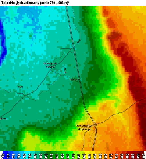
Below is the Elevation map of Tolocirio, which displays elevation range with different colors. Scale of the first map is from 769 to 903 m (2523 to 2963 ft) with average elevation of 826 meters (=2710 ft) [note 1]
These maps also provides idea of topography and contour of this city, they are displayed at different zoom levels. More info about maps, scale and edge coordinates you can find below images.
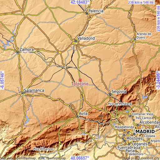
| \ | Map #1 | Topo.Map |
| Scale [m] | 769..903 m | × |
| Scale [ft] | 2523..2963 ft | × |
| Average | 826 m = 2710 ft | × |
| Width | 7.36 km = 4.6 mi | 235.5 km = 146.3 mi |
| Height | 7.36 km = 4.6 mi | 235.5 km = 146.3 mi |
| ↑Max Latitude | 41.16734° | 42.18483° |
| Latitude at center | 41.13425° | 41.13425° |
| ↓Min Latitude | 41.101143° | 40.06657° |
| ← Min Longitude | -4.695155° | -6.05746° |
| Longitude center | -4.65121° | -4.65121° |
| →Max Longitude | -4.607265° | -3.24496° |
Nearby cities:
Cities around Tolocirio sort by population:
• Arévalo elevation 827 m
9.9 km,  216°
216°
• Santiuste de San Juan Bautista 821 m
7.1 km,  70°
70°
• Codorniz 890 m
8.6 km,  150°
150°
• Montejo de Arévalo 803 m
1.3 km,  301°
301°
• Rapariegos 858 m
4.4 km,  181°
181°
• Aldeanueva del Codonal 859 m
10.7 km,  122°
122°
• Martín Muñoz de la Dehesa 835 m
8.1 km,  201°
201°
• Fuente de Santa Cruz 834 m
8.5 km,  9°
9°
• San Cristóbal de la Vega 859 m
2.5 km,  167°
167°
• Donhierro 805 m
4.3 km,  242°
242°
• Puras 803 m
5.5 km,  1°
1°
• Almenara de Adaja 780 m
9.2 km,  345°
345°
Multilingual:
 En español:
Tolocirio elevación 809 m.
 En France:
Tolocirio élévation 809 m.
 Auf Deutsch:
Tolocirio höhe über dem Meeresspiegel ist 809 m.

Sources and notes:
- [note 1] Map square and city borders are not equal. Map elevation data is calculated only from area inside that square.
- [src 1] Elevation data from geonames database provided with same terms of usage.
- [src 2] The elevation map of Tolocirio is generated using elevation data from NASA's 3 arcsec (90m) resolution SRTM data.
- [src 3] Base (background) map © OpenStreetMap contributors tiles are generated by Geofabrik and OpenTopoMap.
Copyright & License:
This Tolocirio Elevation Map is licensed under CC BY-SA. You may reuse any part from this page, if you give a proper credit by linking to this URL:
 More info on terms of use page.