Topas elevation
Topas (Castille and León, Provincia de Salamanca), Spain elevation is 825 meters and Topas elevation in feet is 2707 ft above sea level [src 1]. Topas is a seat of a third-order administrative division (feature code) with elevation that is 222 meters (728 ft) bigger than average city elevation in Spain.
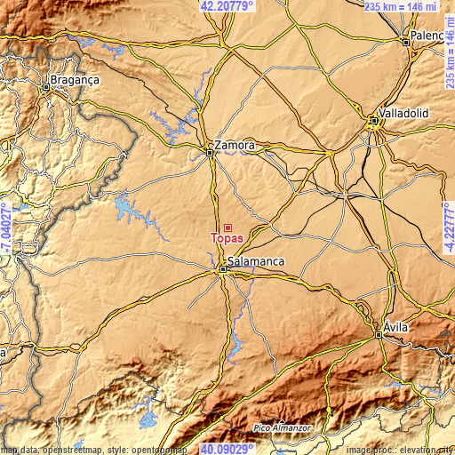
Below is the Elevation map of Topas, which displays elevation range with different colors. Scale of the first map is from 799 to 868 m (2621 to 2848 ft) with average elevation of 831.8 meters (=2729 ft) [note 1]
These maps also provides idea of topography and contour of this city, they are displayed at different zoom levels. More info about maps, scale and edge coordinates you can find below images.

| \ | Map #1 | Topo.Map |
| Scale [m] | 799..868 m | × |
| Scale [ft] | 2621..2848 ft | × |
| Average | 831.8 m = 2729 ft | × |
| Width | 7.36 km = 4.6 mi | 235.4 km = 146.3 mi |
| Height | 7.36 km = 4.6 mi | 235.4 km = 146.3 mi |
| ↑Max Latitude | 41.190668° | 42.20779° |
| Latitude at center | 41.15759° | 41.15759° |
| ↓Min Latitude | 41.124495° | 40.09029° |
| ← Min Longitude | -5.677965° | -7.04027° |
| Longitude center | -5.63402° | -5.63402° |
| →Max Longitude | -5.590075° | -4.22777° |
Nearby cities:
Cities around Topas sort by population:
• Calzada de Valdunciel elevation 801 m
9.7 km,  215°
215°
• Castellanos de Villiquera 829 m
12.9 km,  203°
203°
• Villamor de los Escuderos 836 m
11.7 km,  25°
25°
• Valdelosa 842 m
12.6 km,  277°
277°
• Aldeanueva de Figueroa 873 m
9.3 km,  96°
96°
• Forfoleda 792 m
11.8 km,  235°
235°
• Tardáguila 833 m
6.9 km,  133°
133°
• Pedrosillo el Ralo 815 m
12.7 km,  145°
145°
• Negrilla de Palencia 824 m
8.1 km, 154°
• Arcediano 826 m
9.4 km,  139°
139°
• Valdunciel 806 m
8.6 km, 201°
• Palencia de Negrilla 825 m
7.5 km,  158°
158°
Multilingual:
 En español:
Topas elevación 825 m.
 En France:
Topas élévation 825 m.


Sources and notes:
- [note 1] Map square and city borders are not equal. Map elevation data is calculated only from area inside that square.
- [src 1] Elevation data from geonames database provided with same terms of usage.
- [src 2] The elevation map of Topas is generated using elevation data from NASA's 3 arcsec (90m) resolution SRTM data.
- [src 3] Base (background) map © OpenStreetMap contributors tiles are generated by Geofabrik and OpenTopoMap.
Copyright & License:
This Topas Elevation Map is licensed under CC BY-SA. You may reuse any part from this page, if you give a proper credit by linking to this URL:
 More info on terms of use page.