Torralba elevation
Torralba (Castille-La Mancha, Provincia de Cuenca), Spain elevation is 910 meters and Torralba elevation in feet is 2986 ft above sea level [src 1]. Torralba is a seat of a third-order administrative division (feature code) with elevation that is 307 meters (1007 ft) bigger than average city elevation in Spain.
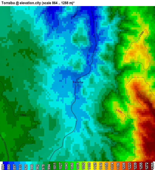
Below is the Elevation map of Torralba, which displays elevation range with different colors. Scale of the first map is from 864 to 1288 m (2835 to 4226 ft) with average elevation of 995.6 meters (=3266 ft) [note 1]
These maps also provides idea of topography and contour of this city, they are displayed at different zoom levels. More info about maps, scale and edge coordinates you can find below images.
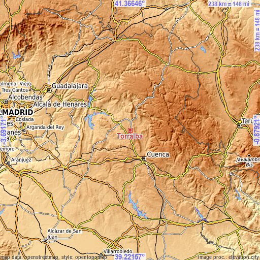
| \ | Map #1 | Topo.Map |
| Scale [m] | 864..1288 m | × |
| Scale [ft] | 2835..4226 ft | × |
| Average | 995.6 m = 3266 ft | × |
| Width | 7.45 km = 4.6 mi | 238.5 km = 148.2 mi |
| Height | 7.45 km = 4.6 mi | 238.5 km = 148.2 mi |
| ↑Max Latitude | 40.336036° | 41.36646° |
| Latitude at center | 40.30253° | 40.30253° |
| ↓Min Latitude | 40.269007° | 39.22157° |
| ← Min Longitude | -2.329405° | -3.69171° |
| Longitude center | -2.28546° | -2.28546° |
| →Max Longitude | -2.241515° | -0.87921° |
Nearby cities:
Cities around Torralba sort by population:
• Villaconejos de Trabaque elevation 814 m
11.3 km,  345°
345°
• Cañaveras 821 m
11.3 km,  304°
304°
• Albalate de las Nogueras 844 m
7.1 km,  5°
5°
• Villar de Domingo García 944 m
7.3 km,  183°
183°
• La Frontera 977 m
12.5 km,  27°
27°
• Arcos de la Sierra 1011 m
15.4 km,  71°
71°
• Buciegas 821 m
15.5 km,  284°
284°
• Castillejo-Sierra 1000 m
14.7 km,  56°
56°
• Arrancacepas 918 m
6.2 km,  270°
270°
• Bascuñana de San Pedro 1058 m
11.1 km,  153°
153°
• Olmedilla de Eliz 876 m
11.4 km, 269°
• Castillo-Albaráñez 906 m
9.1 km, 267°
Multilingual:
 En español:
Torralba elevación 910 m.
 En France:
Torralba élévation 910 m.
 Auf Deutsch:
Torralba höhe über dem Meeresspiegel ist 910 m.

Sources and notes:
- [note 1] Map square and city borders are not equal. Map elevation data is calculated only from area inside that square.
- [src 1] Elevation data from geonames database provided with same terms of usage.
- [src 2] The elevation map of Torralba is generated using elevation data from NASA's 3 arcsec (90m) resolution SRTM data.
- [src 3] Base (background) map © OpenStreetMap contributors tiles are generated by Geofabrik and OpenTopoMap.
Copyright & License:
This Torralba Elevation Map is licensed under CC BY-SA. You may reuse any part from this page, if you give a proper credit by linking to this URL:
 More info on terms of use page.