Tórtoles elevation
Tórtoles (Castille and León, Provincia de Ávila), Spain elevation is 1240 meters and Tórtoles elevation in feet is 4068 ft above sea level [src 1]. Tórtoles is a seat of a third-order administrative division (feature code) with elevation that is 637 meters (2090 ft) bigger than average city elevation in Spain.
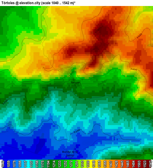
Below is the Elevation map of Tórtoles, which displays elevation range with different colors. Scale of the first map is from 1040 to 1542 m (3412 to 5059 ft) with average elevation of 1256 meters (=4121 ft) [note 1]
These maps also provides idea of topography and contour of this city, they are displayed at different zoom levels. More info about maps, scale and edge coordinates you can find below images.
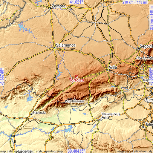
| \ | Map #1 | Topo.Map |
| Scale [m] | 1040..1542 m | × |
| Scale [ft] | 3412..5059 ft | × |
| Average | 1256 m = 4121 ft | × |
| Width | 7.42 km = 4.6 mi | 237.6 km = 147.6 mi |
| Height | 7.42 km = 4.6 mi | 237.6 km = 147.6 mi |
| ↑Max Latitude | 40.594577° | 41.621° |
| Latitude at center | 40.5612° | 40.5612° |
| ↓Min Latitude | 40.527806° | 39.48435° |
| ← Min Longitude | -5.305145° | -6.66745° |
| Longitude center | -5.2612° | -5.2612° |
| →Max Longitude | -5.217255° | -3.85495° |
Nearby cities:
Cities around Tórtoles sort by population:
• Martínez elevation 1100 m
10.6 km,  316°
316°
• Malpartida de Corneja 1025 m
8.7 km,  239°
239°
• Villafranca de la Sierra 1099 m
7.5 km,  159°
159°
• Villanueva del Campillo 1441 m
7.1 km,  76°
76°
• Bonilla de la Sierra 1080 m
3.4 km,  184°
184°
• Zapardiel de la Cañada 1151 m
8.2 km,  307°
307°
• Becedillas 1069 m
6 km, 244°
• Navacepedilla de Corneja 1257 m
10.6 km,  141°
141°
• San Miguel de Corneja 1063 m
8.5 km,  194°
194°
• Mesegar de Corneja 1022 m
7.4 km,  207°
207°
• Navaescurial 1211 m
10.1 km, 187°
• Collado del Mirón 1168 m
7.9 km,  263°
263°
Multilingual:
 En español:
Tórtoles elevación 1240 m.
 En France:
Tórtoles élévation 1240 m.
 Auf Deutsch:
Tórtoles höhe über dem Meeresspiegel ist 1240 m.

Sources and notes:
- [note 1] Map square and city borders are not equal. Map elevation data is calculated only from area inside that square.
- [src 1] Elevation data from geonames database provided with same terms of usage.
- [src 2] The elevation map of Tórtoles is generated using elevation data from NASA's 3 arcsec (90m) resolution SRTM data.
- [src 3] Base (background) map © OpenStreetMap contributors tiles are generated by Geofabrik and OpenTopoMap.
Copyright & License:
This Tórtoles Elevation Map is licensed under CC BY-SA. You may reuse any part from this page, if you give a proper credit by linking to this URL:
 More info on terms of use page.