Tortosa elevation
Tortosa (Catalonia, Província de Tarragona), Spain elevation is 18 meters and Tortosa elevation in feet is 59 ft above sea level [src 1]. Tortosa is a seat of a third-order administrative division (feature code) with elevation that is 585 meters (1919 ft) smaller than average city elevation in Spain.
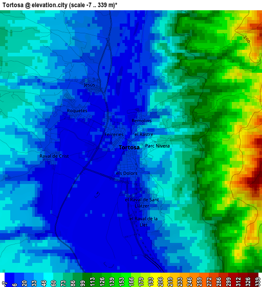
Below is the Elevation map of Tortosa, which displays elevation range with different colors. Scale of the first map is from -7 to 339 m (-23 to 1112 ft) with average elevation of 62 meters (=203 ft) [note 1]
These maps also provides idea of topography and contour of this city, they are displayed at different zoom levels. More info about maps, scale and edge coordinates you can find below images.
| \ | Map #1 | Map #2 | Topo.Map |
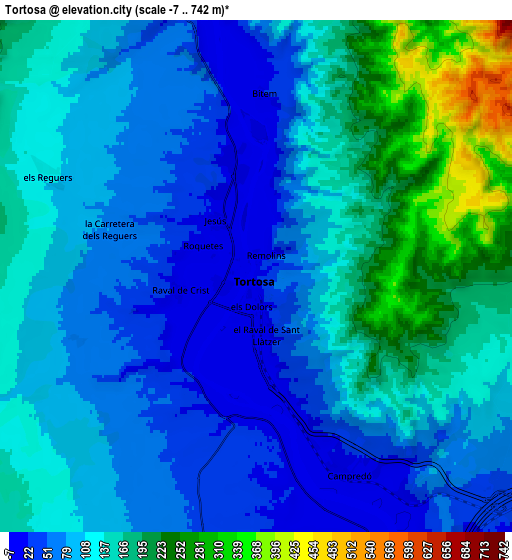
| Scale [m] | -7..339 m | -7..742 m | × |
| Scale [ft] | -23..1112 ft | -23..2434 ft | × |
| Average | 62 m = 203 ft | 118.7 m = 389 ft | × |
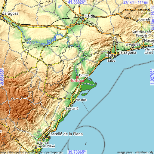
| Width | 7.4 km = 4.6 mi | 14.79 km = 9.2 mi | 236.7 km = 147.1 mi |
| Height | 7.4 km = 4.6 mi | 14.79 km = 9.2 mi | 236.7 km = 147.1 mi |
| ↑Max Latitude | 40.845742° | 40.878977° | 41.86826° |
| Latitude at center | 40.81249° | 40.81249° | 40.81249° |
| ↓Min Latitude | 40.779222° | 40.745936° | 39.73965° |
| ← Min Longitude | 0.477655° | 0.433709° | -0.88465° |
| Longitude center | 0.5216° | 0.5216° | 0.5216° |
| →Max Longitude | 0.565545° | 0.609491° | 1.92785° |
Nearby cities:
Cities around Tortosa sort by population:
• Amposta elevation 11 m
12.4 km,  157°
157°
• Sant Carles de la Ràpita 1 m
22.8 km, 163°
• Deltebre 3 m
18.8 km,  123°
123°
• Santa Bárbara 82 m
11.1 km,  192°
192°
• El Perelló 156 m
17.4 km,  66°
66°
• L'Ampolla 7 m
15.9 km,  90°
90°
• Masdenverge 45 m
10.8 km,  176°
176°
• Rasquera 176 m
22.1 km,  17°
17°
• Tivenys 23 m
10.6 km,  355°
355°
• Benifallet 23 m
18 km, 358°
• Mas de Barberans 375 m
15.7 km,  235°
235°
• Camarles 40 m
11.7 km,  106°
106°
Multilingual:
 En español:
Tortosa elevación 18 m.
 En France:
Tortosa élévation 18 m.


Sources and notes:
- [note 1] Map square and city borders are not equal. Map elevation data is calculated only from area inside that square.
- [src 1] Elevation data from geonames database provided with same terms of usage.
- [src 2] The elevation map of Tortosa is generated using elevation data from NASA's 3 arcsec (90m) resolution SRTM data.
- [src 3] Base (background) map © OpenStreetMap contributors tiles are generated by Geofabrik and OpenTopoMap.
Copyright & License:
This Tortosa Elevation Map is licensed under CC BY-SA. You may reuse any part from this page, if you give a proper credit by linking to this URL:
 More info on terms of use page.