Viguera elevation
Viguera (La Rioja, Provincia de La Rioja), Spain elevation is 706 meters and Viguera elevation in feet is 2316 ft above sea level [src 1]. Viguera is a seat of a third-order administrative division (feature code) with elevation that is 103 meters (338 ft) bigger than average city elevation in Spain.
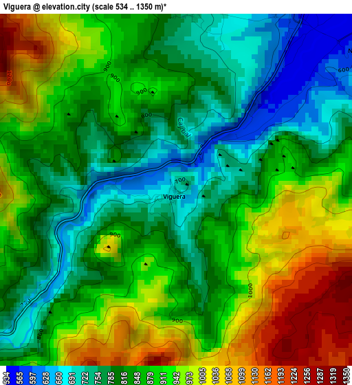
Below is the Elevation map of Viguera, which displays elevation range with different colors. Scale of the first map is from 534 to 1350 m (1752 to 4429 ft) with average elevation of 869.3 meters (=2852 ft) [note 1]
These maps also provides idea of topography and contour of this city, they are displayed at different zoom levels. More info about maps, scale and edge coordinates you can find below images.
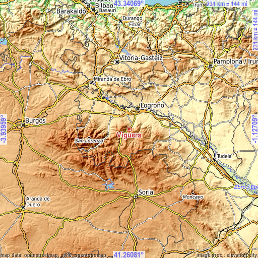
| \ | Map #1 | Topo.Map |
| Scale [m] | 534..1350 m | × |
| Scale [ft] | 1752..4429 ft | × |
| Average | 869.3 m = 2852 ft | × |
| Width | 7.23 km = 4.5 mi | 231.3 km = 143.7 mi |
| Height | 7.23 km = 4.5 mi | 231.3 km = 143.7 mi |
| ↑Max Latitude | 42.34183° | 43.34069° |
| Latitude at center | 42.30934° | 42.30934° |
| ↓Min Latitude | 42.276833° | 41.26081° |
| ← Min Longitude | -2.577285° | -3.93959° |
| Longitude center | -2.53334° | -2.53334° |
| →Max Longitude | -2.489395° | -1.12709° |
Nearby cities:
Cities around Viguera sort by population:
• Albelda de Iregua elevation 545 m
7.4 km,  42°
42°
• Entrena 554 m
8.7 km,  1°
1°
• Nalda 633 m
4.7 km,  53°
53°
• Sorzano 715 m
3.8 km,  5°
5°
• Medrano 597 m
8.4 km,  348°
348°
• Soto en Cameros 713 m
9.2 km,  106°
106°
• Sojuela 668 m
6.8 km, 351°
• Muro en Cameros 1106 m
9.4 km,  178°
178°
• Terroba 788 m
9.3 km,  127°
127°
• Torre en Cameros 1161 m
7.7 km,  170°
170°
• Nestares 866 m
8.4 km,  238°
238°
• Daroca de Rioja 725 m
7.9 km,  329°
329°
Multilingual:
 En español:
Viguera elevación 706 m.
 En France:
Viguera élévation 706 m.


Sources and notes:
- [note 1] Map square and city borders are not equal. Map elevation data is calculated only from area inside that square.
- [src 1] Elevation data from geonames database provided with same terms of usage.
- [src 2] The elevation map of Viguera is generated using elevation data from NASA's 3 arcsec (90m) resolution SRTM data.
- [src 3] Base (background) map © OpenStreetMap contributors tiles are generated by Geofabrik and OpenTopoMap.
Copyright & License:
This Viguera Elevation Map is licensed under CC BY-SA. You may reuse any part from this page, if you give a proper credit by linking to this URL:
 More info on terms of use page.