Vilanant elevation
Vilanant (Catalonia, Província de Girona), Spain elevation is 99 meters and Vilanant elevation in feet is 325 ft above sea level [src 1]. Vilanant is a seat of a third-order administrative division (feature code) with elevation that is 504 meters (1654 ft) smaller than average city elevation in Spain.
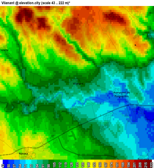
Below is the Elevation map of Vilanant, which displays elevation range with different colors. Scale of the first map is from 43 to 222 m (141 to 728 ft) with average elevation of 121 meters (=397 ft) [note 1]
These maps also provides idea of topography and contour of this city, they are displayed at different zoom levels. More info about maps, scale and edge coordinates you can find below images.
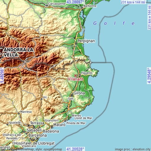
| \ | Map #1 | Topo.Map |
| Scale [m] | 43..222 m | × |
| Scale [ft] | 141..728 ft | × |
| Average | 121 m = 397 ft | × |
| Width | 7.23 km = 4.5 mi | 231.5 km = 143.8 mi |
| Height | 7.23 km = 4.5 mi | 231.5 km = 143.8 mi |
| ↑Max Latitude | 42.287228° | 43.28697° |
| Latitude at center | 42.25471° | 42.25471° |
| ↓Min Latitude | 42.222175° | 41.20528° |
| ← Min Longitude | 2.845285° | 1.48298° |
| Longitude center | 2.88923° | 2.88923° |
| →Max Longitude | 2.933175° | 4.29548° |
Nearby cities:
Cities around Vilanant sort by population:
• Figueres elevation 41 m
6.1 km,  77°
77°
• Vilafant 54 m
4.1 km,  102°
102°
• Llers 167 m
4.9 km,  22°
22°
• Navata 148 m
4.2 km,  213°
213°
• Borrassà 75 m
4.6 km,  139°
139°
• Lladó 199 m
6.3 km,  262°
262°
• Pont de Molins 45 m
7.4 km,  26°
26°
• Ordis 98 m
4.3 km,  160°
160°
• Cistella 130 m
3.7 km,  294°
294°
• Terrades 231 m
7.5 km,  326°
326°
• Cabanelles 191 m
6.3 km,  244°
244°
• Avinyonet de Puigventós 71 m
2.2 km, 104°
Multilingual:
 En español:
Vilanant elevación 99 m.
 En France:
Vilanant élévation 99 m.


Sources and notes:
- [note 1] Map square and city borders are not equal. Map elevation data is calculated only from area inside that square.
- [src 1] Elevation data from geonames database provided with same terms of usage.
- [src 2] The elevation map of Vilanant is generated using elevation data from NASA's 3 arcsec (90m) resolution SRTM data.
- [src 3] Base (background) map © OpenStreetMap contributors tiles are generated by Geofabrik and OpenTopoMap.
Copyright & License:
This Vilanant Elevation Map is licensed under CC BY-SA. You may reuse any part from this page, if you give a proper credit by linking to this URL:
 More info on terms of use page.