Villabona elevation
Villabona (Basque Country, Gipuzkoa), Spain elevation is 59 meters and Villabona elevation in feet is 194 ft above sea level [src 1]. Villabona is a seat of a third-order administrative division (feature code) with elevation that is 544 meters (1785 ft) smaller than average city elevation in Spain.
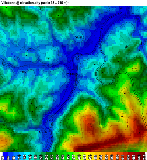
Below is the Elevation map of Villabona, which displays elevation range with different colors. Scale of the first map is from 38 to 715 m (125 to 2346 ft) with average elevation of 231.1 meters (=758 ft) [note 1]
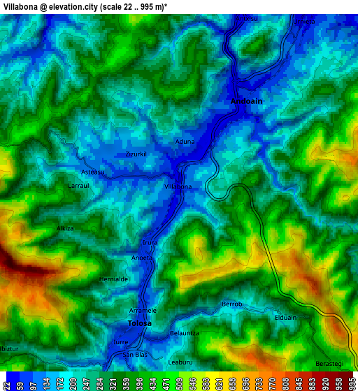
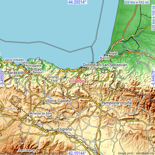
These maps also provides idea of topography and contour of this city, they are displayed at different zoom levels. More info about maps, scale and edge coordinates you can find below images.
| \ | Map #1 | Map #2 | Topo.Map |
| Scale [m] | 38..715 m | 22..995 m | × |
| Scale [ft] | 125..2346 ft | 72..3264 ft | × |
| Average | 231.1 m = 758 ft | 313.3 m = 1028 ft | × |
| Width | 7.13 km = 4.4 mi | 14.25 km = 8.9 mi | 228 km = 141.7 mi |
| Height | 7.13 km = 4.4 mi | 14.25 km = 8.9 mi | 228 km = 141.7 mi |
| ↑Max Latitude | 43.217434° | 43.249451° | 44.20214° |
| Latitude at center | 43.1854° | 43.1854° | 43.1854° |
| ↓Min Latitude | 43.153349° | 43.121282° | 42.15144° |
| ← Min Longitude | -2.096985° | -2.140931° | -3.45929° |
| Longitude center | -2.05304° | -2.05304° | -2.05304° |
| →Max Longitude | -2.009095° | -1.965149° | -0.64679° |
Nearby cities:
Cities around Villabona sort by population:
• Tolosa elevation 80 m
6 km,  199°
199°
• Andoain 50 m
4.1 km,  32°
32°
• Asteasu 104 m
3.8 km,  285°
285°
• Irura 87 m
2.4 km,  209°
209°
• Berrobi 155 m
5 km,  154°
154°
• Hernialde 290 m
4.3 km,  217°
217°
• Larraul 234 m
4 km,  273°
273°
• Belauntza 202 m
5.5 km,  178°
178°
• Alkiza 340 m
4.8 km,  252°
252°
• Anoeta 73 m
2.9 km, 209°
• Zizurkil 115 m
2.3 km,  311°
311°
• Aduna 129 m
2.1 km,  6°
6°
Multilingual:
 En español:
Villabona elevación 59 m.
 En France:
Villabona élévation 59 m.
 Auf Deutsch:
Villabona höhe über dem Meeresspiegel ist 59 m.

Sources and notes:
- [note 1] Map square and city borders are not equal. Map elevation data is calculated only from area inside that square.
- [src 1] Elevation data from geonames database provided with same terms of usage.
- [src 2] The elevation map of Villabona is generated using elevation data from NASA's 3 arcsec (90m) resolution SRTM data.
- [src 3] Base (background) map © OpenStreetMap contributors tiles are generated by Geofabrik and OpenTopoMap.
Copyright & License:
This Villabona Elevation Map is licensed under CC BY-SA. You may reuse any part from this page, if you give a proper credit by linking to this URL:
 More info on terms of use page.