Villamayor elevation
Villamayor (Castille and León, Provincia de Salamanca), Spain elevation is 786 meters and Villamayor elevation in feet is 2579 ft above sea level [src 1]. Villamayor is a seat of a third-order administrative division (feature code) with elevation that is 183 meters (600 ft) bigger than average city elevation in Spain.
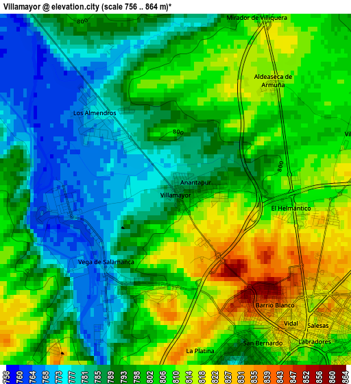
Below is the Elevation map of Villamayor, which displays elevation range with different colors. Scale of the first map is from 756 to 864 m (2480 to 2835 ft) with average elevation of 798.2 meters (=2619 ft) [note 1]
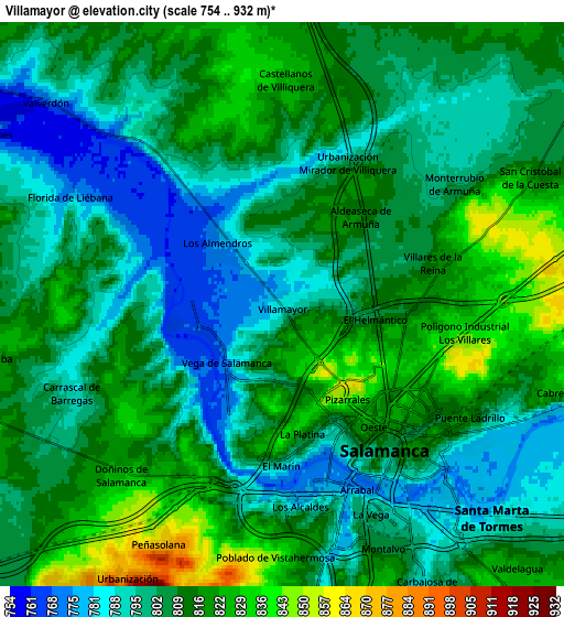
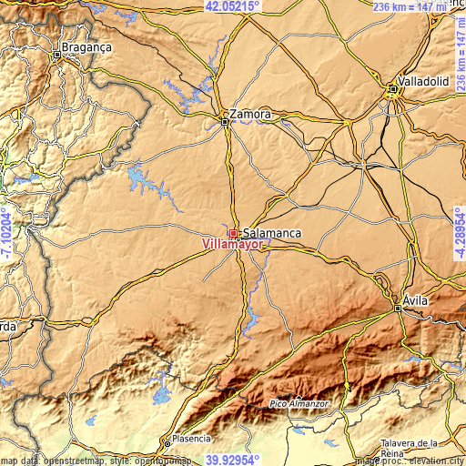
These maps also provides idea of topography and contour of this city, they are displayed at different zoom levels. More info about maps, scale and edge coordinates you can find below images.
| \ | Map #1 | Map #2 | Topo.Map |
| Scale [m] | 756..864 m | 754..932 m | × |
| Scale [ft] | 2480..2835 ft | 2474..3058 ft | × |
| Average | 798.2 m = 2619 ft | 806.6 m = 2646 ft | × |
| Width | 7.38 km = 4.6 mi | 14.75 km = 9.2 mi | 236 km = 146.6 mi |
| Height | 7.38 km = 4.6 mi | 14.75 km = 9.2 mi | 236 km = 146.6 mi |
| ↑Max Latitude | 41.032548° | 41.065689° | 42.05215° |
| Latitude at center | 40.99939° | 40.99939° | 40.99939° |
| ↓Min Latitude | 40.966215° | 40.933024° | 39.92954° |
| ← Min Longitude | -5.739735° | -5.783681° | -7.10204° |
| Longitude center | -5.69579° | -5.69579° | -5.69579° |
| →Max Longitude | -5.651845° | -5.607899° | -4.28954° |
Nearby cities:
Cities around Villamayor sort by population:
• Salamanca elevation 815 m
4.3 km,  141°
141°
• Santa Marta de Tormes 788 m
7.9 km,  133°
133°
• Villares de la Reina 812 m
4.1 km,  75°
75°
• Carbajosa de la Sagrada 794 m
8.3 km,  152°
152°
• Cabrerizos 825 m
7.7 km,  108°
108°
• Doñinos de Salamanca 830 m
6 km,  222°
222°
• Monterrubio de Armuña 802 m
5.3 km,  55°
55°
• Castellanos de Villiquera 829 m
5.8 km,  0°
0°
• San Cristóbal de la Cuesta 818 m
7.3 km, 63°
• Carrascal de Barregas 795 m
6 km,  247°
247°
• Valverdón 767 m
8.1 km,  310°
310°
• Florida de Liébana 781 m
6.2 km,  295°
295°
Multilingual:
 En español:
Villamayor elevación 786 m.
 En France:
Villamayor élévation 786 m.
 Auf Deutsch:
Villamayor höhe über dem Meeresspiegel ist 786 m.

Sources and notes:
- [note 1] Map square and city borders are not equal. Map elevation data is calculated only from area inside that square.
- [src 1] Elevation data from geonames database provided with same terms of usage.
- [src 2] The elevation map of Villamayor is generated using elevation data from NASA's 3 arcsec (90m) resolution SRTM data.
- [src 3] Base (background) map © OpenStreetMap contributors tiles are generated by Geofabrik and OpenTopoMap.
Copyright & License:
This Villamayor Elevation Map is licensed under CC BY-SA. You may reuse any part from this page, if you give a proper credit by linking to this URL:
 More info on terms of use page.