Ayora elevation
Ayora (Valencia, Província de València), Spain elevation is 609 meters and Ayora elevation in feet is 1998 ft above sea level [src 1]. Ayora is a populated place (feature code) with elevation that is 6 meters (20 ft) bigger than average city elevation in Spain.
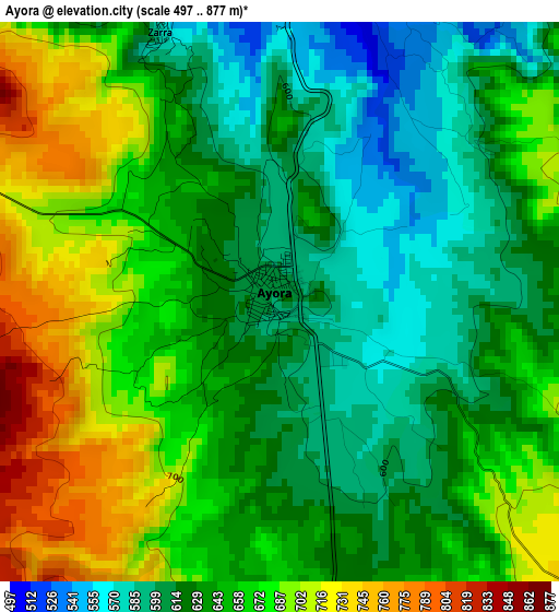
Below is the Elevation map of Ayora, which displays elevation range with different colors. Scale of the first map is from 497 to 877 m (1631 to 2877 ft) with average elevation of 647.6 meters (=2125 ft) [note 1]
These maps also provides idea of topography and contour of this city, they are displayed at different zoom levels. More info about maps, scale and edge coordinates you can find below images.
| \ | Map #1 | Map #2 | Topo.Map |
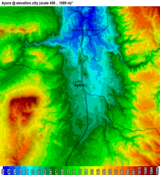
| Scale [m] | 497..877 m | 450..1089 m | × |
| Scale [ft] | 1631..2877 ft | 1476..3573 ft | × |
| Average | 647.6 m = 2125 ft | 735.1 m = 2412 ft | × |
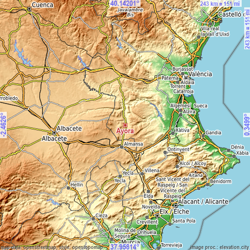
| Width | 7.59 km = 4.7 mi | 15.18 km = 9.4 mi | 242.8 km = 150.9 mi |
| Height | 7.59 km = 4.7 mi | 15.18 km = 9.4 mi | 242.8 km = 150.9 mi |
| ↑Max Latitude | 39.092635° | 39.126734° | 40.14201° |
| Latitude at center | 39.05852° | 39.05852° | 39.05852° |
| ↓Min Latitude | 39.024388° | 38.99024° | 37.95814° |
| ← Min Longitude | -1.100295° | -1.144241° | -2.4626° |
| Longitude center | -1.05635° | -1.05635° | -1.05635° |
| →Max Longitude | -1.012405° | -0.968459° | 0.3499° |
Nearby cities:
Cities around Ayora sort by population:
• Almansa elevation 702 m
21.3 km,  189°
189°
• Alpera 814 m
18.7 km,  233°
233°
• Cortes de Pallás 356 m
23.8 km,  26°
26°
• Jalance 409 m
15.8 km,  356°
356°
• Cofrentes 373 m
19 km, 358°
• Jarafuel 589 m
9.2 km,  350°
350°
• Carcelén 921 m
22.3 km,  282°
282°
• Bicorp 295 m
24.6 km,  70°
70°
• Alatoz 860 m
26.6 km, 278°
• Zarra 573 m
4 km,  336°
336°
• Balsa de Ves 736 m
26.2 km,  331°
331°
• Villa de Ves 674 m
21.9 km,  315°
315°
Multilingual:
 En español:
Ayora elevación 609 m.
 En France:
Ayora élévation 609 m.


Sources and notes:
- [note 1] Map square and city borders are not equal. Map elevation data is calculated only from area inside that square.
- [src 1] Elevation data from geonames database provided with same terms of usage.
- [src 2] The elevation map of Ayora is generated using elevation data from NASA's 3 arcsec (90m) resolution SRTM data.
- [src 3] Base (background) map © OpenStreetMap contributors tiles are generated by Geofabrik and OpenTopoMap.
Copyright & License:
This Ayora Elevation Map is licensed under CC BY-SA. You may reuse any part from this page, if you give a proper credit by linking to this URL:
 More info on terms of use page.