Cáceres elevation
Cáceres (Extremadura, Provincia de Cáceres), Spain elevation is 441 meters and Cáceres elevation in feet is 1447 ft above sea level [src 1]. Cáceres is a seat of a second-order administrative division (feature code) with elevation that is 162 meters (531 ft) smaller than average city elevation in Spain.
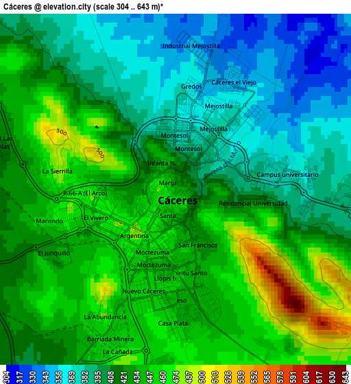
Below is the Elevation map of Cáceres, which displays elevation range with different colors. Scale of the first map is from 304 to 643 m (997 to 2110 ft) with average elevation of 420.7 meters (=1380 ft) [note 1]
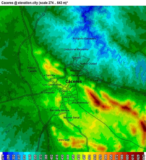
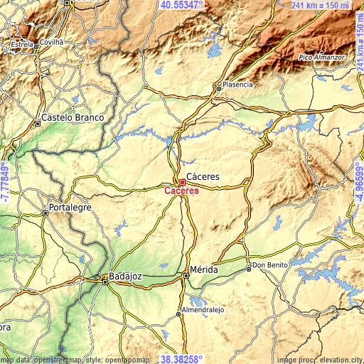
These maps also provides idea of topography and contour of this city, they are displayed at different zoom levels. More info about maps, scale and edge coordinates you can find below images.
| \ | Map #1 | Map #2 | Topo.Map |
| Scale [m] | 304..643 m | 274..643 m | × |
| Scale [ft] | 997..2110 ft | 899..2110 ft | × |
| Average | 420.7 m = 1380 ft | 407.1 m = 1336 ft | × |
| Width | 7.54 km = 4.7 mi | 15.09 km = 9.4 mi | 241.4 km = 150 mi |
| Height | 7.54 km = 4.7 mi | 15.09 km = 9.4 mi | 241.4 km = 150 mi |
| ↑Max Latitude | 39.510402° | 39.544298° | 40.55347° |
| Latitude at center | 39.47649° | 39.47649° | 39.47649° |
| ↓Min Latitude | 39.442561° | 39.408615° | 38.38258° |
| ← Min Longitude | -6.416185° | -6.460131° | -7.77849° |
| Longitude center | -6.37224° | -6.37224° | -6.37224° |
| →Max Longitude | -6.328295° | -6.284349° | -4.96599° |
Nearby cities:
Cities around Cáceres sort by population:
• Arroyo de la Luz elevation 352 m
18.2 km,  273°
273°
• Casar de Cáceres 369 m
10.2 km,  336°
336°
• Malpartida de Cáceres 371 m
12.1 km,  254°
254°
• Sierra de Fuentes 421 m
9.5 km,  115°
115°
• Torreorgaz 427 m
14.8 km,  134°
134°
• Torremocha 445 m
22.4 km, 130°
• Aldea del Cano 395 m
21.4 km,  167°
167°
• Torrequemada 440 m
17.9 km, 133°
• Hinojal 337 m
25.9 km,  3°
3°
• Santiago del Campo 344 m
16.9 km, 2°
• Santa Marta de Magasca 377 m
23.8 km,  80°
80°
• Casas de Don Antonio 403 m
27.7 km, 165°
Multilingual:
 En español:
Cáceres elevación 441 m.
 En France:
Cáceres élévation 441 m.


Sources and notes:
- [note 1] Map square and city borders are not equal. Map elevation data is calculated only from area inside that square.
- [src 1] Elevation data from geonames database provided with same terms of usage.
- [src 2] The elevation map of Cáceres is generated using elevation data from NASA's 3 arcsec (90m) resolution SRTM data.
- [src 3] Base (background) map © OpenStreetMap contributors tiles are generated by Geofabrik and OpenTopoMap.
Copyright & License:
This Cáceres Elevation Map is licensed under CC BY-SA. You may reuse any part from this page, if you give a proper credit by linking to this URL:
 More info on terms of use page.