Carlet elevation
Carlet (Valencia, Província de València), Spain elevation is 55 meters and Carlet elevation in feet is 180 ft above sea level [src 1]. Carlet is a seat of a third-order administrative division (feature code) with elevation that is 548 meters (1798 ft) smaller than average city elevation in Spain.
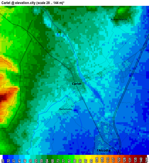
Below is the Elevation map of Carlet, which displays elevation range with different colors. Scale of the first map is from 28 to 144 m (92 to 472 ft) with average elevation of 54.2 meters (=178 ft) [note 1]
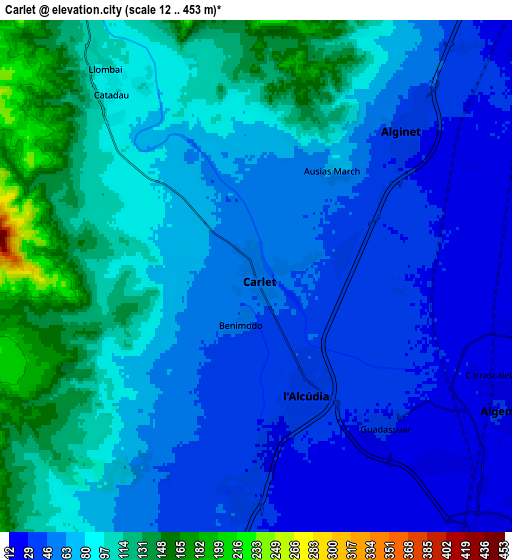
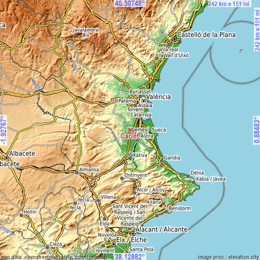
These maps also provides idea of topography and contour of this city, they are displayed at different zoom levels. More info about maps, scale and edge coordinates you can find below images.
| \ | Map #1 | Map #2 | Topo.Map |
| Scale [m] | 28..144 m | 12..453 m | × |
| Scale [ft] | 92..472 ft | 39..1486 ft | × |
| Average | 54.2 m = 178 ft | 74.4 m = 244 ft | × |
| Width | 7.57 km = 4.7 mi | 15.14 km = 9.4 mi | 242.2 km = 150.5 mi |
| Height | 7.57 km = 4.7 mi | 15.14 km = 9.4 mi | 242.2 km = 150.5 mi |
| ↑Max Latitude | 39.260634° | 39.294652° | 40.30748° |
| Latitude at center | 39.2266° | 39.2266° | 39.2266° |
| ↓Min Latitude | 39.192549° | 39.158482° | 38.12882° |
| ← Min Longitude | -0.565365° | -0.609311° | -1.92767° |
| Longitude center | -0.52142° | -0.52142° | -0.52142° |
| →Max Longitude | -0.477475° | -0.433529° | 0.88483° |
Nearby cities:
Cities around Carlet sort by population:
• Algemesí elevation 32 m
8.4 km,  118°
118°
• Alginet 34 m
6.5 km,  46°
46°
• Benifaió 26 m
10.4 km, 51°
• L'Alcúdia 43 m
3.6 km,  157°
157°
• Almussafes 8 m
11 km,  55°
55°
• Guadassuar 34 m
5.8 km,  140°
140°
• Llombai 98 m
7.4 km,  328°
328°
• Catadau 84 m
5.9 km,  318°
318°
• Benimodo 48 m
1.5 km,  198°
198°
• Masalavés 36 m
9.2 km,  180°
180°
• Alfarp 90 m
6.8 km,  338°
338°
• Benimuslem 25 m
10.8 km,  166°
166°
Multilingual:
 En español:
Carlet elevación 55 m.
 En France:
Carlet élévation 55 m.


Sources and notes:
- [note 1] Map square and city borders are not equal. Map elevation data is calculated only from area inside that square.
- [src 1] Elevation data from geonames database provided with same terms of usage.
- [src 2] The elevation map of Carlet is generated using elevation data from NASA's 3 arcsec (90m) resolution SRTM data.
- [src 3] Base (background) map © OpenStreetMap contributors tiles are generated by Geofabrik and OpenTopoMap.
Copyright & License:
This Carlet Elevation Map is licensed under CC BY-SA. You may reuse any part from this page, if you give a proper credit by linking to this URL:
 More info on terms of use page.