Cheles elevation
Cheles (Extremadura, Provincia de Badajoz), Spain elevation is 197 meters and Cheles elevation in feet is 646 ft above sea level [src 1]. Cheles is a seat of a third-order administrative division (feature code) with elevation that is 406 meters (1332 ft) smaller than average city elevation in Spain.
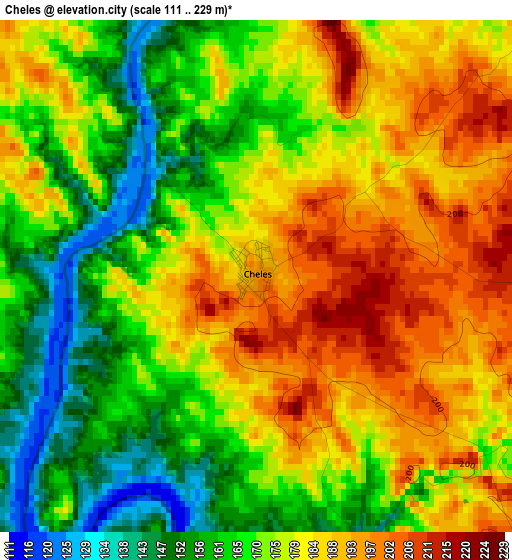
Below is the Elevation map of Cheles, which displays elevation range with different colors. Scale of the first map is from 111 to 229 m (364 to 751 ft) with average elevation of 176.2 meters (=578 ft) [note 1]
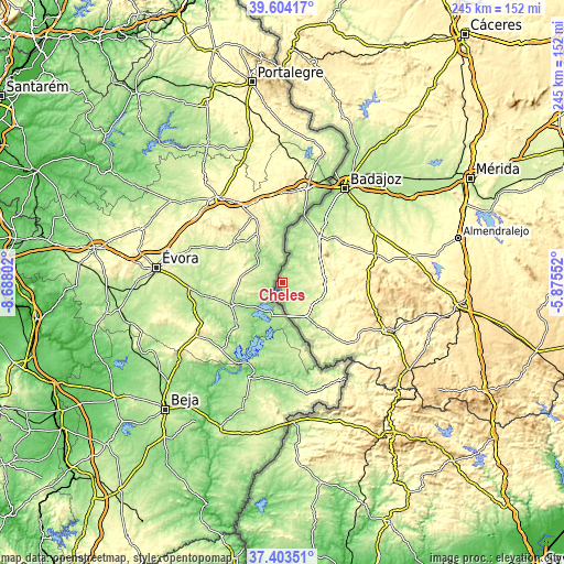
These maps also provides idea of topography and contour of this city, they are displayed at different zoom levels. More info about maps, scale and edge coordinates you can find below images.
| \ | Map #1 | Topo.Map |
| Scale [m] | 111..229 m | × |
| Scale [ft] | 364..751 ft | × |
| Average | 176.2 m = 578 ft | × |
| Width | 7.65 km = 4.8 mi | 244.7 km = 152 mi |
| Height | 7.65 km = 4.8 mi | 244.7 km = 152 mi |
| ↑Max Latitude | 38.546628° | 39.60417° |
| Latitude at center | 38.51225° | 38.51225° |
| ↓Min Latitude | 38.477856° | 37.40351° |
| ← Min Longitude | -7.325715° | -8.68802° |
| Longitude center | -7.28177° | -7.28177° |
| →Max Longitude | -7.237825° | -5.87552° |
Nearby cities:
Cities around Cheles sort by population:
• Olivenza elevation 262 m
24.6 km,  39°
39°
• Oliva de la Frontera 376 m
41.1 km,  129°
129°
• Valverde de Leganés 295 m
31.6 km,  56°
56°
• Barcarrota 489 m
37.6 km,  89°
89°
• Villanueva del Fresno 256 m
18.1 km,  146°
146°
• Zahinos 330 m
34.8 km, 125°
• Salvaleón 531 m
43.1 km, 90°
• Higuera de Vargas 358 m
27.7 km,  105°
105°
• Alconchel 283 m
18.3 km, 88°
• Almendral 325 m
41.6 km,  74°
74°
• Valencia del Mombuey 295 m
33.2 km, 154°
• Táliga 305 m
23.1 km, 85°
Multilingual:
 En español:
Cheles elevación 197 m.
 En France:
Cheles élévation 197 m.


Sources and notes:
- [note 1] Map square and city borders are not equal. Map elevation data is calculated only from area inside that square.
- [src 1] Elevation data from geonames database provided with same terms of usage.
- [src 2] The elevation map of Cheles is generated using elevation data from NASA's 3 arcsec (90m) resolution SRTM data.
- [src 3] Base (background) map © OpenStreetMap contributors tiles are generated by Geofabrik and OpenTopoMap.
Copyright & License:
This Cheles Elevation Map is licensed under CC BY-SA. You may reuse any part from this page, if you give a proper credit by linking to this URL:
 More info on terms of use page.