Corral de Almaguer elevation
Corral de Almaguer (Castille-La Mancha, Province of Toledo), Spain elevation is 706 meters and Corral de Almaguer elevation in feet is 2316 ft above sea level [src 1]. Corral de Almaguer is a seat of a third-order administrative division (feature code) with elevation that is 103 meters (338 ft) bigger than average city elevation in Spain.
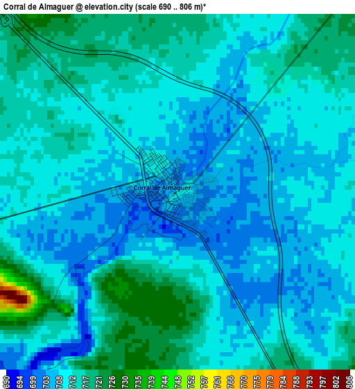
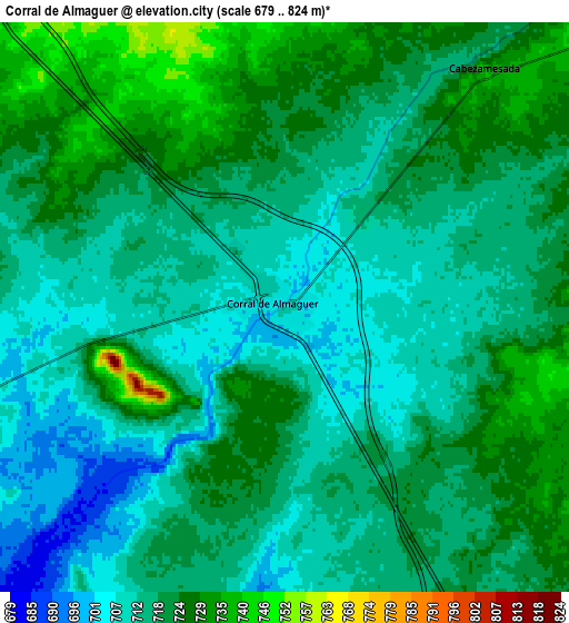
Below is the Elevation map of Corral de Almaguer, which displays elevation range with different colors. Scale of the first map is from 690 to 806 m (2264 to 2644 ft) with average elevation of 711.5 meters (=2334 ft) [note 1]
These maps also provides idea of topography and contour of this city, they are displayed at different zoom levels. More info about maps, scale and edge coordinates you can find below images.
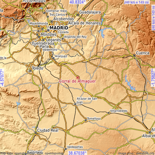
| \ | Map #1 | Map #2 | Topo.Map |
| Scale [m] | 690..806 m | 679..824 m | × |
| Scale [ft] | 2264..2644 ft | 2228..2703 ft | × |
| Average | 711.5 m = 2334 ft | 718 m = 2356 ft | × |
| Width | 7.51 km = 4.7 mi | 15.02 km = 9.3 mi | 240.4 km = 149.4 mi |
| Height | 7.51 km = 4.7 mi | 15.02 km = 9.3 mi | 240.4 km = 149.4 mi |
| ↑Max Latitude | 39.793644° | 39.827401° | 40.8324° |
| Latitude at center | 39.75987° | 39.75987° | 39.75987° |
| ↓Min Latitude | 39.72608° | 39.692273° | 38.67038° |
| ← Min Longitude | -3.208465° | -3.252411° | -4.57077° |
| Longitude center | -3.16452° | -3.16452° | -3.16452° |
| →Max Longitude | -3.120575° | -3.076629° | -1.75827° |
Nearby cities:
Cities around Corral de Almaguer sort by population:
• Quintanar de la Orden elevation 692 m
21.3 km,  150°
150°
• Villacañas 677 m
21.2 km,  224°
224°
• La Puebla de Almoradiel 695 m
18.4 km,  167°
167°
• Villa de Don Fadrique 672 m
16.8 km,  196°
196°
• Horcajo de Santiago 766 m
17 km,  57°
57°
• Villanueva de Alcardete 729 m
16 km,  126°
126°
• Villamayor de Santiago 781 m
20.9 km,  98°
98°
• Lillo 687 m
12.8 km,  251°
251°
• Villatobas 736 m
20.8 km,  319°
319°
• Fuente de Pedro Naharro 774 m
22.6 km,  35°
35°
• Cabezamesada 735 m
8.2 km, 40°
• Pozorrubio 788 m
19.4 km,  71°
71°
Multilingual:
 En español:
Corral de Almaguer elevación 706 m.
 En France:
Corral de Almaguer élévation 706 m.
 Auf Deutsch:
Corral de Almaguer höhe über dem Meeresspiegel ist 706 m.
 На русском:
Corral de Almaguer высота над уровнем моря 706 м
Sources and notes:
- [note 1] Map square and city borders are not equal. Map elevation data is calculated only from area inside that square.
- [src 1] Elevation data from geonames database provided with same terms of usage.
- [src 2] The elevation map of Corral de Almaguer is generated using elevation data from NASA's 3 arcsec (90m) resolution SRTM data.
- [src 3] Base (background) map © OpenStreetMap contributors tiles are generated by Geofabrik and OpenTopoMap.
Copyright & License:
This Corral de Almaguer Elevation Map is licensed under CC BY-SA. You may reuse any part from this page, if you give a proper credit by linking to this URL:
 More info on terms of use page.