Finestrat elevation
Finestrat (Valencia, Provincia de Alicante), Spain elevation is 262 meters and Finestrat elevation in feet is 860 ft above sea level [src 1]. Finestrat is a seat of a third-order administrative division (feature code) with elevation that is 341 meters (1119 ft) smaller than average city elevation in Spain.
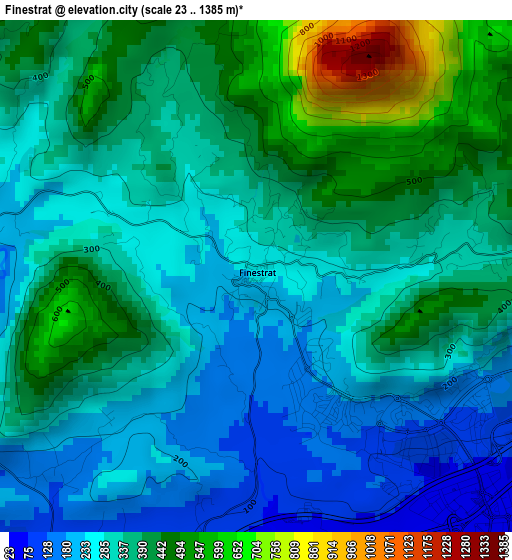
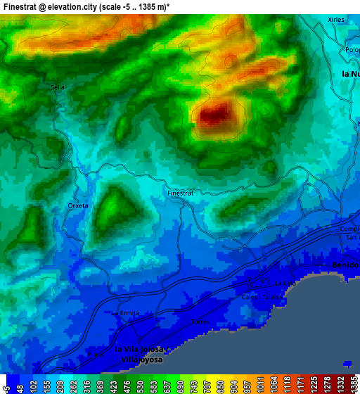
Below is the Elevation map of Finestrat, which displays elevation range with different colors. Scale of the first map is from 23 to 1385 m (75 to 4544 ft) with average elevation of 338.2 meters (=1110 ft) [note 1]
These maps also provides idea of topography and contour of this city, they are displayed at different zoom levels. More info about maps, scale and edge coordinates you can find below images.
| \ | Map #1 | Map #2 | Topo.Map |
| Scale [m] | 23..1385 m | -5..1385 m | × |
| Scale [ft] | 75..4544 ft | -16..4544 ft | × |
| Average | 338.2 m = 1110 ft | 352.7 m = 1157 ft | × |
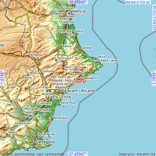
| Width | 7.64 km = 4.7 mi | 15.28 km = 9.5 mi | 244.5 km = 151.9 mi |
| Height | 7.64 km = 4.7 mi | 15.28 km = 9.5 mi | 244.5 km = 151.9 mi |
| ↑Max Latitude | 38.601722° | 38.636057° | 39.65845° |
| Latitude at center | 38.56737° | 38.56737° | 38.56737° |
| ↓Min Latitude | 38.533002° | 38.498618° | 37.45947° |
| ← Min Longitude | -0.256295° | -0.300241° | -1.6186° |
| Longitude center | -0.21235° | -0.21235° | -0.21235° |
| →Max Longitude | -0.168405° | -0.124459° | 1.1939° |
Nearby cities:
Cities around Finestrat sort by population:
• Benidorm elevation 30 m
7.8 km,  114°
114°
• Villajoyosa 39 m
6.9 km,  195°
195°
• l'Alfàs del Pi 98 m
9.6 km,  81°
81°
• la Nucia 240 m
9 km,  55°
55°
• Polop 217 m
9.4 km,  49°
49°
• Orcheta 198 m
4.4 km,  265°
265°
• Relleu 431 m
8.9 km,  284°
284°
• Sella 426 m
7 km,  311°
311°
• Benimantell 544 m
12.2 km,  0°
0°
• Confrides 786 m
13.9 km,  339°
339°
• Beniardá 468 m
13 km,  358°
358°
• Callosa d'En Sarrià 203 m
12.4 km,  42°
42°
Multilingual:
 En español:
Finestrat elevación 262 m.
 En France:
Finestrat élévation 262 m.
 Auf Deutsch:
Finestrat höhe über dem Meeresspiegel ist 262 m.

Sources and notes:
- [note 1] Map square and city borders are not equal. Map elevation data is calculated only from area inside that square.
- [src 1] Elevation data from geonames database provided with same terms of usage.
- [src 2] The elevation map of Finestrat is generated using elevation data from NASA's 3 arcsec (90m) resolution SRTM data.
- [src 3] Base (background) map © OpenStreetMap contributors tiles are generated by Geofabrik and OpenTopoMap.
Copyright & License:
This Finestrat Elevation Map is licensed under CC BY-SA. You may reuse any part from this page, if you give a proper credit by linking to this URL:
 More info on terms of use page.