Firgas elevation
Firgas (Canary Islands, Provincia de Las Palmas), Spain elevation is 510 meters and Firgas elevation in feet is 1673 ft above sea level [src 1]. Firgas is a seat of a third-order administrative division (feature code) with elevation that is 93 meters (305 ft) smaller than average city elevation in Spain.
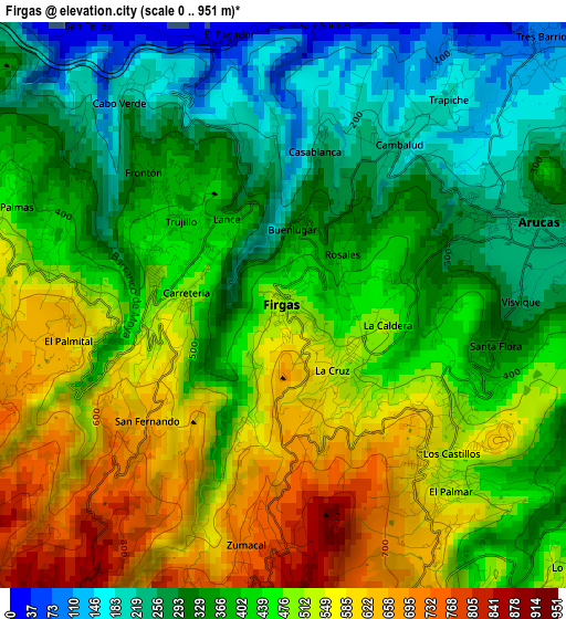
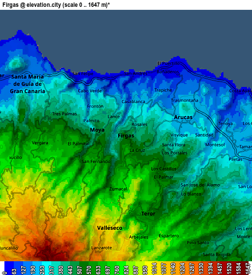
Below is the Elevation map of Firgas, which displays elevation range with different colors. Scale of the first map is from 0 to 951 m (0 to 3120 ft) with average elevation of 429.2 meters (=1408 ft) [note 1]
These maps also provides idea of topography and contour of this city, they are displayed at different zoom levels. More info about maps, scale and edge coordinates you can find below images.
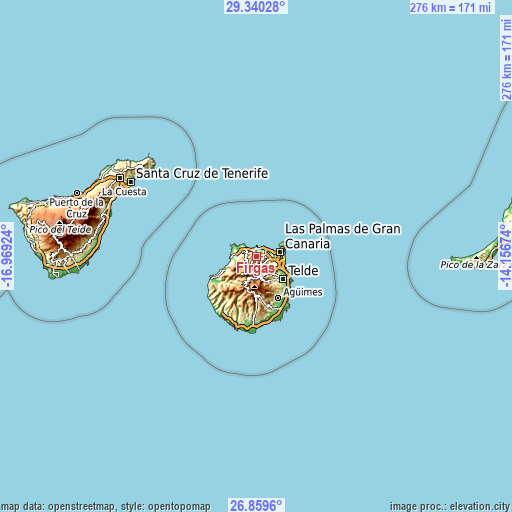
| \ | Map #1 | Map #2 | Topo.Map |
| Scale [m] | 0..951 m | 0..1647 m | × |
| Scale [ft] | 0..3120 ft | 0..5404 ft | × |
| Average | 429.2 m = 1408 ft | 549 m = 1801 ft | × |
| Width | 8.62 km = 5.4 mi | 17.24 km = 10.7 mi | 275.8 km = 171.4 mi |
| Height | 8.62 km = 5.4 mi | 17.24 km = 10.7 mi | 275.8 km = 171.4 mi |
| ↑Max Latitude | 28.145866° | 28.184608° | 29.34028° |
| Latitude at center | 28.10711° | 28.10711° | 28.10711° |
| ↓Min Latitude | 28.06834° | 28.029556° | 26.8596° |
| ← Min Longitude | -15.606935° | -15.650881° | -16.96924° |
| Longitude center | -15.56299° | -15.56299° | -15.56299° |
| →Max Longitude | -15.519045° | -15.475099° | -14.15674° |
Nearby cities:
Cities around Firgas sort by population:
• Las Palmas de Gran Canaria elevation 23 m
14.7 km,  93°
93°
• Arucas 280 m
4.1 km,  70°
70°
• Gáldar 148 m
9.6 km,  297°
297°
• Santa Brígida 499 m
10.1 km,  145°
145°
• Guia 181 m
7.8 km, 297°
• Teror 634 m
5.3 km,  165°
165°
• Vega de San Mateo 848 m
11.3 km, 165°
• Moya 282 m
2 km,  282°
282°
• Agaete 55 m
13.5 km,  266°
266°
• Valleseco 1067 m
7.2 km,  190°
190°
• Tejeda 1046 m
13.5 km,  202°
202°
• Artenara 1235 m
12.7 km,  220°
220°
Multilingual:
 En español:
Firgas elevación 510 m.
 En France:
Firgas élévation 510 m.


Sources and notes:
- [note 1] Map square and city borders are not equal. Map elevation data is calculated only from area inside that square.
- [src 1] Elevation data from geonames database provided with same terms of usage.
- [src 2] The elevation map of Firgas is generated using elevation data from NASA's 3 arcsec (90m) resolution SRTM data.
- [src 3] Base (background) map © OpenStreetMap contributors tiles are generated by Geofabrik and OpenTopoMap.
Copyright & License:
This Firgas Elevation Map is licensed under CC BY-SA. You may reuse any part from this page, if you give a proper credit by linking to this URL:
 More info on terms of use page.