Fuengirola elevation
Fuengirola (Andalusia, Provincia de Málaga), Spain elevation is 13 meters and Fuengirola elevation in feet is 43 ft above sea level [src 1]. Fuengirola is a seat of a third-order administrative division (feature code) with elevation that is 590 meters (1936 ft) smaller than average city elevation in Spain.
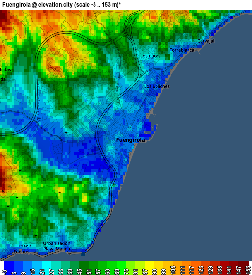
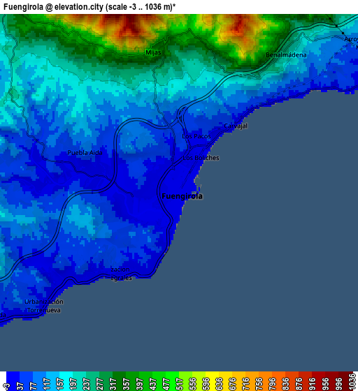
Below is the Elevation map of Fuengirola, which displays elevation range with different colors. Scale of the first map is from -3 to 153 m (-10 to 502 ft) with average elevation of 44.9 meters (=147 ft) [note 1]
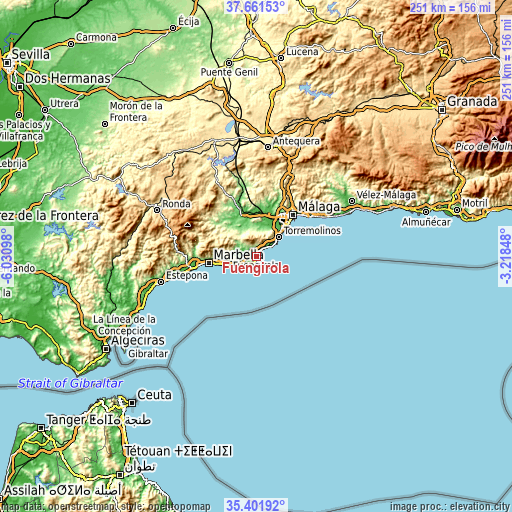
These maps also provides idea of topography and contour of this city, they are displayed at different zoom levels. More info about maps, scale and edge coordinates you can find below images.
| \ | Map #1 | Map #2 | Topo.Map |
| Scale [m] | -3..153 m | -3..1036 m | × |
| Scale [ft] | -10..502 ft | -10..3399 ft | × |
| Average | 44.9 m = 147 ft | 168.9 m = 554 ft | × |
| Width | 7.85 km = 4.9 mi | 15.7 km = 9.8 mi | 251.2 km = 156.1 mi |
| Height | 7.85 km = 4.9 mi | 15.7 km = 9.8 mi | 251.2 km = 156.1 mi |
| ↑Max Latitude | 36.575279° | 36.610563° | 37.66153° |
| Latitude at center | 36.53998° | 36.53998° | 36.53998° |
| ↓Min Latitude | 36.504664° | 36.469333° | 35.40192° |
| ← Min Longitude | -4.668675° | -4.712621° | -6.03098° |
| Longitude center | -4.62473° | -4.62473° | -4.62473° |
| →Max Longitude | -4.580785° | -4.536839° | -3.21848° |
Nearby cities:
Cities around Fuengirola sort by population:
• Marbella elevation 57 m
23.5 km,  263°
263°
• Mijas 418 m
6.3 km,  349°
349°
• Torremolinos 47 m
14.3 km,  51°
51°
• Benalmádena 240 m
7.8 km,  36°
36°
• Alhaurín de la Torre 93 m
14.9 km,  22°
22°
• Alhaurín el Grande 249 m
12.7 km,  334°
334°
• Coín 210 m
17.7 km,  318°
318°
• Cártama 89 m
19 km,  357°
357°
• Estación de Cártama 40 m
21.5 km,  1°
1°
• Ojén 330 m
20.8 km,  277°
277°
• Monda 365 m
21 km,  298°
298°
• Guaro 343 m
22.7 km, 304°
Multilingual:
 En español:
Fuengirola elevación 13 m.
 En France:
Fuengirola élévation 13 m.
 Auf Deutsch:
Fuengirola höhe über dem Meeresspiegel ist 13 m.

Sources and notes:
- [note 1] Map square and city borders are not equal. Map elevation data is calculated only from area inside that square.
- [src 1] Elevation data from geonames database provided with same terms of usage.
- [src 2] The elevation map of Fuengirola is generated using elevation data from NASA's 3 arcsec (90m) resolution SRTM data.
- [src 3] Base (background) map © OpenStreetMap contributors tiles are generated by Geofabrik and OpenTopoMap.
Copyright & License:
This Fuengirola Elevation Map is licensed under CC BY-SA. You may reuse any part from this page, if you give a proper credit by linking to this URL:
 More info on terms of use page.