Fuente-Tójar elevation
Fuente-Tójar (Andalusia, Province of Córdoba), Spain elevation is 587 meters and Fuente-Tójar elevation in feet is 1926 ft above sea level [src 1]. Fuente-Tójar is a seat of a third-order administrative division (feature code) with elevation that is 16 meters (52 ft) smaller than average city elevation in Spain.
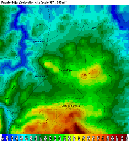
Below is the Elevation map of Fuente-Tójar, which displays elevation range with different colors. Scale of the first map is from 397 to 885 m (1302 to 2904 ft) with average elevation of 561.4 meters (=1842 ft) [note 1]
These maps also provides idea of topography and contour of this city, they are displayed at different zoom levels. More info about maps, scale and edge coordinates you can find below images.
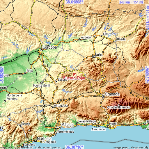
| \ | Map #1 | Topo.Map |
| Scale [m] | 397..885 m | × |
| Scale [ft] | 1302..2904 ft | × |
| Average | 561.4 m = 1842 ft | × |
| Width | 7.75 km = 4.8 mi | 248.1 km = 154.2 mi |
| Height | 7.75 km = 4.8 mi | 248.1 km = 154.2 mi |
| ↑Max Latitude | 37.545801° | 38.61808° |
| Latitude at center | 37.51095° | 37.51095° |
| ↓Min Latitude | 37.476083° | 36.38716° |
| ← Min Longitude | -4.190255° | -5.55256° |
| Longitude center | -4.14631° | -4.14631° |
| →Max Longitude | -4.102365° | -2.74006° |
Nearby cities:
Cities around Fuente-Tójar sort by population:
• Priego de Córdoba elevation 661 m
9.2 km,  208°
208°
• Alcalá la Real 918 m
20.5 km,  105°
105°
• Baena 412 m
19.5 km,  307°
307°
• Alcaudete 672 m
10.5 km,  32°
32°
• Montefrío 796 m
24.2 km,  149°
149°
• Castillo de Locubín 727 m
18.1 km,  83°
83°
• Doña Mencía 597 m
19.1 km,  284°
284°
• Algarinejo 606 m
20.7 km,  182°
182°
• Luque 679 m
12.9 km,  293°
293°
• Carcabuey 617 m
13.5 km,  236°
236°
• Almedinilla 638 m
9.4 km, 148°
• Zuheros 665 m
15.3 km, 283°
Multilingual:
 En español:
Fuente-Tójar elevación 587 m.
 En France:
Fuente-Tójar élévation 587 m.
 Auf Deutsch:
Fuente-Tójar höhe über dem Meeresspiegel ist 587 m.

Sources and notes:
- [note 1] Map square and city borders are not equal. Map elevation data is calculated only from area inside that square.
- [src 1] Elevation data from geonames database provided with same terms of usage.
- [src 2] The elevation map of Fuente-Tójar is generated using elevation data from NASA's 3 arcsec (90m) resolution SRTM data.
- [src 3] Base (background) map © OpenStreetMap contributors tiles are generated by Geofabrik and OpenTopoMap.
Copyright & License:
This Fuente-Tójar Elevation Map is licensed under CC BY-SA. You may reuse any part from this page, if you give a proper credit by linking to this URL:
 More info on terms of use page.