Granada elevation
Granada (Andalusia, Provincia de Granada), Spain elevation is 689 meters and Granada elevation in feet is 2260 ft above sea level [src 1]. Granada is a seat of a second-order administrative division (feature code) with elevation that is 86 meters (282 ft) bigger than average city elevation in Spain.
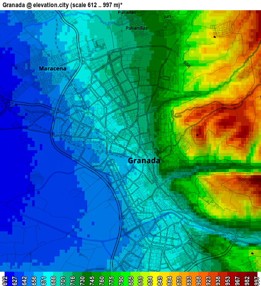
Below is the Elevation map of Granada, which displays elevation range with different colors. Scale of the first map is from 612 to 997 m (2008 to 3271 ft) with average elevation of 719.2 meters (=2360 ft) [note 1]
These maps also provides idea of topography and contour of this city, they are displayed at different zoom levels. More info about maps, scale and edge coordinates you can find below images.
| \ | Map #1 | Map #2 | Topo.Map |
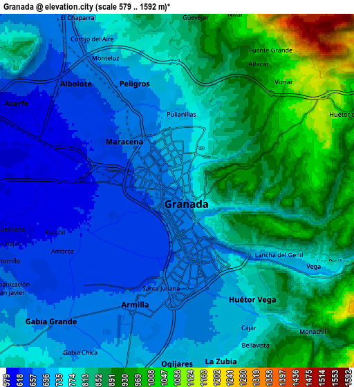
| Scale [m] | 612..997 m | 579..1592 m | × |
| Scale [ft] | 2008..3271 ft | 1900..5223 ft | × |
| Average | 719.2 m = 2360 ft | 782.7 m = 2568 ft | × |
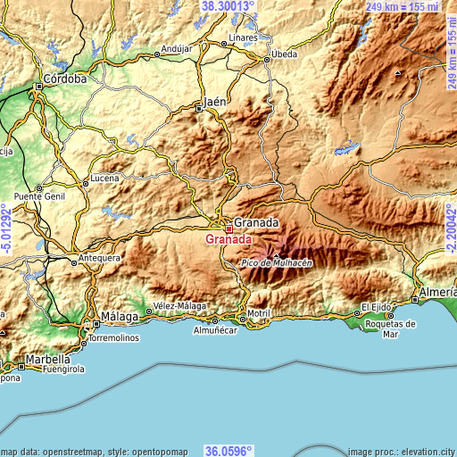
| Width | 7.79 km = 4.8 mi | 15.57 km = 9.7 mi | 249.1 km = 154.8 mi |
| Height | 7.79 km = 4.8 mi | 15.57 km = 9.7 mi | 249.1 km = 154.8 mi |
| ↑Max Latitude | 37.223171° | 37.258156° | 38.30013° |
| Latitude at center | 37.18817° | 37.18817° | 37.18817° |
| ↓Min Latitude | 37.153153° | 37.118119° | 36.0596° |
| ← Min Longitude | -3.650615° | -3.694561° | -5.01292° |
| Longitude center | -3.60667° | -3.60667° | -3.60667° |
| →Max Longitude | -3.562725° | -3.518779° | -2.20042° |
Nearby cities:
Cities around Granada sort by population:
• Armilla elevation 666 m
5.2 km,  198°
198°
• Maracena 662 m
3.3 km,  310°
310°
• Albolote 654 m
6.4 km,  317°
317°
• Churriana de la Vega 663 m
5.9 km,  216°
216°
• Huétor Vega 746 m
5.8 km,  145°
145°
• Peligros 693 m
5.3 km,  338°
338°
• Cúllar-Vega 643 m
6.9 km,  235°
235°
• Alfacar 929 m
6.5 km,  31°
31°
• Pulianas 727 m
3.9 km,  357°
357°
• Cájar 725 m
6.8 km, 153°
• Víznar 1083 m
6.7 km,  44°
44°
• Jun 767 m
3.8 km,  17°
17°
Multilingual:
 En español:
Granada elevación 689 m.
 En France:
Grenade élévation 689 m.


Sources and notes:
- [note 1] Map square and city borders are not equal. Map elevation data is calculated only from area inside that square.
- [src 1] Elevation data from geonames database provided with same terms of usage.
- [src 2] The elevation map of Granada is generated using elevation data from NASA's 3 arcsec (90m) resolution SRTM data.
- [src 3] Base (background) map © OpenStreetMap contributors tiles are generated by Geofabrik and OpenTopoMap.
Copyright & License:
This Granada Elevation Map is licensed under CC BY-SA. You may reuse any part from this page, if you give a proper credit by linking to this URL:
 More info on terms of use page.