Víznar elevation
Víznar (Andalusia, Provincia de Granada), Spain elevation is 1083 meters and Víznar elevation in feet is 3553 ft above sea level [src 1]. Víznar is a seat of a third-order administrative division (feature code) with elevation that is 480 meters (1575 ft) bigger than average city elevation in Spain.
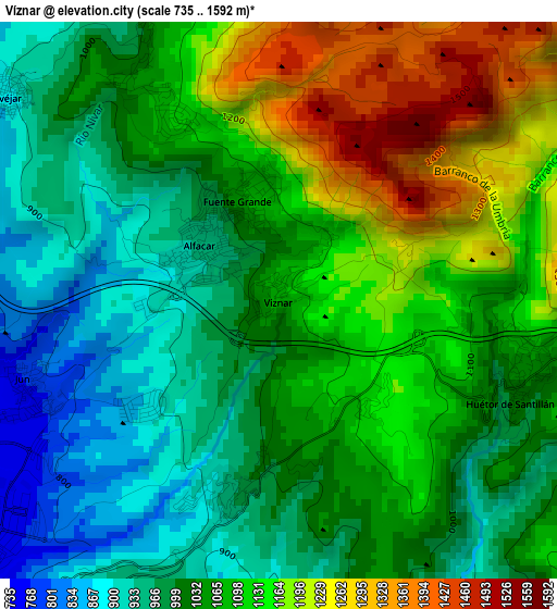
Below is the Elevation map of Víznar, which displays elevation range with different colors. Scale of the first map is from 735 to 1592 m (2411 to 5223 ft) with average elevation of 1060.7 meters (=3480 ft) [note 1]
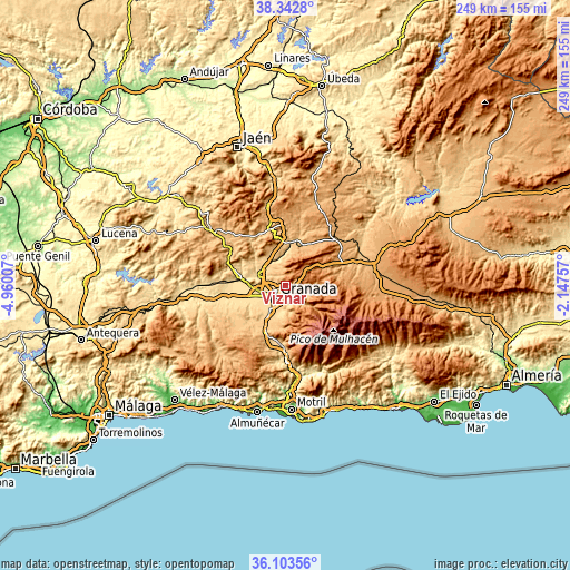
These maps also provides idea of topography and contour of this city, they are displayed at different zoom levels. More info about maps, scale and edge coordinates you can find below images.
| \ | Map #1 | Topo.Map |
| Scale [m] | 735..1592 m | × |
| Scale [ft] | 2411..5223 ft | × |
| Average | 1060.7 m = 3480 ft | × |
| Width | 7.78 km = 4.8 mi | 249 km = 154.7 mi |
| Height | 7.78 km = 4.8 mi | 249 km = 154.7 mi |
| ↑Max Latitude | 37.266471° | 38.3428° |
| Latitude at center | 37.23149° | 37.23149° |
| ↓Min Latitude | 37.196493° | 36.10356° |
| ← Min Longitude | -3.597765° | -4.96007° |
| Longitude center | -3.55382° | -3.55382° |
| →Max Longitude | -3.509875° | -2.14757° |
Nearby cities:
Cities around Víznar sort by population:
• Granada elevation 689 m
6.7 km,  224°
224°
• Maracena 662 m
7.7 km,  249°
249°
• Peligros 693 m
6.7 km,  270°
270°
• Alfacar 929 m
1.4 km,  297°
297°
• Pulianas 727 m
4.9 km,  258°
258°
• Güevéjar 885 m
4.8 km,  307°
307°
• Huétor Santillán 1028 m
3.5 km,  109°
109°
• Beas de Granada 1079 m
6.6 km,  103°
103°
• Nívar 1034 m
3.7 km,  325°
325°
• Calicasas 759 m
6.9 km, 309°
• Dúdar 811 m
8 km,  129°
129°
• Jun 767 m
3.8 km, 251°
Multilingual:
 En español:
Víznar elevación 1083 m.
 En France:
Víznar élévation 1083 m.


Sources and notes:
- [note 1] Map square and city borders are not equal. Map elevation data is calculated only from area inside that square.
- [src 1] Elevation data from geonames database provided with same terms of usage.
- [src 2] The elevation map of Víznar is generated using elevation data from NASA's 3 arcsec (90m) resolution SRTM data.
- [src 3] Base (background) map © OpenStreetMap contributors tiles are generated by Geofabrik and OpenTopoMap.
Copyright & License:
This Víznar Elevation Map is licensed under CC BY-SA. You may reuse any part from this page, if you give a proper credit by linking to this URL:
 More info on terms of use page.