Mérida elevation
Mérida (Extremadura, Provincia de Badajoz), Spain elevation is 229 meters and Mérida elevation in feet is 751 ft above sea level [src 1]. Mérida is a seat of a first-order administrative division (feature code) with elevation that is 374 meters (1227 ft) smaller than average city elevation in Spain.
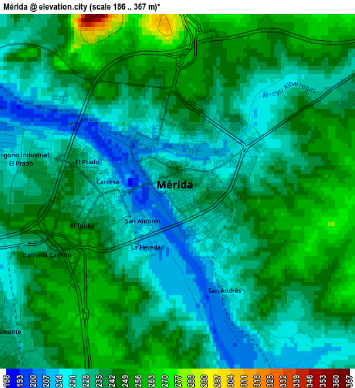
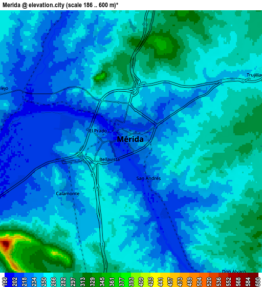
Below is the Elevation map of Mérida, which displays elevation range with different colors. Scale of the first map is from 186 to 367 m (610 to 1204 ft) with average elevation of 236.5 meters (=776 ft) [note 1]
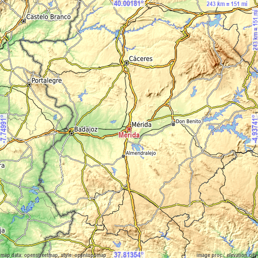
These maps also provides idea of topography and contour of this city, they are displayed at different zoom levels. More info about maps, scale and edge coordinates you can find below images.
| \ | Map #1 | Map #2 | Topo.Map |
| Scale [m] | 186..367 m | 186..600 m | × |
| Scale [ft] | 610..1204 ft | 610..1969 ft | × |
| Average | 236.5 m = 776 ft | 253.2 m = 831 ft | × |
| Width | 7.6 km = 4.7 mi | 15.21 km = 9.5 mi | 243.3 km = 151.2 mi |
| Height | 7.6 km = 4.7 mi | 15.21 km = 9.5 mi | 243.3 km = 151.2 mi |
| ↑Max Latitude | 38.950294° | 38.984462° | 40.00181° |
| Latitude at center | 38.91611° | 38.91611° | 38.91611° |
| ↓Min Latitude | 38.881909° | 38.847692° | 37.81354° |
| ← Min Longitude | -6.387605° | -6.431551° | -7.74991° |
| Longitude center | -6.34366° | -6.34366° | -6.34366° |
| →Max Longitude | -6.299715° | -6.255769° | -4.93741° |
Nearby cities:
Cities around Mérida sort by population:
• Calamonte elevation 237 m
4.9 km,  231°
231°
• Arroyo de San Serván 232 m
11.8 km, 234°
• La Garrovilla 204 m
11.6 km,  271°
271°
• Torremegía 305 m
14.3 km,  191°
191°
• Esparragalejo 235 m
8.5 km,  290°
290°
• Mirandilla 295 m
10.7 km,  26°
26°
• Trujillanos 255 m
8.5 km,  61°
61°
• Villagonzalo 237 m
14 km,  114°
114°
• Valverde de Mérida 268 m
10.7 km,  92°
92°
• San Pedro de Mérida 290 m
14.1 km,  74°
74°
• Don Álvaro 264 m
9.6 km,  141°
141°
• Aljucén 268 m
14.3 km,  4°
4°
Multilingual:
 En español:
Mérida elevación 229 m.
 En France:
Mérida élévation 229 m.


Sources and notes:
- [note 1] Map square and city borders are not equal. Map elevation data is calculated only from area inside that square.
- [src 1] Elevation data from geonames database provided with same terms of usage.
- [src 2] The elevation map of Mérida is generated using elevation data from NASA's 3 arcsec (90m) resolution SRTM data.
- [src 3] Base (background) map © OpenStreetMap contributors tiles are generated by Geofabrik and OpenTopoMap.
Copyright & License:
This Mérida Elevation Map is licensed under CC BY-SA. You may reuse any part from this page, if you give a proper credit by linking to this URL:
 More info on terms of use page.