Monachil elevation
Monachil (Andalusia, Provincia de Granada), Spain elevation is 868 meters and Monachil elevation in feet is 2848 ft above sea level [src 1]. Monachil is a seat of a third-order administrative division (feature code) with elevation that is 265 meters (869 ft) bigger than average city elevation in Spain.
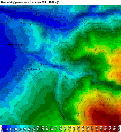
Below is the Elevation map of Monachil, which displays elevation range with different colors. Scale of the first map is from 683 to 1837 m (2241 to 6027 ft) with average elevation of 1002.2 meters (=3288 ft) [note 1]
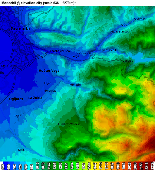
These maps also provides idea of topography and contour of this city, they are displayed at different zoom levels. More info about maps, scale and edge coordinates you can find below images.
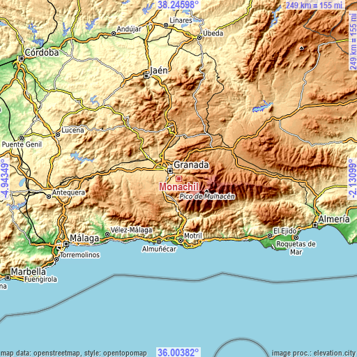
| \ | Map #1 | Map #2 | Topo.Map |
| Scale [m] | 683..1837 m | 636..2279 m | × |
| Scale [ft] | 2241..6027 ft | 2087..7477 ft | × |
| Average | 1002.2 m = 3288 ft | 1061.4 m = 3482 ft | × |
| Width | 7.79 km = 4.8 mi | 15.58 km = 9.7 mi | 249.3 km = 154.9 mi |
| Height | 7.79 km = 4.8 mi | 15.58 km = 9.7 mi | 249.3 km = 154.9 mi |
| ↑Max Latitude | 37.168227° | 37.203237° | 38.24598° |
| Latitude at center | 37.1332° | 37.1332° | 37.1332° |
| ↓Min Latitude | 37.098157° | 37.063098° | 36.00382° |
| ← Min Longitude | -3.581185° | -3.625131° | -4.94349° |
| Longitude center | -3.53724° | -3.53724° | -3.53724° |
| →Max Longitude | -3.493295° | -3.449349° | -2.13099° |
Nearby cities:
Cities around Monachil sort by population:
• Granada elevation 689 m
8.7 km,  314°
314°
• Armilla 666 m
7.9 km,  278°
278°
• Zubia 755 m
4.4 km,  249°
249°
• Ogíjares 723 m
6.4 km,  255°
255°
• Huétor Vega 746 m
3.2 km,  295°
295°
• Cenes de la Vega 751 m
3 km,  2°
2°
• Gójar 794 m
6.9 km,  242°
242°
• Cájar 725 m
3.1 km,  271°
271°
• Dílar 892 m
8.8 km,  220°
220°
• Pinos Genil 777 m
4.6 km,  42°
42°
• Quéntar 871 m
9.1 km, 43°
• Dúdar 811 m
7.5 km, 39°
Multilingual:
 En español:
Monachil elevación 868 m.
 En France:
Monachil élévation 868 m.
 Auf Deutsch:
Monachil höhe über dem Meeresspiegel ist 868 m.

Sources and notes:
- [note 1] Map square and city borders are not equal. Map elevation data is calculated only from area inside that square.
- [src 1] Elevation data from geonames database provided with same terms of usage.
- [src 2] The elevation map of Monachil is generated using elevation data from NASA's 3 arcsec (90m) resolution SRTM data.
- [src 3] Base (background) map © OpenStreetMap contributors tiles are generated by Geofabrik and OpenTopoMap.
Copyright & License:
This Monachil Elevation Map is licensed under CC BY-SA. You may reuse any part from this page, if you give a proper credit by linking to this URL:
 More info on terms of use page.