Nambroca elevation
Nambroca (Castille-La Mancha, Province of Toledo), Spain elevation is 680 meters and Nambroca elevation in feet is 2231 ft above sea level [src 1]. Nambroca is a seat of a third-order administrative division (feature code) with elevation that is 77 meters (253 ft) bigger than average city elevation in Spain.
Below is the Elevation map of Nambroca, which displays elevation range with different colors. Scale of the first map is from 587 to 929 m (1926 to 3048 ft) with average elevation of 686.6 meters (=2253 ft) [note 1]
These maps also provides idea of topography and contour of this city, they are displayed at different zoom levels. More info about maps, scale and edge coordinates you can find below images.
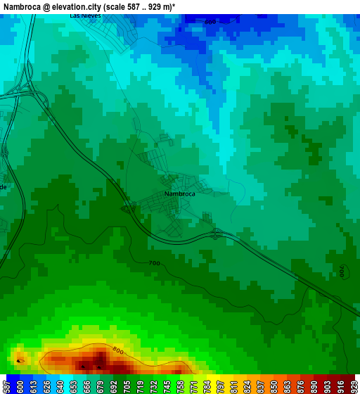
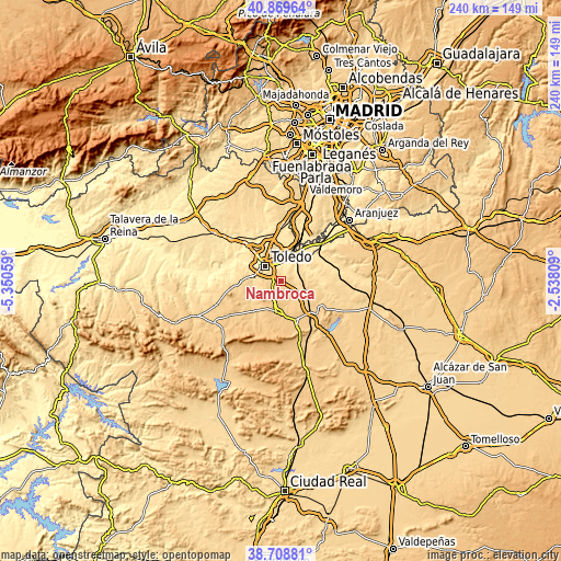
| \ | Map #1 | Topo.Map |
| Scale [m] | 587..929 m | × |
| Scale [ft] | 1926..3048 ft | × |
| Average | 686.6 m = 2253 ft | × |
| Width | 7.51 km = 4.7 mi | 240.3 km = 149.3 mi |
| Height | 7.51 km = 4.7 mi | 240.3 km = 149.3 mi |
| ↑Max Latitude | 39.831465° | 40.86964° |
| Latitude at center | 39.79771° | 39.79771° |
| ↓Min Latitude | 39.763938° | 38.70881° |
| ← Min Longitude | -3.988285° | -5.35059° |
| Longitude center | -3.94434° | -3.94434° |
| →Max Longitude | -3.900395° | -2.53809° |
Nearby cities:
Cities around Nambroca sort by population:
• Toledo elevation 533 m
9.5 km,  315°
315°
• Sonseca 755 m
13.6 km,  190°
190°
• Mocejón 483 m
15.9 km,  8°
8°
• Cobisa 676 m
7 km,  276°
276°
• Ajofrín 774 m
10.2 km,  198°
198°
• Burguillos de Toledo 680 m
4.1 km,  267°
267°
• Mazarambroz 778 m
13.2 km,  209°
209°
• Villaminaya 728 m
11.4 km,  146°
146°
• Mascaraque 714 m
14.4 km,  128°
128°
• Layos 652 m
10.5 km,  257°
257°
• Chueca 739 m
7.3 km,  179°
179°
• Casasbuenas 686 m
16 km, 255°
Multilingual:
 En español:
Nambroca elevación 680 m.
 En France:
Nambroca élévation 680 m.
 Auf Deutsch:
Nambroca höhe über dem Meeresspiegel ist 680 m.

Sources and notes:
- [note 1] Map square and city borders are not equal. Map elevation data is calculated only from area inside that square.
- [src 1] Elevation data from geonames database provided with same terms of usage.
- [src 2] The elevation map of Nambroca is generated using elevation data from NASA's 3 arcsec (90m) resolution SRTM data.
- [src 3] Base (background) map © OpenStreetMap contributors tiles are generated by Geofabrik and OpenTopoMap.
Copyright & License:
This Nambroca Elevation Map is licensed under CC BY-SA. You may reuse any part from this page, if you give a proper credit by linking to this URL:
 More info on terms of use page.