Ontinyent elevation
Ontinyent (Valencia, Província de València), Spain elevation is 369 meters and Ontinyent elevation in feet is 1211 ft above sea level [src 1]. Ontinyent is a seat of a third-order administrative division (feature code) with elevation that is 234 meters (768 ft) smaller than average city elevation in Spain.
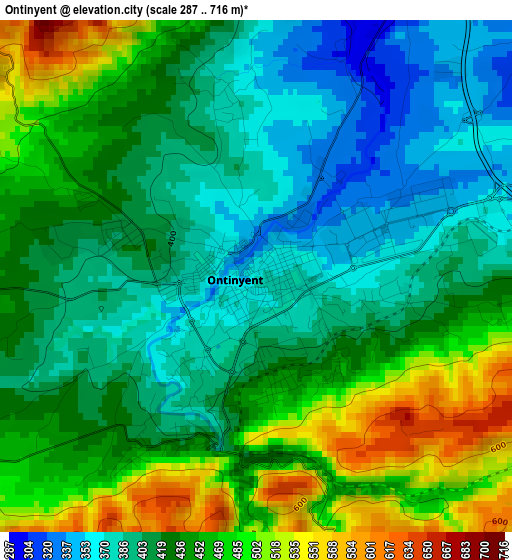
Below is the Elevation map of Ontinyent, which displays elevation range with different colors. Scale of the first map is from 287 to 716 m (942 to 2349 ft) with average elevation of 432 meters (=1417 ft) [note 1]
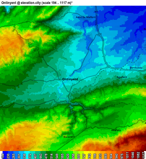
These maps also provides idea of topography and contour of this city, they are displayed at different zoom levels. More info about maps, scale and edge coordinates you can find below images.
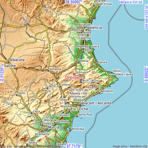
| \ | Map #1 | Map #2 | Topo.Map |
| Scale [m] | 287..716 m | 194..1117 m | × |
| Scale [ft] | 942..2349 ft | 636..3665 ft | × |
| Average | 432 m = 1417 ft | 523.1 m = 1716 ft | × |
| Width | 7.61 km = 4.7 mi | 15.23 km = 9.5 mi | 243.6 km = 151.4 mi |
| Height | 7.61 km = 4.7 mi | 15.23 km = 9.5 mi | 243.6 km = 151.4 mi |
| ↑Max Latitude | 38.856139° | 38.890353° | 39.90907° |
| Latitude at center | 38.82191° | 38.82191° | 38.82191° |
| ↓Min Latitude | 38.787664° | 38.753402° | 37.7179° |
| ← Min Longitude | -0.649975° | -0.693921° | -2.01228° |
| Longitude center | -0.60603° | -0.60603° | -0.60603° |
| →Max Longitude | -0.562085° | -0.518139° | 0.80022° |
Nearby cities:
Cities around Ontinyent sort by population:
• L'Olleria elevation 255 m
11.6 km,  24°
24°
• Albaida 328 m
7.9 km,  76°
76°
• Bocairent 668 m
6.2 km,  188°
188°
• Aielo de Malferit 269 m
7.1 km, 16°
• Vallada 291 m
11 km,  318°
318°
• Agullent 410 m
5 km,  88°
88°
• Atzeneta d'Albaida 384 m
9.3 km, 82°
• Agres 671 m
8.9 km,  118°
118°
• Alfafara 581 m
6.9 km,  140°
140°
• Benissoda 366 m
7.8 km, 80°
• Bufali 237 m
9.3 km,  56°
56°
• Carrícola 328 m
11.8 km, 79°
Multilingual:
 En español:
Onteniente elevación 369 m.
 En France:
Ontinyent élévation 369 m.
 Auf Deutsch:
Ontinyent höhe über dem Meeresspiegel ist 369 m.

Sources and notes:
- [note 1] Map square and city borders are not equal. Map elevation data is calculated only from area inside that square.
- [src 1] Elevation data from geonames database provided with same terms of usage.
- [src 2] The elevation map of Ontinyent is generated using elevation data from NASA's 3 arcsec (90m) resolution SRTM data.
- [src 3] Base (background) map © OpenStreetMap contributors tiles are generated by Geofabrik and OpenTopoMap.
Copyright & License:
This Ontinyent Elevation Map is licensed under CC BY-SA. You may reuse any part from this page, if you give a proper credit by linking to this URL:
 More info on terms of use page.