Puçol elevation
Puçol (Valencia, Província de València), Spain elevation is 10 meters and Puçol elevation in feet is 33 ft above sea level [src 1]. Puçol is a seat of a third-order administrative division (feature code) with elevation that is 593 meters (1946 ft) smaller than average city elevation in Spain.
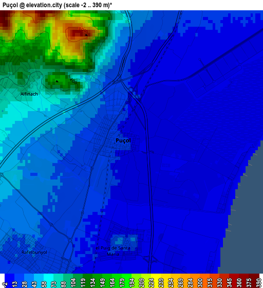
Below is the Elevation map of Puçol, which displays elevation range with different colors. Scale of the first map is from -2 to 390 m (-7 to 1280 ft) with average elevation of 37.6 meters (=123 ft) [note 1]
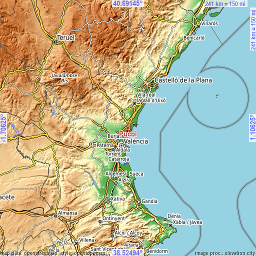
These maps also provides idea of topography and contour of this city, they are displayed at different zoom levels. More info about maps, scale and edge coordinates you can find below images.
| \ | Map #1 | Map #2 | Topo.Map |
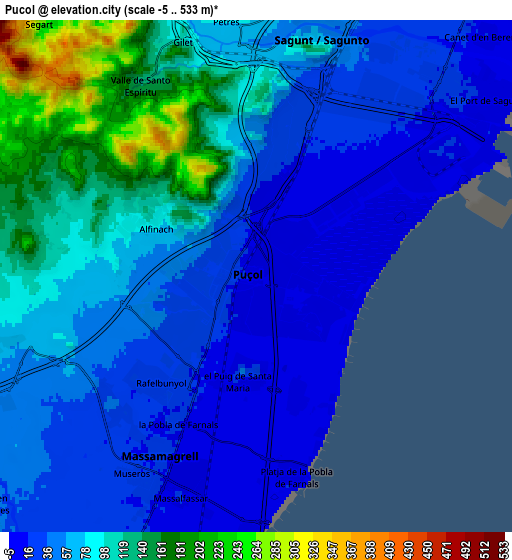
| Scale [m] | -2..390 m | -5..533 m | × |
| Scale [ft] | -7..1280 ft | -16..1749 ft | × |
| Average | 37.6 m = 123 ft | 70.6 m = 232 ft | × |
| Width | 7.53 km = 4.7 mi | 15.06 km = 9.4 mi | 240.9 km = 149.7 mi |
| Height | 7.53 km = 4.7 mi | 15.06 km = 9.4 mi | 240.9 km = 149.7 mi |
| ↑Max Latitude | 39.650514° | 39.684341° | 40.69145° |
| Latitude at center | 39.61667° | 39.61667° | 39.61667° |
| ↓Min Latitude | 39.582809° | 39.548932° | 38.52494° |
| ← Min Longitude | -0.343945° | -0.387891° | -1.70625° |
| Longitude center | -0.3° | -0.3° | -0.3° |
| →Max Longitude | -0.256055° | -0.212109° | 1.10625° |
Nearby cities:
Cities around Puçol sort by population:
• Sagunto elevation 43 m
7.9 km,  21°
21°
• Grao de Murviedro 3 m
5.9 km,  62°
62°
• Massamagrell 18 m
6.3 km,  207°
207°
• Meliana 7 m
9.7 km,  197°
197°
• Puig 13 m
3.1 km,  185°
185°
• La Pobla de Farnals 3 m
5.8 km,  166°
166°
• Museros 19 m
7 km,  217°
217°
• Albuixech 7 m
7.5 km, 190°
• Gilet 82 m
7.5 km,  349°
349°
• Petrés 75 m
7.4 km,  0°
0°
• Emperador 11 m
7.9 km, 201°
• Segart 256 m
9.4 km,  322°
322°
Multilingual:
 En español:
Puzol elevación 10 m.
 En France:
Puçol élévation 10 m.


Sources and notes:
- [note 1] Map square and city borders are not equal. Map elevation data is calculated only from area inside that square.
- [src 1] Elevation data from geonames database provided with same terms of usage.
- [src 2] The elevation map of Puçol is generated using elevation data from NASA's 3 arcsec (90m) resolution SRTM data.
- [src 3] Base (background) map © OpenStreetMap contributors tiles are generated by Geofabrik and OpenTopoMap.
Copyright & License:
This Puçol Elevation Map is licensed under CC BY-SA. You may reuse any part from this page, if you give a proper credit by linking to this URL:
 More info on terms of use page.