Saelices elevation
Saelices (Castille-La Mancha, Provincia de Cuenca), Spain elevation is 929 meters and Saelices elevation in feet is 3048 ft above sea level [src 1]. Saelices is a seat of a third-order administrative division (feature code) with elevation that is 326 meters (1070 ft) bigger than average city elevation in Spain.
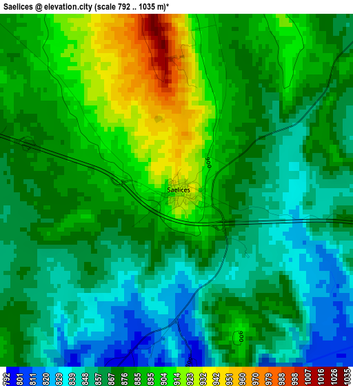
Below is the Elevation map of Saelices, which displays elevation range with different colors. Scale of the first map is from 792 to 1035 m (2598 to 3396 ft) with average elevation of 875.4 meters (=2872 ft) [note 1]
These maps also provides idea of topography and contour of this city, they are displayed at different zoom levels. More info about maps, scale and edge coordinates you can find below images.
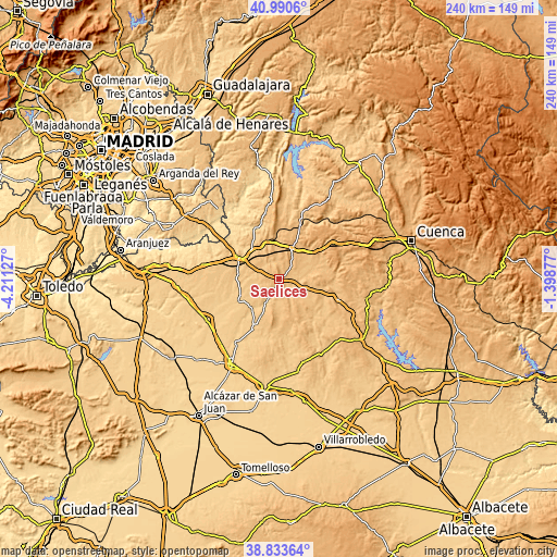
| \ | Map #1 | Topo.Map |
| Scale [m] | 792..1035 m | × |
| Scale [ft] | 2598..3396 ft | × |
| Average | 875.4 m = 2872 ft | × |
| Width | 7.49 km = 4.7 mi | 239.8 km = 149 mi |
| Height | 7.49 km = 4.7 mi | 239.8 km = 149 mi |
| ↑Max Latitude | 39.954305° | 40.9906° |
| Latitude at center | 39.92061° | 39.92061° |
| ↓Min Latitude | 39.886899° | 38.83364° |
| ← Min Longitude | -2.848965° | -4.21127° |
| Longitude center | -2.80502° | -2.80502° |
| →Max Longitude | -2.761075° | -1.39877° |
Nearby cities:
Cities around Saelices sort by population:
• Montalbo elevation 876 m
12.3 km,  111°
111°
• Almonacid del Marquesado 895 m
11.3 km,  163°
163°
• Puebla de Almenara 857 m
15.2 km,  183°
183°
• Pozorrubio 788 m
16.9 km,  226°
226°
• Torrubia del Campo 805 m
13.6 km,  259°
259°
• Uclés 846 m
8.1 km,  323°
323°
• Villarrubio 829 m
8.1 km,  289°
289°
• Alcázar del Rey 874 m
15.8 km,  359°
359°
• Tribaldos 830 m
9.8 km,  306°
306°
• Rozalén del Monte 877 m
7.8 km, 359°
• Paredes 835 m
16.7 km,  345°
345°
• Huelves 822 m
15.2 km,  333°
333°
Multilingual:
 En español:
Saelices elevación 929 m.
 En France:
Saelices élévation 929 m.
 Auf Deutsch:
Saelices höhe über dem Meeresspiegel ist 929 m.

Sources and notes:
- [note 1] Map square and city borders are not equal. Map elevation data is calculated only from area inside that square.
- [src 1] Elevation data from geonames database provided with same terms of usage.
- [src 2] The elevation map of Saelices is generated using elevation data from NASA's 3 arcsec (90m) resolution SRTM data.
- [src 3] Base (background) map © OpenStreetMap contributors tiles are generated by Geofabrik and OpenTopoMap.
Copyright & License:
This Saelices Elevation Map is licensed under CC BY-SA. You may reuse any part from this page, if you give a proper credit by linking to this URL:
 More info on terms of use page.