Teulada elevation
Teulada (Valencia, Provincia de Alicante), Spain elevation is 186 meters and Teulada elevation in feet is 610 ft above sea level [src 1]. Teulada is a seat of a third-order administrative division (feature code) with elevation that is 417 meters (1368 ft) smaller than average city elevation in Spain.
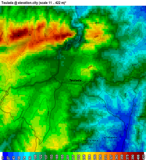
Below is the Elevation map of Teulada, which displays elevation range with different colors. Scale of the first map is from 11 to 422 m (36 to 1385 ft) with average elevation of 166.2 meters (=545 ft) [note 1]
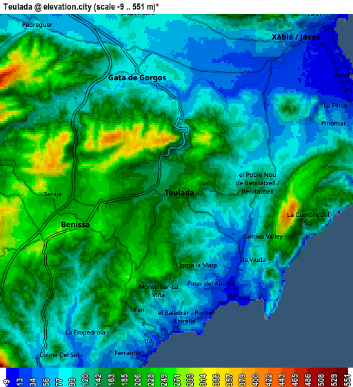
These maps also provides idea of topography and contour of this city, they are displayed at different zoom levels. More info about maps, scale and edge coordinates you can find below images.
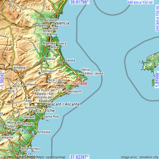
| \ | Map #1 | Map #2 | Topo.Map |
| Scale [m] | 11..422 m | -9..551 m | × |
| Scale [ft] | 36..1385 ft | -30..1808 ft | × |
| Average | 166.2 m = 545 ft | 141.5 m = 464 ft | × |
| Width | 7.62 km = 4.7 mi | 15.25 km = 9.5 mi | 244 km = 151.6 mi |
| Height | 7.62 km = 4.7 mi | 15.25 km = 9.5 mi | 243.9 km = 151.6 mi |
| ↑Max Latitude | 38.763674° | 38.797931° | 39.81798° |
| Latitude at center | 38.7294° | 38.7294° | 38.7294° |
| ↓Min Latitude | 38.69511° | 38.660803° | 37.62397° |
| ← Min Longitude | 0.059885° | 0.015939° | -1.30242° |
| Longitude center | 0.10383° | 0.10383° | 0.10383° |
| →Max Longitude | 0.147775° | 0.191721° | 1.51008° |
Nearby cities:
Cities around Teulada sort by population:
• Denia elevation 18 m
12.4 km,  0°
0°
• Javea 14 m
8.1 km,  42°
42°
• Calp 58 m
10.7 km,  208°
208°
• Benissa 266 m
5.1 km,  251°
251°
• Pedreguer 92 m
9.3 km,  319°
319°
• Ondara 37 m
13.3 km,  325°
325°
• Gata de Gorgos 84 m
5.3 km,  342°
342°
• Benitachell 153 m
3.5 km,  83°
83°
• Jalón 200 m
10.1 km,  277°
277°
• Moraira 17 m
5.3 km,  149°
149°
• Alcalalí 233 m
12.7 km, 280°
• Senija 238 m
5.4 km,  268°
268°
Multilingual:
 En español:
Teulada elevación 186 m.
 En France:
Teulada élévation 186 m.


Sources and notes:
- [note 1] Map square and city borders are not equal. Map elevation data is calculated only from area inside that square.
- [src 1] Elevation data from geonames database provided with same terms of usage.
- [src 2] The elevation map of Teulada is generated using elevation data from NASA's 3 arcsec (90m) resolution SRTM data.
- [src 3] Base (background) map © OpenStreetMap contributors tiles are generated by Geofabrik and OpenTopoMap.
Copyright & License:
This Teulada Elevation Map is licensed under CC BY-SA. You may reuse any part from this page, if you give a proper credit by linking to this URL:
 More info on terms of use page.