Ondara elevation
Ondara (Valencia, Provincia de Alicante), Spain elevation is 37 meters and Ondara elevation in feet is 121 ft above sea level [src 1]. Ondara is a seat of a third-order administrative division (feature code) with elevation that is 566 meters (1857 ft) smaller than average city elevation in Spain.
Below is the Elevation map of Ondara, which displays elevation range with different colors. Scale of the first map is from -8 to 476 m (-26 to 1562 ft) with average elevation of 51 meters (=167 ft) [note 1]
These maps also provides idea of topography and contour of this city, they are displayed at different zoom levels. More info about maps, scale and edge coordinates you can find below images.
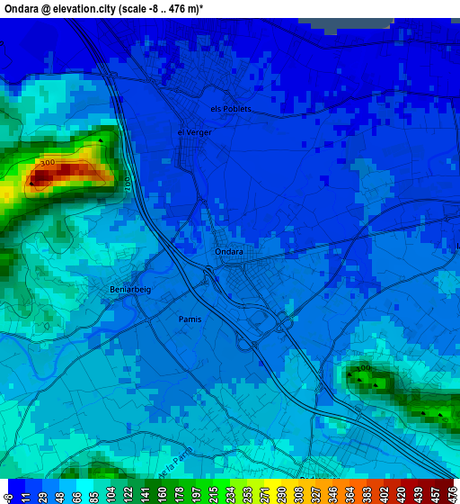
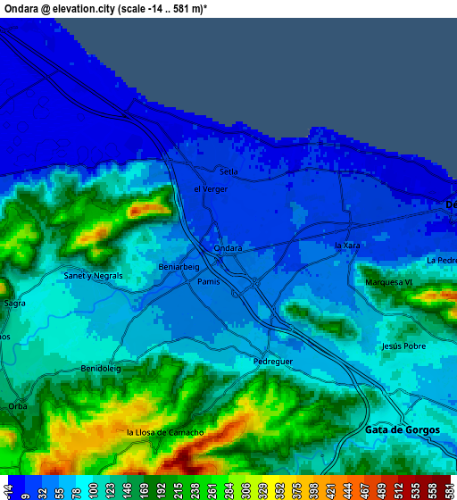
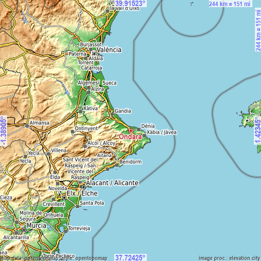
| \ | Map #1 | Map #2 | Topo.Map |
| Scale [m] | -8..476 m | -14..581 m | × |
| Scale [ft] | -26..1562 ft | -46..1906 ft | × |
| Average | 51 m = 167 ft | 106.7 m = 350 ft | × |
| Width | 7.61 km = 4.7 mi | 15.23 km = 9.5 mi | 243.6 km = 151.4 mi |
| Height | 7.61 km = 4.7 mi | 15.23 km = 9.5 mi | 243.6 km = 151.4 mi |
| ↑Max Latitude | 38.862396° | 38.896606° | 39.91523° |
| Latitude at center | 38.82817° | 38.82817° | 38.82817° |
| ↓Min Latitude | 38.793927° | 38.759668° | 37.72425° |
| ← Min Longitude | -0.026745° | -0.070691° | -1.38905° |
| Longitude center | 0.0172° | 0.0172° | 0.0172° |
| →Max Longitude | 0.061145° | 0.105091° | 1.42345° |
Nearby cities:
Cities around Ondara sort by population:
• Denia elevation 18 m
7.8 km,  79°
79°
• Pedreguer 92 m
4.2 km,  159°
159°
• Gata de Gorgos 84 m
8.4 km,  135°
135°
• Vergel 23 m
2.2 km,  344°
344°
• els Poblets 13 m
2.9 km,  6°
6°
• Orba 163 m
8.7 km,  232°
232°
• Beniarbeig 45 m
1.8 km,  248°
248°
• Benidoleig 111 m
5.7 km, 226°
• Sanet y Negrals 94 m
4.5 km,  257°
257°
• Sagra 111 m
7.4 km, 255°
• Tormos 127 m
8.2 km, 248°
• Benimeli 95 m
5.2 km, 264°
Multilingual:
 En español:
Ondara elevación 37 m.
 En France:
Ondara élévation 37 m.


Sources and notes:
- [note 1] Map square and city borders are not equal. Map elevation data is calculated only from area inside that square.
- [src 1] Elevation data from geonames database provided with same terms of usage.
- [src 2] The elevation map of Ondara is generated using elevation data from NASA's 3 arcsec (90m) resolution SRTM data.
- [src 3] Base (background) map © OpenStreetMap contributors tiles are generated by Geofabrik and OpenTopoMap.
Copyright & License:
This Ondara Elevation Map is licensed under CC BY-SA. You may reuse any part from this page, if you give a proper credit by linking to this URL:
 More info on terms of use page.