Trujillo elevation
Trujillo (Extremadura, Provincia de Cáceres), Spain elevation is 520 meters and Trujillo elevation in feet is 1706 ft above sea level [src 1]. Trujillo is a seat of a third-order administrative division (feature code) with elevation that is 83 meters (272 ft) smaller than average city elevation in Spain.
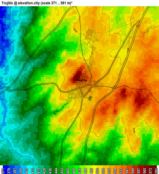
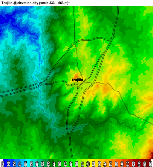
Below is the Elevation map of Trujillo, which displays elevation range with different colors. Scale of the first map is from 371 to 581 m (1217 to 1906 ft) with average elevation of 478 meters (=1568 ft) [note 1]
These maps also provides idea of topography and contour of this city, they are displayed at different zoom levels. More info about maps, scale and edge coordinates you can find below images.
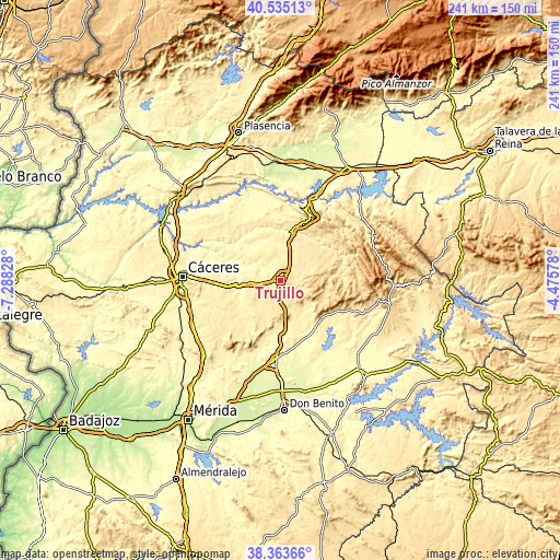
| \ | Map #1 | Map #2 | Topo.Map |
| Scale [m] | 371..581 m | 333..663 m | × |
| Scale [ft] | 1217..1906 ft | 1093..2175 ft | × |
| Average | 478 m = 1568 ft | 462.4 m = 1517 ft | × |
| Width | 7.55 km = 4.7 mi | 15.09 km = 9.4 mi | 241.4 km = 150 mi |
| Height | 7.55 km = 4.7 mi | 15.09 km = 9.4 mi | 241.4 km = 150 mi |
| ↑Max Latitude | 39.491782° | 39.525687° | 40.53513° |
| Latitude at center | 39.45786° | 39.45786° | 39.45786° |
| ↓Min Latitude | 39.423922° | 39.389967° | 38.36366° |
| ← Min Longitude | -5.925975° | -5.969921° | -7.28828° |
| Longitude center | -5.88203° | -5.88203° | -5.88203° |
| →Max Longitude | -5.838085° | -5.794139° | -4.47578° |
Nearby cities:
Cities around Trujillo sort by population:
• Madroñera elevation 591 m
11.4 km,  108°
108°
• Torrecillas de la Tiesa 503 m
17.2 km,  44°
44°
• La Cumbre 482 m
10 km,  233°
233°
• Ibahernando 532 m
15.1 km,  191°
191°
• Plasenzuela 427 m
16.6 km,  239°
239°
• Puerto de Santa Cruz 458 m
15.9 km,  172°
172°
• Herguijuela 463 m
14 km,  131°
131°
• Santa Ana 489 m
19.1 km,  209°
209°
• Santa Cruz de la Sierra 455 m
13.9 km, 166°
• Santa Marta de Magasca 377 m
19.5 km,  287°
287°
• Conquista de la Sierra 441 m
17.4 km, 133°
• Ruanes 480 m
18.3 km,  218°
218°
Multilingual:
 En español:
Trujillo elevación 520 m.
 En France:
Trujillo élévation 520 m.
 Auf Deutsch:
Trujillo höhe über dem Meeresspiegel ist 520 m.

Sources and notes:
- [note 1] Map square and city borders are not equal. Map elevation data is calculated only from area inside that square.
- [src 1] Elevation data from geonames database provided with same terms of usage.
- [src 2] The elevation map of Trujillo is generated using elevation data from NASA's 3 arcsec (90m) resolution SRTM data.
- [src 3] Base (background) map © OpenStreetMap contributors tiles are generated by Geofabrik and OpenTopoMap.
Copyright & License:
This Trujillo Elevation Map is licensed under CC BY-SA. You may reuse any part from this page, if you give a proper credit by linking to this URL:
 More info on terms of use page.