Umbrete elevation
Umbrete (Andalusia, Provincia de Sevilla), Spain elevation is 122 meters and Umbrete elevation in feet is 400 ft above sea level [src 1]. Umbrete is a seat of a third-order administrative division (feature code) with elevation that is 481 meters (1578 ft) smaller than average city elevation in Spain.
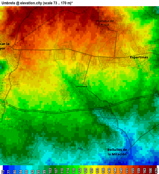
Below is the Elevation map of Umbrete, which displays elevation range with different colors. Scale of the first map is from 73 to 170 m (240 to 558 ft) with average elevation of 122.6 meters (=402 ft) [note 1]
These maps also provides idea of topography and contour of this city, they are displayed at different zoom levels. More info about maps, scale and edge coordinates you can find below images.
| \ | Map #1 | Map #2 | Topo.Map |
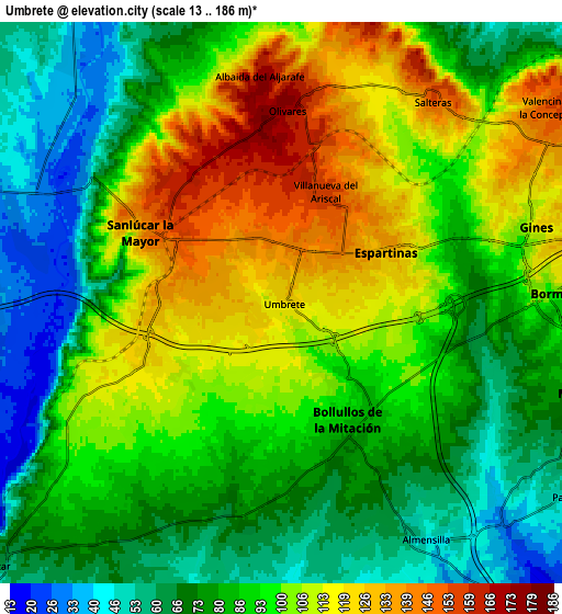
| Scale [m] | 73..170 m | 13..186 m | × |
| Scale [ft] | 240..558 ft | 43..610 ft | × |
| Average | 122.6 m = 402 ft | 90.9 m = 298 ft | × |
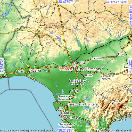
| Width | 7.77 km = 4.8 mi | 15.53 km = 9.6 mi | 248.5 km = 154.4 mi |
| Height | 7.77 km = 4.8 mi | 15.53 km = 9.6 mi | 248.5 km = 154.4 mi |
| ↑Max Latitude | 37.403727° | 37.438628° | 38.47807° |
| Latitude at center | 37.36881° | 37.36881° | 37.36881° |
| ↓Min Latitude | 37.333877° | 37.298927° | 36.24291° |
| ← Min Longitude | -6.202415° | -6.246361° | -7.56472° |
| Longitude center | -6.15847° | -6.15847° | -6.15847° |
| →Max Longitude | -6.114525° | -6.070579° | -4.75222° |
Nearby cities:
Cities around Umbrete sort by population:
• Mairena del Aljarafe elevation 70 m
8.8 km,  107°
107°
• Bormujos 113 m
7.6 km,  86°
86°
• Gines 119 m
7.4 km,  74°
74°
• Sanlúcar la Mayor 141 m
4.5 km,  297°
297°
• Espartinas 132 m
3.2 km,  63°
63°
• Olivares 175 m
5.5 km,  2°
2°
• Bollullos de la Mitación 87 m
3.7 km,  149°
149°
• Benacazón 120 m
3.8 km,  242°
242°
• Villanueva del Ariscal 153 m
3.4 km,  27°
27°
• Almensilla 51 m
7.7 km, 146°
• Salteras 156 m
7.2 km,  36°
36°
• Albaida del Aljarafe 173 m
6.1 km,  353°
353°
Multilingual:
 En español:
Umbrete elevación 122 m.
 En France:
Umbrete élévation 122 m.


Sources and notes:
- [note 1] Map square and city borders are not equal. Map elevation data is calculated only from area inside that square.
- [src 1] Elevation data from geonames database provided with same terms of usage.
- [src 2] The elevation map of Umbrete is generated using elevation data from NASA's 3 arcsec (90m) resolution SRTM data.
- [src 3] Base (background) map © OpenStreetMap contributors tiles are generated by Geofabrik and OpenTopoMap.
Copyright & License:
This Umbrete Elevation Map is licensed under CC BY-SA. You may reuse any part from this page, if you give a proper credit by linking to this URL:
 More info on terms of use page.