Utrera elevation
Utrera (Andalusia, Provincia de Sevilla), Spain elevation is 52 meters and Utrera elevation in feet is 171 ft above sea level [src 1]. Utrera is a seat of a third-order administrative division (feature code) with elevation that is 551 meters (1808 ft) smaller than average city elevation in Spain.
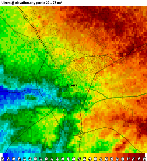
Below is the Elevation map of Utrera, which displays elevation range with different colors. Scale of the first map is from 22 to 78 m (72 to 256 ft) with average elevation of 54.4 meters (=178 ft) [note 1]
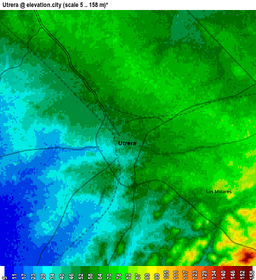
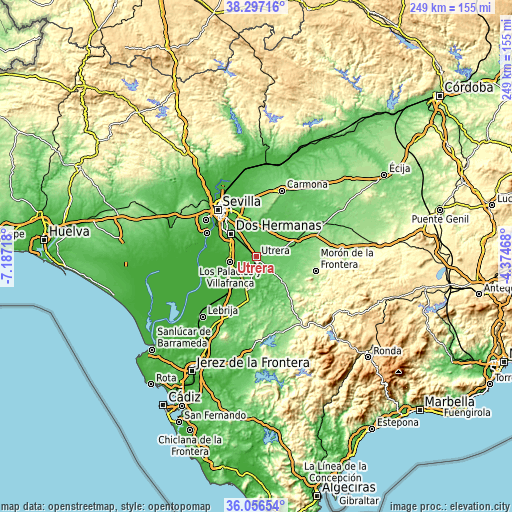
These maps also provides idea of topography and contour of this city, they are displayed at different zoom levels. More info about maps, scale and edge coordinates you can find below images.
| \ | Map #1 | Map #2 | Topo.Map |
| Scale [m] | 22..78 m | 5..158 m | × |
| Scale [ft] | 72..256 ft | 16..518 ft | × |
| Average | 54.4 m = 178 ft | 52.8 m = 173 ft | × |
| Width | 7.79 km = 4.8 mi | 15.57 km = 9.7 mi | 249.1 km = 154.8 mi |
| Height | 7.79 km = 4.8 mi | 15.57 km = 9.7 mi | 249.1 km = 154.8 mi |
| ↑Max Latitude | 37.220163° | 37.255149° | 38.29716° |
| Latitude at center | 37.18516° | 37.18516° | 37.18516° |
| ↓Min Latitude | 37.150141° | 37.115106° | 36.05654° |
| ← Min Longitude | -5.824875° | -5.868821° | -7.18718° |
| Longitude center | -5.78093° | -5.78093° | -5.78093° |
| →Max Longitude | -5.736985° | -5.693039° | -4.37468° |
Nearby cities:
Cities around Utrera sort by population:
• Dos Hermanas elevation 45 m
16.5 km,  311°
311°
• Alcalá de Guadaira 71 m
17.8 km,  343°
343°
• Los Palacios y Villafranca 13 m
13 km,  258°
258°
• Coria del Río 13 m
26.7 km,  295°
295°
• Mairena del Alcor 135 m
21.1 km,  7°
7°
• El Arahal 118 m
22.6 km,  67°
67°
• El Viso del Alcor 167 m
23.5 km, 13°
• Las Cabezas de San Juan 46 m
26.4 km,  212°
212°
• La Puebla del Río 22 m
26.6 km,  290°
290°
• Gelves 8 m
27.3 km, 307°
• El Coronil 134 m
17.5 km,  132°
132°
• Los Molares 84 m
6.4 km,  119°
119°
Multilingual:
 En español:
Utrera elevación 52 m.
 En France:
Utrera élévation 52 m.


Sources and notes:
- [note 1] Map square and city borders are not equal. Map elevation data is calculated only from area inside that square.
- [src 1] Elevation data from geonames database provided with same terms of usage.
- [src 2] The elevation map of Utrera is generated using elevation data from NASA's 3 arcsec (90m) resolution SRTM data.
- [src 3] Base (background) map © OpenStreetMap contributors tiles are generated by Geofabrik and OpenTopoMap.
Copyright & License:
This Utrera Elevation Map is licensed under CC BY-SA. You may reuse any part from this page, if you give a proper credit by linking to this URL:
 More info on terms of use page.