Qinā elevation
Qinā (Qena), Egypt elevation is 80 meters and Qinā elevation in feet is 262 ft above sea level [src 1]. Qinā is a seat of a first-order administrative division (feature code) with elevation that is 36 meters (118 ft) bigger than average city elevation in Egypt.
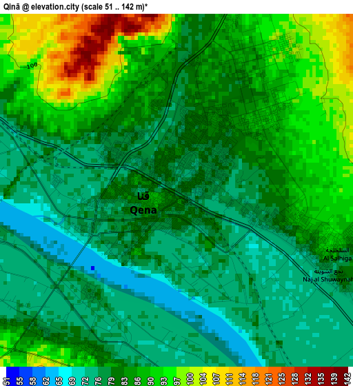
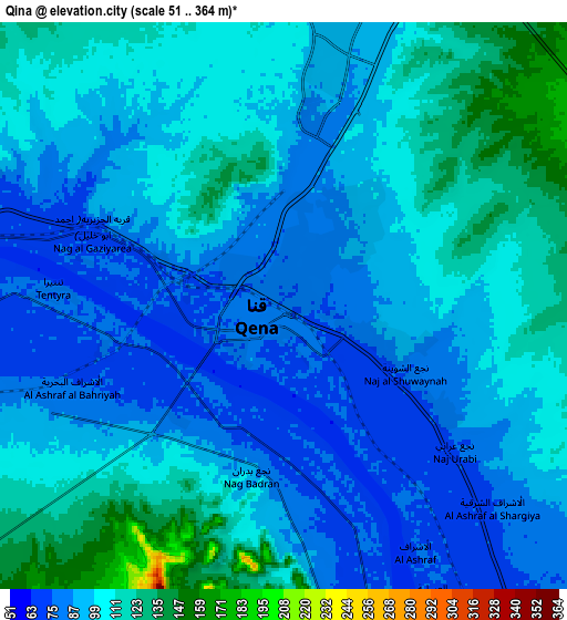
Below is the Elevation map of Qinā, which displays elevation range with different colors. Scale of the first map is from 51 to 142 m (167 to 466 ft) with average elevation of 82.8 meters (=272 ft) [note 1]
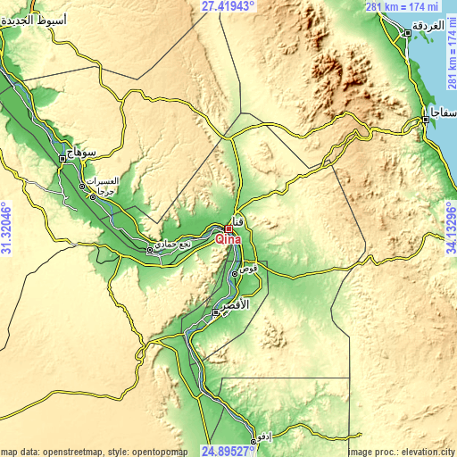
These maps also provides idea of topography and contour of this city, they are displayed at different zoom levels. More info about maps, scale and edge coordinates you can find below images.
| \ | Map #1 | Map #2 | Topo.Map |
| Scale [m] | 51..142 m | 51..364 m | × |
| Scale [ft] | 167..466 ft | 167..1194 ft | × |
| Average | 82.8 m = 272 ft | 98.9 m = 324 ft | × |
| Width | 8.77 km = 5.4 mi | 17.54 km = 10.9 mi | 280.7 km = 174.4 mi |
| Height | 8.77 km = 5.4 mi | 17.54 km = 10.9 mi | 280.7 km = 174.4 mi |
| ↑Max Latitude | 26.203616° | 26.243038° | 27.41943° |
| Latitude at center | 26.16418° | 26.16418° | 26.16418° |
| ↓Min Latitude | 26.124731° | 26.085268° | 24.89527° |
| ← Min Longitude | 32.682765° | 32.638819° | 31.32046° |
| Longitude center | 32.72671° | 32.72671° | 32.72671° |
| →Max Longitude | 32.770655° | 32.814601° | 34.13296° |
Nearby cities:
Cities around Qinā sort by population:
• Luxor elevation 89 m
52.4 km,  189°
189°
• Sohag 67 m
111.7 km,  293°
293°
• Idfū 90 m
132.6 km,  173°
173°
• Jirjā 70 m
85.5 km,  283°
283°
• Akhmīm 85 m
107.3 km, 294°
• Isnā 86 m
98.4 km, 190°
• Al Manshāh 72 m
98.4 km, 290°
• Kousa 76 m
27.9 km, 172°
• Dishnā 75 m
25.4 km,  260°
260°
• Farshūţ 78 m
57.5 km, 257°
• Al Balyanā 75 m
72.6 km, 276°
• Naja' Ḥammādī 78 m
50.1 km, 255°
Multilingual:
 En español:
Qinā elevación 80 m.
 En France:
Qinā élévation 80 m.


Sources and notes:
- [note 1] Map square and city borders are not equal. Map elevation data is calculated only from area inside that square.
- [src 1] Elevation data from geonames database provided with same terms of usage.
- [src 2] The elevation map of Qinā is generated using elevation data from NASA's 3 arcsec (90m) resolution SRTM data.
- [src 3] Base (background) map © OpenStreetMap contributors tiles are generated by Geofabrik and OpenTopoMap.
Copyright & License:
This Qinā Elevation Map is licensed under CC BY-SA. You may reuse any part from this page, if you give a proper credit by linking to this URL:
 More info on terms of use page.