Valdez elevation
Valdez (Esmeraldas, Cantón Eloy Alfaro), Ecuador elevation is 7 meters and Valdez elevation in feet is 23 ft above sea level [src 1]. Valdez is a populated place (feature code) with elevation that is 938 meters (3077 ft) smaller than average city elevation in Ecuador.
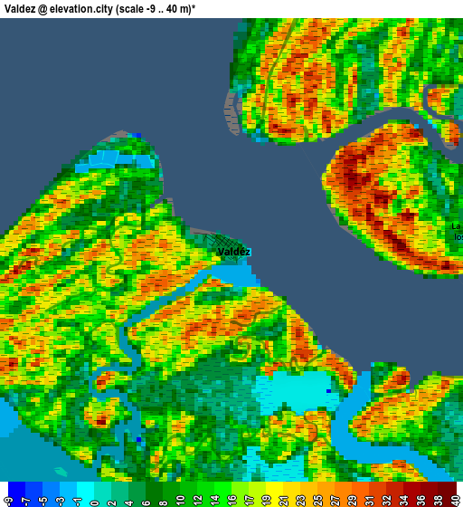
Below is the Elevation map of Valdez, which displays elevation range with different colors. Scale of the first map is from -9 to 40 m (-30 to 131 ft) with average elevation of 14.3 meters (=47 ft) [note 1]
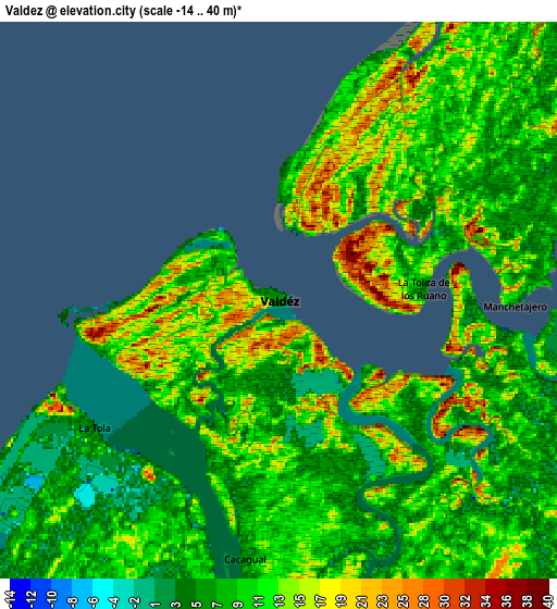
These maps also provides idea of topography and contour of this city, they are displayed at different zoom levels. More info about maps, scale and edge coordinates you can find below images.
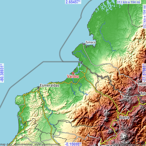
| \ | Map #1 | Map #2 | Topo.Map |
| Scale [m] | -9..40 m | -14..40 m | × |
| Scale [ft] | -30..131 ft | -46..131 ft | × |
| Average | 14.3 m = 47 ft | 10.3 m = 34 ft | × |
| Width | 9.77 km = 6.1 mi | 19.54 km = 12.1 mi | 312.6 km = 194.2 mi |
| Height | 9.77 km = 6.1 mi | 19.54 km = 12.1 mi | 312.6 km = 194.2 mi |
| ↑Max Latitude | 1.293104° | 1.337038° | 2.65457° |
| Latitude at center | 1.24917° | 1.24917° | 1.24917° |
| ↓Min Latitude | 1.205235° | 1.161299° | -0.15698° |
| ← Min Longitude | -79.027005° | -79.070951° | -80.38931° |
| Longitude center | -78.98306° | -78.98306° | -78.98306° |
| →Max Longitude | -78.939115° | -78.895169° | -77.57681° |
Nearby cities:
Cities around Valdez sort by population:
• Esmeraldas elevation 18 m
81.3 km,  246°
246°
• Ibarra 2208 m
138.3 km,  136°
136°
• Rosa Zarate 88 m
116.1 km,  208°
208°
• Otavalo 2532 m
138.4 km, 144°
• San Lorenzo de Esmeraldas 14 m
17 km,  75°
75°
• Atuntaqui 2413 m
133.1 km, 139°
• San Gabriel 2860 m
147.4 km,  119°
119°
• Muisne 4 m
135.2 km,  238°
238°
• Cotacachi 2442 m
132.3 km, 142°
• El Ángel 3008 m
135.3 km, 120°
• Pampanal de Bolívar 7 m
15.2 km,  40°
40°
• Cube 138 m
105.1 km,  224°
224°
Multilingual:
 En español:
Valdez elevación 7 m.
 En France:
Valdez élévation 7 m.


Sources and notes:
- [note 1] Map square and city borders are not equal. Map elevation data is calculated only from area inside that square.
- [src 1] Elevation data from geonames database provided with same terms of usage.
- [src 2] The elevation map of Valdez is generated using elevation data from NASA's 3 arcsec (90m) resolution SRTM data.
- [src 3] Base (background) map © OpenStreetMap contributors tiles are generated by Geofabrik and OpenTopoMap.
Copyright & License:
This Valdez Elevation Map is licensed under CC BY-SA. You may reuse any part from this page, if you give a proper credit by linking to this URL:
 More info on terms of use page.