Castillo elevation
Castillo (Duarte), Dominican Republic elevation is 80 meters and Castillo elevation in feet is 262 ft above sea level [src 1]. Castillo is a populated place (feature code) with elevation that is 83 meters (272 ft) smaller than average city elevation in Dominican Republic.
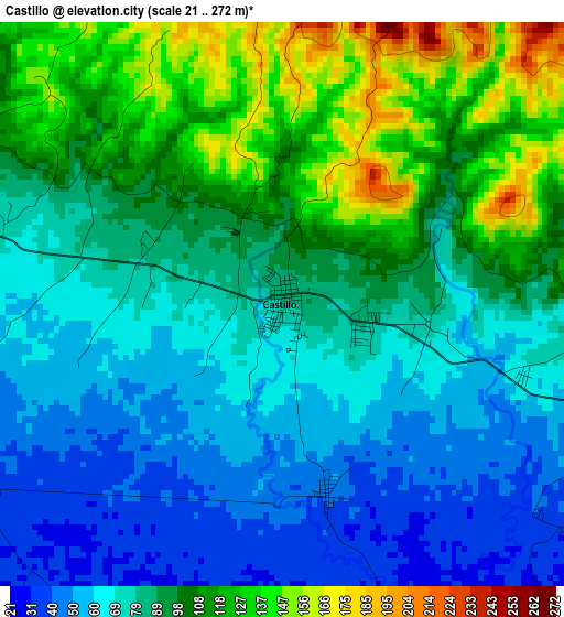
Below is the Elevation map of Castillo, which displays elevation range with different colors. Scale of the first map is from 21 to 272 m (69 to 892 ft) with average elevation of 88 meters (=289 ft) [note 1]
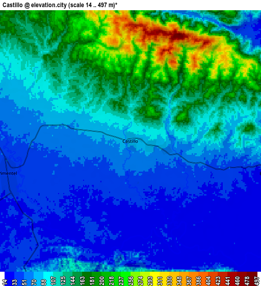
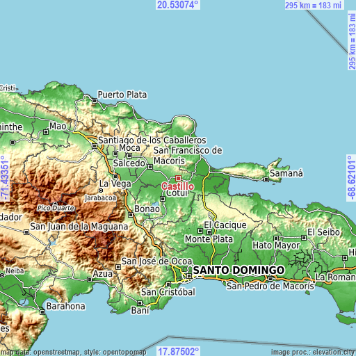
These maps also provides idea of topography and contour of this city, they are displayed at different zoom levels. More info about maps, scale and edge coordinates you can find below images.
| \ | Map #1 | Map #2 | Topo.Map |
| Scale [m] | 21..272 m | 14..497 m | × |
| Scale [ft] | 69..892 ft | 46..1631 ft | × |
| Average | 88 m = 289 ft | 103.1 m = 338 ft | × |
| Width | 9.23 km = 5.7 mi | 18.46 km = 11.5 mi | 295.3 km = 183.5 mi |
| Height | 9.23 km = 5.7 mi | 18.46 km = 11.5 mi | 295.3 km = 183.5 mi |
| ↑Max Latitude | 19.249734° | 19.291217° | 20.53074° |
| Latitude at center | 19.20824° | 19.20824° | 19.20824° |
| ↓Min Latitude | 19.166736° | 19.125221° | 17.87502° |
| ← Min Longitude | -70.071205° | -70.115151° | -71.43351° |
| Longitude center | -70.02726° | -70.02726° | -70.02726° |
| →Max Longitude | -69.983315° | -69.939369° | -68.62101° |
Nearby cities:
Cities around Castillo sort by population:
• San Francisco de Macorís elevation 121 m
25.8 km,  293°
293°
• Cotuí 67 m
21.5 km,  216°
216°
• Nagua 9 m
27.1 km,  44°
44°
• Las Guáranas 48 m
19.1 km,  264°
264°
• Pimentel 42 m
9 km,  252°
252°
• El Factor 20 m
19 km,  49°
49°
• Villa Riva 29 m
12.4 km,  104°
104°
• Cevicos 95 m
23.2 km,  167°
167°
• Arenoso 18 m
17.8 km, 97°
• Agua Santa del Yuna 11 m
24.6 km,  105°
105°
• Hostos 48 m
3.2 km, 166°
• Majagual 226 m
27.3 km,  132°
132°
Multilingual:
 En español:
Castillo elevación 80 m.
 En France:
Castillo élévation 80 m.


Sources and notes:
- [note 1] Map square and city borders are not equal. Map elevation data is calculated only from area inside that square.
- [src 1] Elevation data from geonames database provided with same terms of usage.
- [src 2] The elevation map of Castillo is generated using elevation data from NASA's 3 arcsec (90m) resolution SRTM data.
- [src 3] Base (background) map © OpenStreetMap contributors tiles are generated by Geofabrik and OpenTopoMap.
Copyright & License:
This Castillo Elevation Map is licensed under CC BY-SA. You may reuse any part from this page, if you give a proper credit by linking to this URL:
 More info on terms of use page.