San Francisco de Macorís elevation
San Francisco de Macorís (Duarte), Dominican Republic elevation is 121 meters and San Francisco de Macorís elevation in feet is 397 ft above sea level [src 1]. San Francisco de Macorís is a seat of a first-order administrative division (feature code) with elevation that is 42 meters (138 ft) smaller than average city elevation in Dominican Republic.
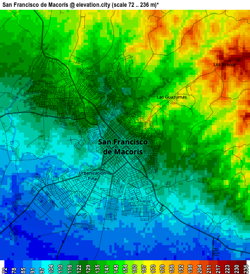
Below is the Elevation map of San Francisco de Macorís, which displays elevation range with different colors. Scale of the first map is from 72 to 236 m (236 to 774 ft) with average elevation of 126.6 meters (=415 ft) [note 1]
These maps also provides idea of topography and contour of this city, they are displayed at different zoom levels. More info about maps, scale and edge coordinates you can find below images.
| \ | Map #1 | Map #2 | Topo.Map |
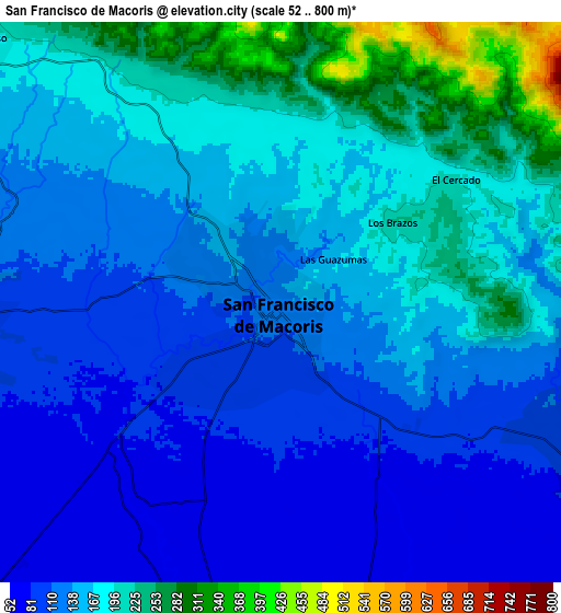
| Scale [m] | 72..236 m | 52..800 m | × |
| Scale [ft] | 236..774 ft | 171..2625 ft | × |
| Average | 126.6 m = 415 ft | 152.1 m = 499 ft | × |
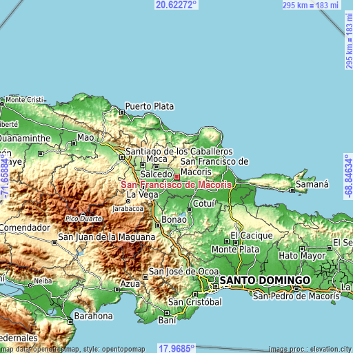
| Width | 9.22 km = 5.7 mi | 18.45 km = 11.5 mi | 295.1 km = 183.4 mi |
| Height | 9.22 km = 5.7 mi | 18.45 km = 11.5 mi | 295.1 km = 183.4 mi |
| ↑Max Latitude | 19.34246° | 19.38392° | 20.62272° |
| Latitude at center | 19.30099° | 19.30099° | 19.30099° |
| ↓Min Latitude | 19.259509° | 19.218018° | 17.9685° |
| ← Min Longitude | -70.296535° | -70.340481° | -71.65884° |
| Longitude center | -70.25259° | -70.25259° | -70.25259° |
| →Max Longitude | -70.208645° | -70.164699° | -68.84634° |
Nearby cities:
Cities around San Francisco de Macorís sort by population:
• Salcedo elevation 196 m
19.3 km,  296°
296°
• Salsipuedes 252 m
17.7 km,  311°
311°
• Fantino 56 m
20.6 km,  193°
193°
• Las Guáranas 48 m
12.9 km,  158°
158°
• Pimentel 42 m
19.9 km,  130°
130°
• Tenares 173 m
13.2 km, 308°
• Castillo 80 m
25.8 km,  113°
113°
• Jima Abajo 69 m
22.7 km,  214°
214°
• Rincón 88 m
25.9 km,  218°
218°
• Villa Tapia 107 m
17.8 km,  269°
269°
• Cayetano Germosén 150 m
24.7 km,  281°
281°
• Hostos 48 m
27.8 km,  118°
118°
Multilingual:
 En español:
San Francisco de Macorís elevación 121 m.
 En France:
San Francisco de Macorís élévation 121 m.
 Auf Deutsch:
San Francisco de Macorís höhe über dem Meeresspiegel ist 121 m.
 На русском:
San Francisco de Macorís высота над уровнем моря 121 м
Sources and notes:
- [note 1] Map square and city borders are not equal. Map elevation data is calculated only from area inside that square.
- [src 1] Elevation data from geonames database provided with same terms of usage.
- [src 2] The elevation map of San Francisco de Macorís is generated using elevation data from NASA's 3 arcsec (90m) resolution SRTM data.
- [src 3] Base (background) map © OpenStreetMap contributors tiles are generated by Geofabrik and OpenTopoMap.
Copyright & License:
This San Francisco de Macorís Elevation Map is licensed under CC BY-SA. You may reuse any part from this page, if you give a proper credit by linking to this URL:
 More info on terms of use page.