Aachen elevation
Aachen (North Rhine-Westphalia, Regierungsbezirk Köln), Germany elevation is 178 meters and Aachen elevation in feet is 584 ft above sea level [src 1]. Aachen is a seat of a third-order administrative division (feature code) with elevation that is 80 meters (262 ft) smaller than average city elevation in Germany.
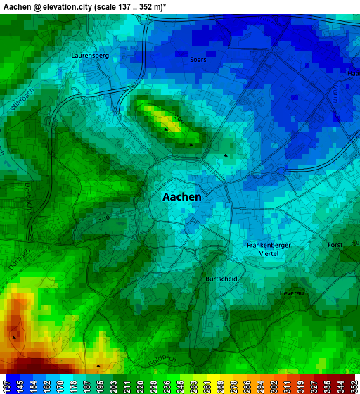
Below is the Elevation map of Aachen, which displays elevation range with different colors. Scale of the first map is from 137 to 352 m (449 to 1155 ft) with average elevation of 194.2 meters (=637 ft) [note 1]
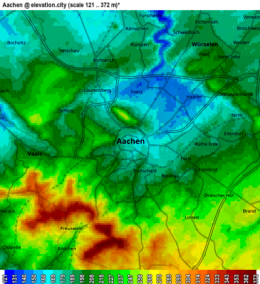
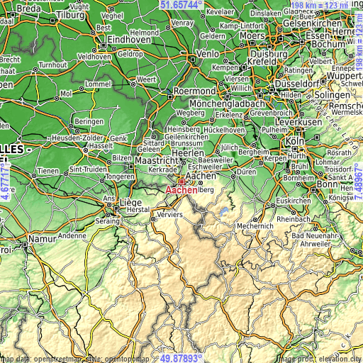
These maps also provides idea of topography and contour of this city, they are displayed at different zoom levels. More info about maps, scale and edge coordinates you can find below images.
| \ | Map #1 | Map #2 | Topo.Map |
| Scale [m] | 137..352 m | 121..372 m | × |
| Scale [ft] | 449..1155 ft | 397..1220 ft | × |
| Average | 194.2 m = 637 ft | 214.7 m = 704 ft | × |
| Width | 6.18 km = 3.8 mi | 12.36 km = 7.7 mi | 197.8 km = 122.9 mi |
| Height | 6.18 km = 3.8 mi | 12.36 km = 7.7 mi | 197.7 km = 122.8 mi |
| ↑Max Latitude | 50.80442° | 50.832184° | 51.65744° |
| Latitude at center | 50.77664° | 50.77664° | 50.77664° |
| ↓Min Latitude | 50.748843° | 50.72103° | 49.87893° |
| ← Min Longitude | 6.039475° | 5.995529° | 4.67717° |
| Longitude center | 6.08342° | 6.08342° | 6.08342° |
| →Max Longitude | 6.127365° | 6.171311° | 7.48967° |
Nearby cities:
Cities around Aachen sort by population:
• Stolberg elevation 185 m
10 km,  91°
91°
• Eschweiler 142 m
14 km,  70°
70°
• Herzogenrath 106 m
10.3 km,  3°
3°
• Alsdorf 167 m
12.5 km,  26°
26°
• Würselen 190 m
5.9 km,  38°
38°
• Baesweiler 117 m
16.5 km, 26°
• Übach-Palenberg 121 m
15.9 km,  10°
10°
• Langerwehe 157 m
19.3 km,  76°
76°
• Roetgen 400 m
16.3 km,  149°
149°
• Siersdorf 125 m
16.9 km, 36°
• Neu-Pattern 120 m
18.4 km,  47°
47°
• Niedermerz 121 m
17.4 km, 47°
Multilingual:
 En español:
Aquisgrán elevación 178 m.
 En France:
Aix-la-Chapelle élévation 178 m.


Sources and notes:
- [note 1] Map square and city borders are not equal. Map elevation data is calculated only from area inside that square.
- [src 1] Elevation data from geonames database provided with same terms of usage.
- [src 2] The elevation map of Aachen is generated using elevation data from NASA's 3 arcsec (90m) resolution SRTM data.
- [src 3] Base (background) map © OpenStreetMap contributors tiles are generated by Geofabrik and OpenTopoMap.
Copyright & License:
This Aachen Elevation Map is licensed under CC BY-SA. You may reuse any part from this page, if you give a proper credit by linking to this URL:
 More info on terms of use page.