Ludweiler-Warndt elevation
Ludweiler-Warndt (Saarland), Germany elevation is 220 meters and Ludweiler-Warndt elevation in feet is 722 ft above sea level [src 1]. Ludweiler-Warndt is a seat of a fourth-order administrative division (feature code) with elevation that is 38 meters (125 ft) smaller than average city elevation in Germany.
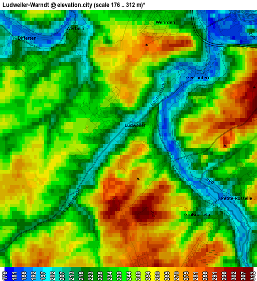
Below is the Elevation map of Ludweiler-Warndt, which displays elevation range with different colors. Scale of the first map is from 176 to 312 m (577 to 1024 ft) with average elevation of 240.2 meters (=788 ft) [note 1]
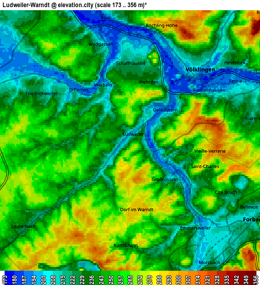
These maps also provides idea of topography and contour of this city, they are displayed at different zoom levels. More info about maps, scale and edge coordinates you can find below images.
| \ | Map #1 | Map #2 | Topo.Map |
| Scale [m] | 176..312 m | 173..356 m | × |
| Scale [ft] | 577..1024 ft | 568..1168 ft | × |
| Average | 240.2 m = 788 ft | 243.4 m = 799 ft | × |
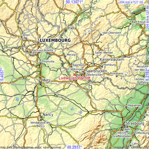
| Width | 6.38 km = 4 mi | 12.77 km = 7.9 mi | 204.3 km = 126.9 mi |
| Height | 6.38 km = 4 mi | 12.77 km = 7.9 mi | 204.2 km = 126.9 mi |
| ↑Max Latitude | 49.249434° | 49.278112° | 50.13071° |
| Latitude at center | 49.22074° | 49.22074° | 49.22074° |
| ↓Min Latitude | 49.192029° | 49.163301° | 48.2937° |
| ← Min Longitude | 6.768005° | 6.724059° | 5.4057° |
| Longitude center | 6.81195° | 6.81195° | 6.81195° |
| →Max Longitude | 6.855895° | 6.899841° | 8.2182° |
Nearby cities:
Cities around Ludweiler-Warndt sort by population:
• Völklingen elevation 197 m
4.8 km,  44°
44°
• Püttlingen 227 m
9 km, 37°
• Schwalbach 210 m
8.8 km,  2°
2°
• Wadgassen 230 m
5.5 km,  337°
337°
• Überherrn 211 m
8.6 km,  285°
285°
• Großrosseln 218 m
2.9 km,  132°
132°
• Bous 223 m
6.3 km,  353°
353°
• Ensdorf 198 m
9.1 km, 346°
• Heidstock 235 m
6.4 km,  52°
52°
• Röchling-Höhe 287 m
5.8 km,  16°
16°
• Fürstenhausen 210 m
4.6 km,  61°
61°
• Luisenthal 193 m
7.2 km, 63°
Multilingual:
 En español:
Ludweiler-Warndt elevación 220 m.
 En France:
Ludweiler-Warndt élévation 220 m.
 Auf Deutsch:
Ludweiler-Warndt höhe über dem Meeresspiegel ist 220 m.

Sources and notes:
- [note 1] Map square and city borders are not equal. Map elevation data is calculated only from area inside that square.
- [src 1] Elevation data from geonames database provided with same terms of usage.
- [src 2] The elevation map of Ludweiler-Warndt is generated using elevation data from NASA's 3 arcsec (90m) resolution SRTM data.
- [src 3] Base (background) map © OpenStreetMap contributors tiles are generated by Geofabrik and OpenTopoMap.
Copyright & License:
This Ludweiler-Warndt Elevation Map is licensed under CC BY-SA. You may reuse any part from this page, if you give a proper credit by linking to this URL:
 More info on terms of use page.