Schöffengrund elevation
Schöffengrund (Hesse, Regierungsbezirk Gießen), Germany elevation is 283 meters and Schöffengrund elevation in feet is 928 ft above sea level [src 1]. Schöffengrund is a seat of a fourth-order administrative division (feature code) with elevation that is 25 meters (82 ft) bigger than average city elevation in Germany.
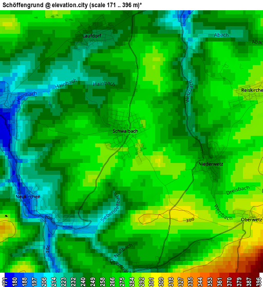
Below is the Elevation map of Schöffengrund, which displays elevation range with different colors. Scale of the first map is from 171 to 396 m (561 to 1299 ft) with average elevation of 258.7 meters (=849 ft) [note 1]
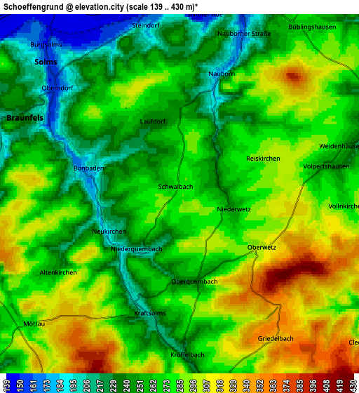
These maps also provides idea of topography and contour of this city, they are displayed at different zoom levels. More info about maps, scale and edge coordinates you can find below images.
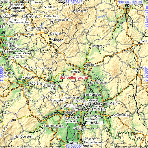
| \ | Map #1 | Map #2 | Topo.Map |
| Scale [m] | 171..396 m | 139..430 m | × |
| Scale [ft] | 561..1299 ft | 456..1411 ft | × |
| Average | 258.7 m = 849 ft | 270.2 m = 886 ft | × |
| Width | 6.22 km = 3.9 mi | 12.43 km = 7.7 mi | 198.9 km = 123.6 mi |
| Height | 6.22 km = 3.9 mi | 12.43 km = 7.7 mi | 198.9 km = 123.6 mi |
| ↑Max Latitude | 50.521398° | 50.54933° | 51.37961° |
| Latitude at center | 50.49345° | 50.49345° | 50.49345° |
| ↓Min Latitude | 50.465485° | 50.437504° | 49.59035° |
| ← Min Longitude | 8.427885° | 8.383939° | 7.06558° |
| Longitude center | 8.47183° | 8.47183° | 8.47183° |
| →Max Longitude | 8.515775° | 8.559721° | 9.87808° |
Nearby cities:
Cities around Schöffengrund sort by population:
• Wetzlar elevation 169 m
7.9 km,  17°
17°
• Aßlar 166 m
10.9 km,  356°
356°
• Solms 156 m
6.6 km,  316°
316°
• Braunfels 235 m
6.3 km,  292°
292°
• Weilmünster 179 m
9.6 km,  224°
224°
• Leun 159 m
10.3 km,  308°
308°
• Burgsolms 156 m
7.2 km, 318°
• Oberbiel 161 m
7.3 km,  334°
334°
• Niederbiel 166 m
8.6 km, 322°
• Albshausen 155 m
6.1 km,  336°
336°
• Laufdorf 237 m
2.7 km, 341°
• Schwalbach 274 m
0.4 km, 334°
Multilingual:
 En español:
Schöffengrund elevación 283 m.
 En France:
Schöffengrund élévation 283 m.
 Auf Deutsch:
Schöffengrund höhe über dem Meeresspiegel ist 283 m.

Sources and notes:
- [note 1] Map square and city borders are not equal. Map elevation data is calculated only from area inside that square.
- [src 1] Elevation data from geonames database provided with same terms of usage.
- [src 2] The elevation map of Schöffengrund is generated using elevation data from NASA's 3 arcsec (90m) resolution SRTM data.
- [src 3] Base (background) map © OpenStreetMap contributors tiles are generated by Geofabrik and OpenTopoMap.
Copyright & License:
This Schöffengrund Elevation Map is licensed under CC BY-SA. You may reuse any part from this page, if you give a proper credit by linking to this URL:
 More info on terms of use page.