Auerbach elevation
Auerbach (Bavaria, Upper Palatinate), Germany elevation is 441 meters and Auerbach elevation in feet is 1447 ft above sea level [src 1]. Auerbach is a populated place (feature code) with elevation that is 183 meters (600 ft) bigger than average city elevation in Germany.
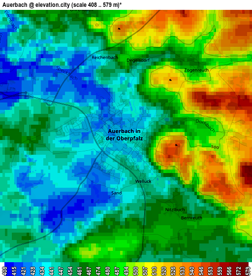
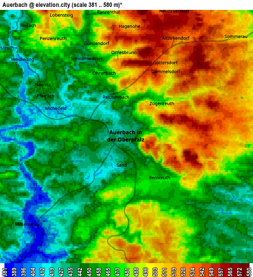
Below is the Elevation map of Auerbach, which displays elevation range with different colors. Scale of the first map is from 408 to 579 m (1339 to 1900 ft) with average elevation of 467.4 meters (=1533 ft) [note 1]
These maps also provides idea of topography and contour of this city, they are displayed at different zoom levels. More info about maps, scale and edge coordinates you can find below images.
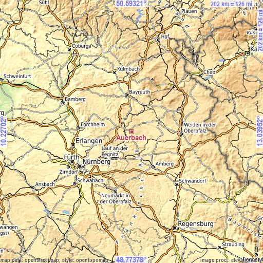
| \ | Map #1 | Map #2 | Topo.Map |
| Scale [m] | 408..579 m | 381..580 m | × |
| Scale [ft] | 1339..1900 ft | 1250..1903 ft | × |
| Average | 467.4 m = 1533 ft | 474.4 m = 1556 ft | × |
| Width | 6.32 km = 3.9 mi | 12.64 km = 7.9 mi | 202.3 km = 125.7 mi |
| Height | 6.32 km = 3.9 mi | 12.64 km = 7.9 mi | 202.3 km = 125.7 mi |
| ↑Max Latitude | 49.72043° | 49.748833° | 50.59321° |
| Latitude at center | 49.69201° | 49.69201° | 49.69201° |
| ↓Min Latitude | 49.663574° | 49.635121° | 48.77378° |
| ← Min Longitude | 11.589325° | 11.545379° | 10.22702° |
| Longitude center | 11.63327° | 11.63327° | 11.63327° |
| →Max Longitude | 11.677215° | 11.721161° | 13.03952° |
Nearby cities:
Cities around Auerbach sort by population:
• Pegnitz elevation 433 m
9.4 km,  315°
315°
• Vilseck 405 m
14.9 km,  125°
125°
• Creußen 430 m
17 km,  358°
358°
• Kirchenthumbach 464 m
9.1 km,  46°
46°
• Neuhaus an der Pegnitz 400 m
9.3 km,  219°
219°
• Edelsfeld 531 m
13.6 km,  160°
160°
• Velden 388 m
12.4 km,  225°
225°
• Königstein 495 m
9.3 km,  180°
180°
• Hartenstein 451 m
13.2 km, 219°
• Speinshart 430 m
17.3 km, 50°
• Prebitz 426 m
16.1 km,  12°
12°
• Vorbach 455 m
16.2 km,  27°
27°
Multilingual:
 En español:
Auerbach elevación 441 m.
 En France:
Auerbach élévation 441 m.
 Auf Deutsch:
Auerbach höhe über dem Meeresspiegel ist 441 m.

Sources and notes:
- [note 1] Map square and city borders are not equal. Map elevation data is calculated only from area inside that square.
- [src 1] Elevation data from geonames database provided with same terms of usage.
- [src 2] The elevation map of Auerbach is generated using elevation data from NASA's 3 arcsec (90m) resolution SRTM data.
- [src 3] Base (background) map © OpenStreetMap contributors tiles are generated by Geofabrik and OpenTopoMap.
Copyright & License:
This Auerbach Elevation Map is licensed under CC BY-SA. You may reuse any part from this page, if you give a proper credit by linking to this URL:
 More info on terms of use page.