Baruth elevation
Baruth (Brandenburg), Germany elevation is 60 meters and Baruth elevation in feet is 197 ft above sea level [src 1]. Baruth is a populated place (feature code) with elevation that is 198 meters (650 ft) smaller than average city elevation in Germany.
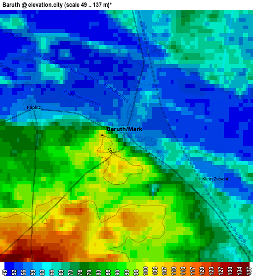
Below is the Elevation map of Baruth, which displays elevation range with different colors. Scale of the first map is from 49 to 137 m (161 to 449 ft) with average elevation of 73.3 meters (=240 ft) [note 1]
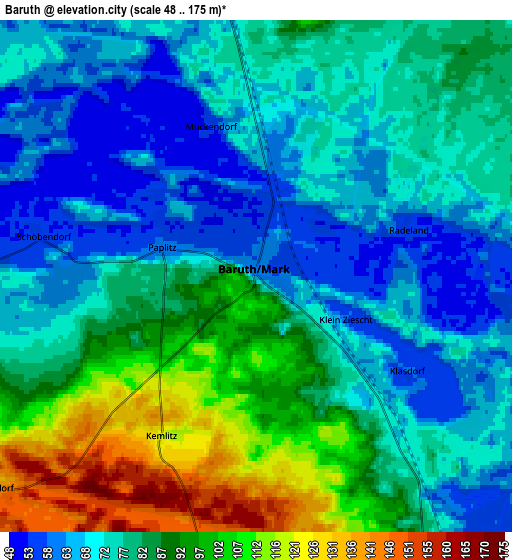
These maps also provides idea of topography and contour of this city, they are displayed at different zoom levels. More info about maps, scale and edge coordinates you can find below images.
| \ | Map #1 | Map #2 | Topo.Map |
| Scale [m] | 49..137 m | 48..175 m | × |
| Scale [ft] | 161..449 ft | 157..574 ft | × |
| Average | 73.3 m = 240 ft | 80.5 m = 264 ft | × |
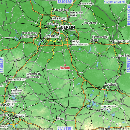
| Width | 6.01 km = 3.7 mi | 12.02 km = 7.5 mi | 192.3 km = 119.5 mi |
| Height | 6.01 km = 3.7 mi | 12.02 km = 7.5 mi | 192.3 km = 119.5 mi |
| ↑Max Latitude | 52.0717° | 52.098704° | 52.90124° |
| Latitude at center | 52.04468° | 52.04468° | 52.04468° |
| ↓Min Latitude | 52.017643° | 51.99059° | 51.17138° |
| ← Min Longitude | 13.458755° | 13.414809° | 12.09645° |
| Longitude center | 13.5027° | 13.5027° | 13.5027° |
| →Max Longitude | 13.546645° | 13.590591° | 14.90895° |
Nearby cities:
Cities around Baruth sort by population:
• Luckenwalde elevation 52 m
23.5 km,  282°
282°
• Zossen 41 m
19.4 km,  349°
349°
• Luckau 63 m
25.6 km,  146°
146°
• Trebbin 41 m
26.9 km,  315°
315°
• Mittenwalde 38 m
24.1 km,  5°
5°
• Bestensee 37 m
23.6 km,  22°
22°
• Dahme 91 m
20.1 km,  194°
194°
• Golßen 59 m
10.5 km,  140°
140°
• Halbe 50 m
15.7 km,  59°
59°
• Groß Köris 37 m
17.2 km,  38°
38°
• Sperenberg 51 m
14.3 km, 318°
• Teupitz 69 m
12.4 km, 40°
Multilingual:
 En español:
Baruth elevación 60 m.
 En France:
Baruth élévation 60 m.


Sources and notes:
- [note 1] Map square and city borders are not equal. Map elevation data is calculated only from area inside that square.
- [src 1] Elevation data from geonames database provided with same terms of usage.
- [src 2] The elevation map of Baruth is generated using elevation data from NASA's 3 arcsec (90m) resolution SRTM data.
- [src 3] Base (background) map © OpenStreetMap contributors tiles are generated by Geofabrik and OpenTopoMap.
Copyright & License:
This Baruth Elevation Map is licensed under CC BY-SA. You may reuse any part from this page, if you give a proper credit by linking to this URL:
 More info on terms of use page.