Bexbach elevation
Bexbach (Saarland), Germany elevation is 250 meters and Bexbach elevation in feet is 820 ft above sea level [src 1]. Bexbach is a populated place (feature code) with elevation that is 8 meters (26 ft) smaller than average city elevation in Germany.
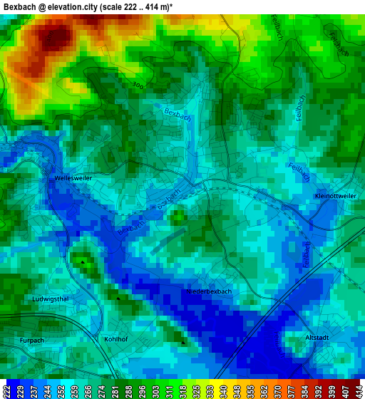
Below is the Elevation map of Bexbach, which displays elevation range with different colors. Scale of the first map is from 222 to 414 m (728 to 1358 ft) with average elevation of 272.4 meters (=894 ft) [note 1]
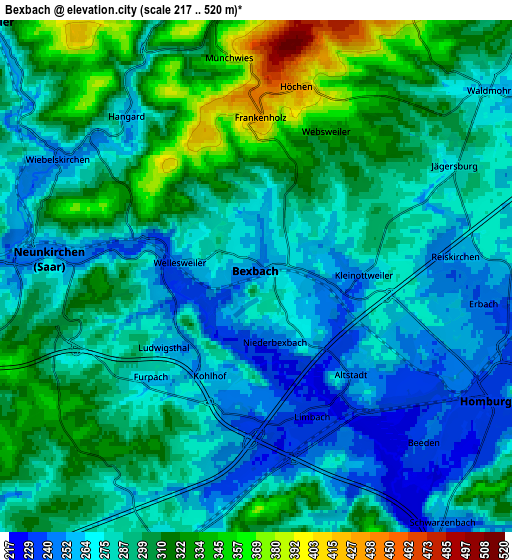
These maps also provides idea of topography and contour of this city, they are displayed at different zoom levels. More info about maps, scale and edge coordinates you can find below images.
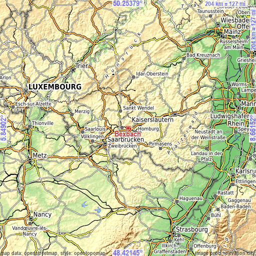
| \ | Map #1 | Map #2 | Topo.Map |
| Scale [m] | 222..414 m | 217..520 m | × |
| Scale [ft] | 728..1358 ft | 712..1706 ft | × |
| Average | 272.4 m = 894 ft | 290 m = 951 ft | × |
| Width | 6.37 km = 4 mi | 12.73 km = 7.9 mi | 203.7 km = 126.6 mi |
| Height | 6.37 km = 4 mi | 12.73 km = 7.9 mi | 203.7 km = 126.6 mi |
| ↑Max Latitude | 49.374771° | 49.403376° | 50.25379° |
| Latitude at center | 49.34615° | 49.34615° | 49.34615° |
| ↓Min Latitude | 49.317512° | 49.288857° | 48.42145° |
| ← Min Longitude | 7.211325° | 7.167379° | 5.84902° |
| Longitude center | 7.25527° | 7.25527° | 7.25527° |
| →Max Longitude | 7.299215° | 7.343161° | 8.66152° |
Nearby cities:
Cities around Bexbach sort by population:
• Neunkirchen elevation 289 m
5.4 km,  268°
268°
• Homburg 242 m
6.4 km,  110°
110°
• Schiffweiler 295 m
9.1 km,  284°
284°
• Ottweiler 254 m
9 km,  312°
312°
• Spiesen-Elversberg 353 m
9.4 km,  249°
249°
• Friedrichsthal 309 m
11.7 km,  259°
259°
• Kirkel 249 m
7.2 km,  192°
192°
• Schönenberg-Kübelberg 264 m
10.9 km,  51°
51°
• Waldmohr 270 m
7 km, 53°
• Bechhofen 315 m
10.5 km,  87°
87°
• Hangard 255 m
5.2 km,  321°
321°
• Altenkirchen 294 m
11.8 km,  23°
23°
Multilingual:
 En español:
Bexbach elevación 250 m.
 En France:
Bexbach élévation 250 m.


Sources and notes:
- [note 1] Map square and city borders are not equal. Map elevation data is calculated only from area inside that square.
- [src 1] Elevation data from geonames database provided with same terms of usage.
- [src 2] The elevation map of Bexbach is generated using elevation data from NASA's 3 arcsec (90m) resolution SRTM data.
- [src 3] Base (background) map © OpenStreetMap contributors tiles are generated by Geofabrik and OpenTopoMap.
Copyright & License:
This Bexbach Elevation Map is licensed under CC BY-SA. You may reuse any part from this page, if you give a proper credit by linking to this URL:
 More info on terms of use page.