Kirkel elevation
Kirkel (Saarland), Germany elevation is 249 meters and Kirkel elevation in feet is 817 ft above sea level [src 1]. Kirkel is a seat of a fourth-order administrative division (feature code) with elevation that is 9 meters (30 ft) smaller than average city elevation in Germany.
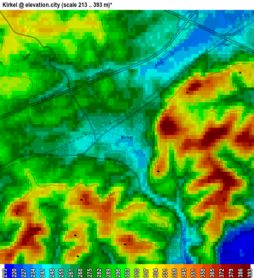
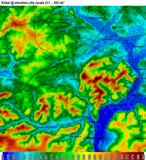
Below is the Elevation map of Kirkel, which displays elevation range with different colors. Scale of the first map is from 213 to 393 m (699 to 1289 ft) with average elevation of 290.2 meters (=952 ft) [note 1]
These maps also provides idea of topography and contour of this city, they are displayed at different zoom levels. More info about maps, scale and edge coordinates you can find below images.
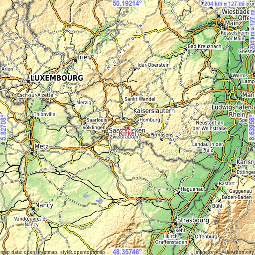
| \ | Map #1 | Map #2 | Topo.Map |
| Scale [m] | 213..393 m | 211..393 m | × |
| Scale [ft] | 699..1289 ft | 692..1289 ft | × |
| Average | 290.2 m = 952 ft | 280.5 m = 920 ft | × |
| Width | 6.37 km = 4 mi | 12.75 km = 7.9 mi | 204 km = 126.8 mi |
| Height | 6.37 km = 4 mi | 12.75 km = 7.9 mi | 204 km = 126.8 mi |
| ↑Max Latitude | 49.311988° | 49.340629° | 50.19214° |
| Latitude at center | 49.28333° | 49.28333° | 49.28333° |
| ↓Min Latitude | 49.254655° | 49.225964° | 48.35746° |
| ← Min Longitude | 7.189385° | 7.145439° | 5.82708° |
| Longitude center | 7.23333° | 7.23333° | 7.23333° |
| →Max Longitude | 7.277275° | 7.321221° | 8.63958° |
Nearby cities:
Cities around Kirkel sort by population:
• Neunkirchen elevation 289 m
7.8 km,  330°
330°
• Homburg 242 m
9 km,  57°
57°
• Sankt Ingbert 230 m
8.5 km,  265°
265°
• Zweibrücken 242 m
10.7 km,  112°
112°
• Blieskastel 242 m
5.4 km,  162°
162°
• Bexbach 250 m
7.2 km,  12°
12°
• Sulzbach 248 m
12.9 km,  277°
277°
• Schiffweiler 295 m
11.8 km,  321°
321°
• Spiesen-Elversberg 353 m
8.1 km,  297°
297°
• Friedrichsthal 309 m
11.1 km, 296°
• Hangard 255 m
11.2 km,  351°
351°
• Rimschweiler 238 m
12.6 km,  124°
124°
Multilingual:
 En español:
Kirkel elevación 249 m.
 En France:
Kirkel élévation 249 m.


Sources and notes:
- [note 1] Map square and city borders are not equal. Map elevation data is calculated only from area inside that square.
- [src 1] Elevation data from geonames database provided with same terms of usage.
- [src 2] The elevation map of Kirkel is generated using elevation data from NASA's 3 arcsec (90m) resolution SRTM data.
- [src 3] Base (background) map © OpenStreetMap contributors tiles are generated by Geofabrik and OpenTopoMap.
Copyright & License:
This Kirkel Elevation Map is licensed under CC BY-SA. You may reuse any part from this page, if you give a proper credit by linking to this URL:
 More info on terms of use page.