Birgte elevation
Birgte (North Rhine-Westphalia, Regierungsbezirk Münster), Germany elevation is 48 meters and Birgte elevation in feet is 157 ft above sea level [src 1]. Birgte is a populated place (feature code) with elevation that is 210 meters (689 ft) smaller than average city elevation in Germany.
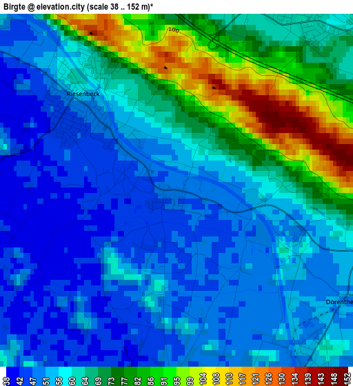
Below is the Elevation map of Birgte, which displays elevation range with different colors. Scale of the first map is from 38 to 152 m (125 to 499 ft) with average elevation of 61.8 meters (=203 ft) [note 1]
These maps also provides idea of topography and contour of this city, they are displayed at different zoom levels. More info about maps, scale and edge coordinates you can find below images.
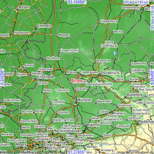
| \ | Map #1 | Topo.Map |
| Scale [m] | 38..152 m | × |
| Scale [ft] | 125..499 ft | × |
| Average | 61.8 m = 203 ft | × |
| Width | 5.98 km = 3.7 mi | 191.5 km = 119 mi |
| Height | 5.98 km = 3.7 mi | 191.5 km = 119 mi |
| ↑Max Latitude | 52.274797° | 53.10054° |
| Latitude at center | 52.2479° | 52.2479° |
| ↓Min Latitude | 52.220986° | 51.37855° |
| ← Min Longitude | 7.604385° | 6.24208° |
| Longitude center | 7.64833° | 7.64833° |
| →Max Longitude | 7.692275° | 9.05458° |
Nearby cities:
Cities around Birgte sort by population:
• Rheine elevation 41 m
14.7 km,  286°
286°
• Ibbenbüren 78 m
5.7 km,  51°
51°
• Emsdetten 44 m
11.7 km,  224°
224°
• Greven 45 m
17.5 km,  192°
192°
• Lengerich 81 m
16 km,  115°
115°
• Hörstel 46 m
7.1 km,  321°
321°
• Mettingen 71 m
11.9 km, 50°
• Recke 51 m
14.3 km,  20°
20°
• Tecklenburg 172 m
11.7 km,  105°
105°
• Saerbeck 46 m
8.3 km, 186°
• Ladbergen 53 m
14.5 km,  151°
151°
• Dreierwalde 36 m
13.6 km,  313°
313°
Multilingual:
 En español:
Birgte elevación 48 m.
 En France:
Birgte élévation 48 m.


Sources and notes:
- [note 1] Map square and city borders are not equal. Map elevation data is calculated only from area inside that square.
- [src 1] Elevation data from geonames database provided with same terms of usage.
- [src 2] The elevation map of Birgte is generated using elevation data from NASA's 3 arcsec (90m) resolution SRTM data.
- [src 3] Base (background) map © OpenStreetMap contributors tiles are generated by Geofabrik and OpenTopoMap.
Copyright & License:
This Birgte Elevation Map is licensed under CC BY-SA. You may reuse any part from this page, if you give a proper credit by linking to this URL:
 More info on terms of use page.