Tecklenburg elevation
Tecklenburg (North Rhine-Westphalia, Regierungsbezirk Münster), Germany elevation is 172 meters and Tecklenburg elevation in feet is 564 ft above sea level [src 1]. Tecklenburg is a populated place (feature code) with elevation that is 86 meters (282 ft) smaller than average city elevation in Germany.
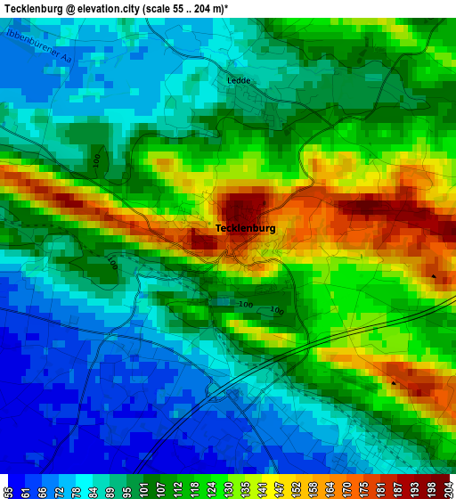
Below is the Elevation map of Tecklenburg, which displays elevation range with different colors. Scale of the first map is from 55 to 204 m (180 to 669 ft) with average elevation of 106 meters (=348 ft) [note 1]
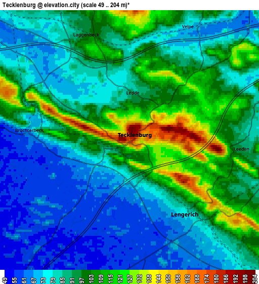
These maps also provides idea of topography and contour of this city, they are displayed at different zoom levels. More info about maps, scale and edge coordinates you can find below images.
| \ | Map #1 | Map #2 | Topo.Map |
| Scale [m] | 55..204 m | 49..204 m | × |
| Scale [ft] | 180..669 ft | 161..669 ft | × |
| Average | 106 m = 348 ft | 89.1 m = 292 ft | × |
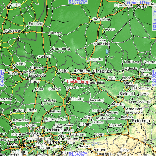
| Width | 5.99 km = 3.7 mi | 11.97 km = 7.4 mi | 191.6 km = 119.1 mi |
| Height | 5.99 km = 3.7 mi | 11.97 km = 7.4 mi | 191.6 km = 119.1 mi |
| ↑Max Latitude | 52.246484° | 52.273382° | 53.07276° |
| Latitude at center | 52.21957° | 52.21957° | 52.21957° |
| ↓Min Latitude | 52.192639° | 52.165692° | 51.34967° |
| ← Min Longitude | 7.769625° | 7.725679° | 6.40732° |
| Longitude center | 7.81357° | 7.81357° | 7.81357° |
| →Max Longitude | 7.857515° | 7.901461° | 9.21982° |
Nearby cities:
Cities around Tecklenburg sort by population:
• Ibbenbüren elevation 78 m
9.5 km,  314°
314°
• Georgsmarienhütte 117 m
15.9 km,  96°
96°
• Lengerich 81 m
4.9 km,  138°
138°
• Hagen 109 m
11.7 km, 102°
• Lotte 60 m
10 km,  44°
44°
• Mettingen 71 m
11 km,  349°
349°
• Westerkappeln 64 m
11.8 km,  23°
23°
• Hasbergen 87 m
10.2 km,  78°
78°
• Lienen 91 m
13.9 km,  123°
123°
• Saerbeck 46 m
13.3 km,  247°
247°
• Ladbergen 53 m
10.5 km,  204°
204°
• Birgte 48 m
11.7 km,  285°
285°
Multilingual:
 En español:
Tecklenburg elevación 172 m.
 En France:
Tecklembourg élévation 172 m.
 Auf Deutsch:
Tecklenburg höhe über dem Meeresspiegel ist 172 m.

Sources and notes:
- [note 1] Map square and city borders are not equal. Map elevation data is calculated only from area inside that square.
- [src 1] Elevation data from geonames database provided with same terms of usage.
- [src 2] The elevation map of Tecklenburg is generated using elevation data from NASA's 3 arcsec (90m) resolution SRTM data.
- [src 3] Base (background) map © OpenStreetMap contributors tiles are generated by Geofabrik and OpenTopoMap.
Copyright & License:
This Tecklenburg Elevation Map is licensed under CC BY-SA. You may reuse any part from this page, if you give a proper credit by linking to this URL:
 More info on terms of use page.