Blaubeuren elevation
Blaubeuren (Baden-Württemberg, Tübingen Region), Germany elevation is 520 meters and Blaubeuren elevation in feet is 1706 ft above sea level [src 1]. Blaubeuren is a populated place (feature code) with elevation that is 262 meters (860 ft) bigger than average city elevation in Germany.
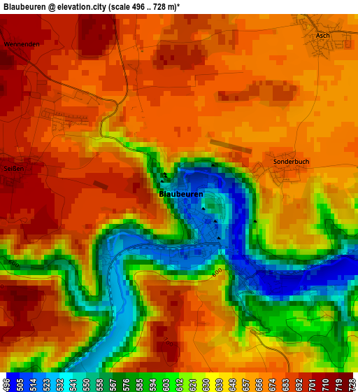
Below is the Elevation map of Blaubeuren, which displays elevation range with different colors. Scale of the first map is from 496 to 728 m (1627 to 2388 ft) with average elevation of 644.2 meters (=2114 ft) [note 1]
These maps also provides idea of topography and contour of this city, they are displayed at different zoom levels. More info about maps, scale and edge coordinates you can find below images.
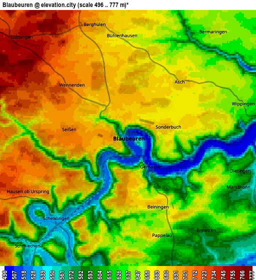
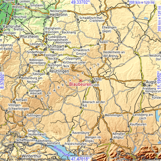
| \ | Map #1 | Map #2 | Topo.Map |
| Scale [m] | 496..728 m | 496..777 m | × |
| Scale [ft] | 1627..2388 ft | 1627..2549 ft | × |
| Average | 644.2 m = 2114 ft | 649.1 m = 2130 ft | × |
| Width | 6.49 km = 4 mi | 12.97 km = 8.1 mi | 207.6 km = 129 mi |
| Height | 6.49 km = 4 mi | 12.97 km = 8.1 mi | 207.6 km = 129 mi |
| ↑Max Latitude | 48.441311° | 48.470455° | 49.33702° |
| Latitude at center | 48.41215° | 48.41215° | 48.41215° |
| ↓Min Latitude | 48.382972° | 48.353778° | 47.47015° |
| ← Min Longitude | 9.740325° | 9.696379° | 8.37802° |
| Longitude center | 9.78427° | 9.78427° | 9.78427° |
| →Max Longitude | 9.828215° | 9.872161° | 11.19052° |
Nearby cities:
Cities around Blaubeuren sort by population:
• Klingenstein elevation 498 m
9.2 km,  85°
85°
• Erbach 484 m
12 km,  140°
140°
• Laichingen 757 m
11.2 km,  319°
319°
• Dornstadt 594 m
13.3 km,  62°
62°
• Schelklingen 538 m
5.6 km,  223°
223°
• Allmendingen 518 m
10.1 km,  206°
206°
• Öpfingen 504 m
14.1 km,  174°
174°
• Berghülen 693 m
6 km,  343°
343°
• Oberdischingen 491 m
13 km,  163°
163°
• Nellingen 691 m
14.4 km,  1°
1°
• Merklingen 709 m
11.2 km,  348°
348°
• Ersingen 484 m
14.3 km, 158°
Multilingual:
 En español:
Blaubeuren elevación 520 m.
 En France:
Blaubeuren élévation 520 m.
 Auf Deutsch:
Blaubeuren höhe über dem Meeresspiegel ist 520 m.

Sources and notes:
- [note 1] Map square and city borders are not equal. Map elevation data is calculated only from area inside that square.
- [src 1] Elevation data from geonames database provided with same terms of usage.
- [src 2] The elevation map of Blaubeuren is generated using elevation data from NASA's 3 arcsec (90m) resolution SRTM data.
- [src 3] Base (background) map © OpenStreetMap contributors tiles are generated by Geofabrik and OpenTopoMap.
Copyright & License:
This Blaubeuren Elevation Map is licensed under CC BY-SA. You may reuse any part from this page, if you give a proper credit by linking to this URL:
 More info on terms of use page.