Borken elevation
Borken (Hesse, Regierungsbezirk Kassel), Germany elevation is 224 meters and Borken elevation in feet is 735 ft above sea level [src 1]. Borken is a populated place (feature code) with elevation that is 34 meters (112 ft) smaller than average city elevation in Germany.
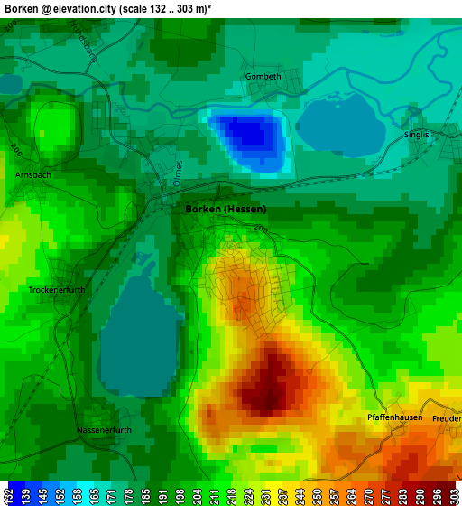
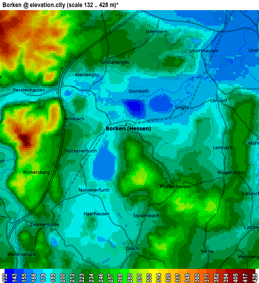
Below is the Elevation map of Borken, which displays elevation range with different colors. Scale of the first map is from 132 to 303 m (433 to 994 ft) with average elevation of 198.5 meters (=651 ft) [note 1]
These maps also provides idea of topography and contour of this city, they are displayed at different zoom levels. More info about maps, scale and edge coordinates you can find below images.
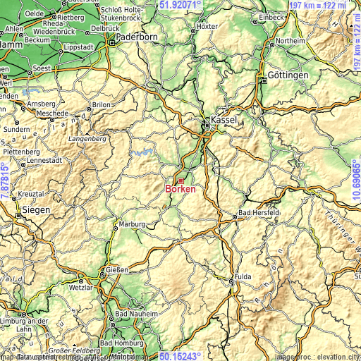
| \ | Map #1 | Map #2 | Topo.Map |
| Scale [m] | 132..303 m | 132..428 m | × |
| Scale [ft] | 433..994 ft | 433..1404 ft | × |
| Average | 198.5 m = 651 ft | 220 m = 722 ft | × |
| Width | 6.14 km = 3.8 mi | 12.29 km = 7.6 mi | 196.6 km = 122.2 mi |
| Height | 6.14 km = 3.8 mi | 12.29 km = 7.6 mi | 196.6 km = 122.2 mi |
| ↑Max Latitude | 51.072631° | 51.100235° | 51.92071° |
| Latitude at center | 51.04501° | 51.04501° | 51.04501° |
| ↓Min Latitude | 51.017373° | 50.989719° | 50.15243° |
| ← Min Longitude | 9.240455° | 9.196509° | 7.87815° |
| Longitude center | 9.2844° | 9.2844° | 9.2844° |
| →Max Longitude | 9.328345° | 9.372291° | 10.69065° |
Nearby cities:
Cities around Borken sort by population:
• Schwalmstadt elevation 235 m
13.3 km,  200°
200°
• Bad Wildungen 276 m
13.9 km,  306°
306°
• Homberg 233 m
8.4 km,  101°
101°
• Fritzlar 220 m
9.7 km,  356°
356°
• Felsberg 165 m
14.1 km,  42°
42°
• Gudensberg 246 m
15.8 km,  21°
21°
• Frielendorf 233 m
8.7 km,  162°
162°
• Wabern 165 m
7.6 km, 36°
• Malsfeld 186 m
18.5 km,  74°
74°
• Neuental 231 m
6.9 km,  223°
223°
• Jesberg 234 m
10.6 km,  241°
241°
• Reinhardshausen 322 m
16.4 km,  296°
296°
Multilingual:
 En español:
Borken elevación 224 m.
 En France:
Borken élévation 224 m.


Sources and notes:
- [note 1] Map square and city borders are not equal. Map elevation data is calculated only from area inside that square.
- [src 1] Elevation data from geonames database provided with same terms of usage.
- [src 2] The elevation map of Borken is generated using elevation data from NASA's 3 arcsec (90m) resolution SRTM data.
- [src 3] Base (background) map © OpenStreetMap contributors tiles are generated by Geofabrik and OpenTopoMap.
Copyright & License:
This Borken Elevation Map is licensed under CC BY-SA. You may reuse any part from this page, if you give a proper credit by linking to this URL:
 More info on terms of use page.