Frielendorf elevation
Frielendorf (Hesse, Regierungsbezirk Kassel), Germany elevation is 233 meters and Frielendorf elevation in feet is 764 ft above sea level [src 1]. Frielendorf is a seat of a fourth-order administrative division (feature code) with elevation that is 25 meters (82 ft) smaller than average city elevation in Germany.
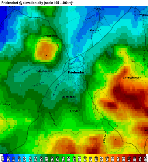
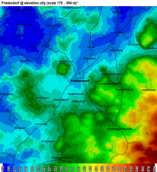
Below is the Elevation map of Frielendorf, which displays elevation range with different colors. Scale of the first map is from 195 to 400 m (640 to 1312 ft) with average elevation of 277.2 meters (=909 ft) [note 1]
These maps also provides idea of topography and contour of this city, they are displayed at different zoom levels. More info about maps, scale and edge coordinates you can find below images.
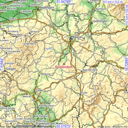
| \ | Map #1 | Map #2 | Topo.Map |
| Scale [m] | 195..400 m | 179..594 m | × |
| Scale [ft] | 640..1312 ft | 587..1949 ft | × |
| Average | 277.2 m = 909 ft | 290.9 m = 954 ft | × |
| Width | 6.15 km = 3.8 mi | 12.31 km = 7.6 mi | 196.9 km = 122.3 mi |
| Height | 6.15 km = 3.8 mi | 12.31 km = 7.6 mi | 196.9 km = 122.3 mi |
| ↑Max Latitude | 50.998395° | 51.026043° | 51.84785° |
| Latitude at center | 50.97073° | 50.97073° | 50.97073° |
| ↓Min Latitude | 50.943049° | 50.915351° | 50.07673° |
| ← Min Longitude | 9.278745° | 9.234799° | 7.91644° |
| Longitude center | 9.32269° | 9.32269° | 9.32269° |
| →Max Longitude | 9.366635° | 9.410581° | 10.72894° |
Nearby cities:
Cities around Frielendorf sort by population:
• Schwalmstadt elevation 235 m
8.5 km,  240°
240°
• Homberg 233 m
8.6 km,  40°
40°
• Borken 224 m
8.7 km,  342°
342°
• Wabern 165 m
14.5 km,  7°
7°
• Neukirchen 263 m
11.4 km,  171°
171°
• Willingshausen 230 m
15.9 km,  212°
212°
• Oberaula 333 m
16.8 km,  143°
143°
• Gilserberg 346 m
18.1 km,  262°
262°
• Neuental 231 m
8.1 km,  293°
293°
• Schrecksbach 225 m
15.5 km,  190°
190°
• Jesberg 234 m
12.5 km, 285°
• Schwarzenborn 484 m
11 km,  127°
127°
Multilingual:
 En español:
Frielendorf elevación 233 m.
 En France:
Frielendorf élévation 233 m.
 Auf Deutsch:
Frielendorf höhe über dem Meeresspiegel ist 233 m.

Sources and notes:
- [note 1] Map square and city borders are not equal. Map elevation data is calculated only from area inside that square.
- [src 1] Elevation data from geonames database provided with same terms of usage.
- [src 2] The elevation map of Frielendorf is generated using elevation data from NASA's 3 arcsec (90m) resolution SRTM data.
- [src 3] Base (background) map © OpenStreetMap contributors tiles are generated by Geofabrik and OpenTopoMap.
Copyright & License:
This Frielendorf Elevation Map is licensed under CC BY-SA. You may reuse any part from this page, if you give a proper credit by linking to this URL:
 More info on terms of use page.