Borsdorf elevation
Borsdorf (Saxony), Germany elevation is 125 meters and Borsdorf elevation in feet is 410 ft above sea level [src 1]. Borsdorf is a seat of a fourth-order administrative division (feature code) with elevation that is 133 meters (436 ft) smaller than average city elevation in Germany.
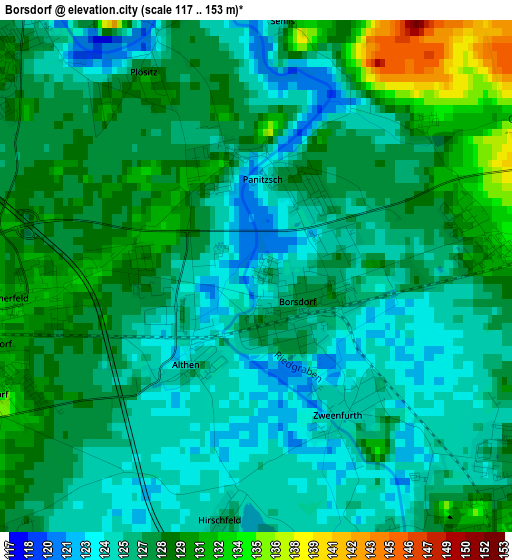
Below is the Elevation map of Borsdorf, which displays elevation range with different colors. Scale of the first map is from 117 to 153 m (384 to 502 ft) with average elevation of 127 meters (=417 ft) [note 1]
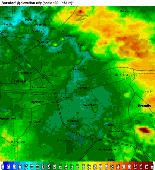
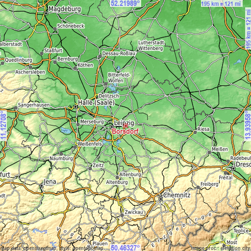
These maps also provides idea of topography and contour of this city, they are displayed at different zoom levels. More info about maps, scale and edge coordinates you can find below images.
| \ | Map #1 | Map #2 | Topo.Map |
| Scale [m] | 117..153 m | 100..181 m | × |
| Scale [ft] | 384..502 ft | 328..594 ft | × |
| Average | 127 m = 417 ft | 132.9 m = 436 ft | × |
| Width | 6.1 km = 3.8 mi | 12.21 km = 7.6 mi | 195.3 km = 121.4 mi |
| Height | 6.1 km = 3.8 mi | 12.21 km = 7.6 mi | 195.3 km = 121.4 mi |
| ↑Max Latitude | 51.377438° | 51.40486° | 52.21989° |
| Latitude at center | 51.35° | 51.35° | 51.35° |
| ↓Min Latitude | 51.322545° | 51.295074° | 50.46327° |
| ← Min Longitude | 12.489385° | 12.445439° | 11.12708° |
| Longitude center | 12.53333° | 12.53333° | 12.53333° |
| →Max Longitude | 12.577275° | 12.621221° | 13.93958° |
Nearby cities:
Cities around Borsdorf sort by population:
• Leipzig elevation 116 m
11.3 km,  264°
264°
• Taucha 127 m
5.1 km,  316°
316°
• Brandis 149 m
5.6 km,  106°
106°
• Naunhof 133 m
8.9 km,  154°
154°
• Machern 154 m
7.2 km,  75°
75°
• Großpösna 150 m
9.6 km,  194°
194°
• Bennewitz 114 m
12.6 km, 84°
• Krostitz 125 m
13.6 km,  336°
336°
• Thallwitz 108 m
13.9 km,  48°
48°
• Belgershain 151 m
13 km,  174°
174°
• Jesewitz 126 m
8.4 km,  14°
14°
• Rackwitz 118 m
13.9 km,  311°
311°
Multilingual:
 En español:
Borsdorf elevación 125 m.
 En France:
Borsdorf élévation 125 m.
 Auf Deutsch:
Borsdorf höhe über dem Meeresspiegel ist 125 m.

Sources and notes:
- [note 1] Map square and city borders are not equal. Map elevation data is calculated only from area inside that square.
- [src 1] Elevation data from geonames database provided with same terms of usage.
- [src 2] The elevation map of Borsdorf is generated using elevation data from NASA's 3 arcsec (90m) resolution SRTM data.
- [src 3] Base (background) map © OpenStreetMap contributors tiles are generated by Geofabrik and OpenTopoMap.
Copyright & License:
This Borsdorf Elevation Map is licensed under CC BY-SA. You may reuse any part from this page, if you give a proper credit by linking to this URL:
 More info on terms of use page.