Großpösna elevation
Großpösna (Saxony), Germany elevation is 150 meters and Großpösna elevation in feet is 492 ft above sea level [src 1]. Großpösna is a seat of a fourth-order administrative division (feature code) with elevation that is 108 meters (354 ft) smaller than average city elevation in Germany.
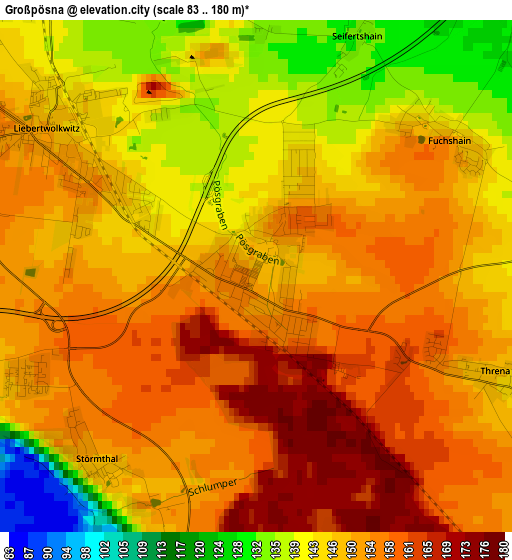
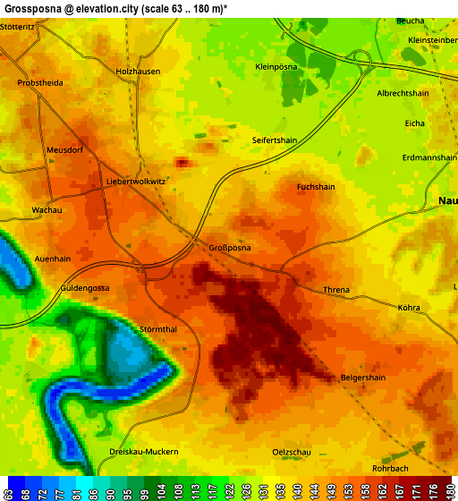
Below is the Elevation map of Großpösna, which displays elevation range with different colors. Scale of the first map is from 83 to 180 m (272 to 591 ft) with average elevation of 149.2 meters (=490 ft) [note 1]
These maps also provides idea of topography and contour of this city, they are displayed at different zoom levels. More info about maps, scale and edge coordinates you can find below images.
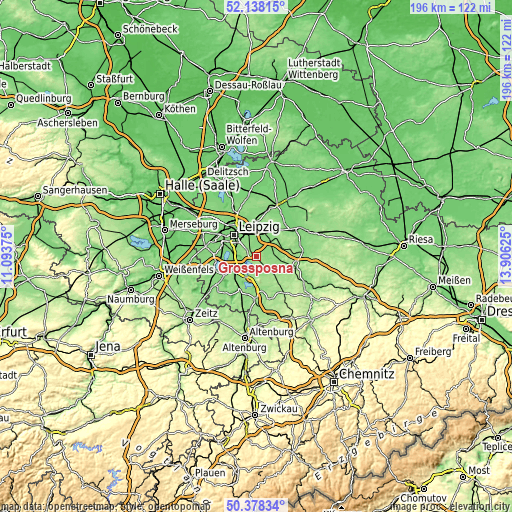
| \ | Map #1 | Map #2 | Topo.Map |
| Scale [m] | 83..180 m | 63..180 m | × |
| Scale [ft] | 272..591 ft | 207..591 ft | × |
| Average | 149.2 m = 490 ft | 138.7 m = 455 ft | × |
| Width | 6.11 km = 3.8 mi | 12.23 km = 7.6 mi | 195.7 km = 121.6 mi |
| Height | 6.11 km = 3.8 mi | 12.23 km = 7.6 mi | 195.7 km = 121.6 mi |
| ↑Max Latitude | 51.294158° | 51.32163° | 52.13815° |
| Latitude at center | 51.26667° | 51.26667° | 51.26667° |
| ↓Min Latitude | 51.239165° | 51.211644° | 50.37834° |
| ← Min Longitude | 12.456055° | 12.412109° | 11.09375° |
| Longitude center | 12.5° | 12.5° | 12.5° |
| →Max Longitude | 12.543945° | 12.587891° | 13.90625° |
Nearby cities:
Cities around Großpösna sort by population:
• Leipzig elevation 116 m
12.1 km,  312°
312°
• Markkleeberg 124 m
9.2 km,  276°
276°
• Brandis 149 m
10.9 km,  44°
44°
• Zwenkau 137 m
13 km,  245°
245°
• Naunhof 133 m
6.3 km,  78°
78°
• Borsdorf 125 m
9.6 km,  14°
14°
• Böhlen 134 m
10.8 km,  227°
227°
• Kitzscher 165 m
11.9 km,  162°
162°
• Rötha 139 m
9.7 km,  217°
217°
• Belgershain 151 m
5.1 km,  136°
136°
• Espenhain 155 m
8.7 km,  189°
189°
• Otterwisch 154 m
11 km,  132°
132°
Multilingual:
 En español:
Großpösna elevación 150 m.
 En France:
Großpösna élévation 150 m.
 Auf Deutsch:
Großpösna höhe über dem Meeresspiegel ist 150 m.

Sources and notes:
- [note 1] Map square and city borders are not equal. Map elevation data is calculated only from area inside that square.
- [src 1] Elevation data from geonames database provided with same terms of usage.
- [src 2] The elevation map of Großpösna is generated using elevation data from NASA's 3 arcsec (90m) resolution SRTM data.
- [src 3] Base (background) map © OpenStreetMap contributors tiles are generated by Geofabrik and OpenTopoMap.
Copyright & License:
This Großpösna Elevation Map is licensed under CC BY-SA. You may reuse any part from this page, if you give a proper credit by linking to this URL:
 More info on terms of use page.