Französisch Buchholz elevation
Französisch Buchholz (Berlin), Germany elevation is 46 meters and Französisch Buchholz elevation in feet is 151 ft above sea level [src 1]. Französisch Buchholz is a section of populated place (feature code) with elevation that is 212 meters (696 ft) smaller than average city elevation in Germany.
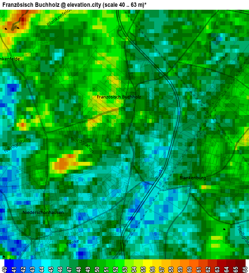
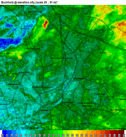
Below is the Elevation map of Französisch Buchholz, which displays elevation range with different colors. Scale of the first map is from 40 to 63 m (131 to 207 ft) with average elevation of 47.9 meters (=157 ft) [note 1]
These maps also provides idea of topography and contour of this city, they are displayed at different zoom levels. More info about maps, scale and edge coordinates you can find below images.
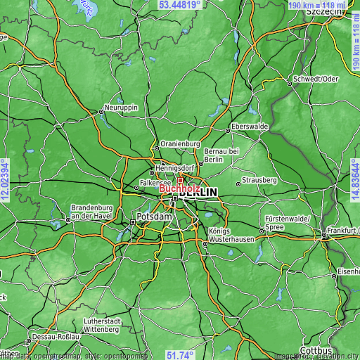
| \ | Map #1 | Map #2 | Topo.Map |
| Scale [m] | 40..63 m | 29..91 m | × |
| Scale [ft] | 131..207 ft | 95..299 ft | × |
| Average | 47.9 m = 157 ft | 49.7 m = 163 ft | × |
| Width | 5.94 km = 3.7 mi | 11.87 km = 7.4 mi | 189.9 km = 118 mi |
| Height | 5.94 km = 3.7 mi | 11.87 km = 7.4 mi | 189.9 km = 118 mi |
| ↑Max Latitude | 52.629102° | 52.655767° | 53.44819° |
| Latitude at center | 52.60242° | 52.60242° | 52.60242° |
| ↓Min Latitude | 52.575722° | 52.549008° | 51.74° |
| ← Min Longitude | 13.386245° | 13.342299° | 12.02394° |
| Longitude center | 13.43019° | 13.43019° | 13.43019° |
| →Max Longitude | 13.474135° | 13.518081° | 14.83644° |
Nearby cities:
Cities around Französisch Buchholz sort by population:
• Pankow elevation 47 m
4.2 km,  207°
207°
• Weißensee 53 m
5.7 km,  154°
154°
• Märkisches Viertel 52 m
4.9 km,  264°
264°
• Niederschönhausen 48 m
2.7 km,  223°
223°
• Karow 55 m
3.5 km,  77°
77°
• Rosenthal 47 m
3.6 km,  265°
265°
• Wilhelmsruh 44 m
4.5 km,  247°
247°
• Blankenburg 47 m
2 km,  122°
122°
• Heinersdorf 50 m
3.4 km,  171°
171°
• Lübars 53 m
5.4 km,  286°
286°
• Blankenfelde 53 m
3.2 km,  303°
303°
• Stadtrandsiedlung Malchow 47 m
3.9 km, 123°
Multilingual:
 En español:
Französisch Buchholz elevación 46 m.
 En France:
Berlin-Französisch Buchholz élévation 46 m.
 Auf Deutsch:
Berlin-Französisch Buchholz höhe über dem Meeresspiegel ist 46 m.

Sources and notes:
- [note 1] Map square and city borders are not equal. Map elevation data is calculated only from area inside that square.
- [src 1] Elevation data from geonames database provided with same terms of usage.
- [src 2] The elevation map of Französisch Buchholz is generated using elevation data from NASA's 3 arcsec (90m) resolution SRTM data.
- [src 3] Base (background) map © OpenStreetMap contributors tiles are generated by Geofabrik and OpenTopoMap.
Copyright & License:
This Französisch Buchholz Elevation Map is licensed under CC BY-SA. You may reuse any part from this page, if you give a proper credit by linking to this URL:
 More info on terms of use page.